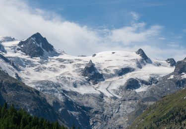

GR / champfèr höheweg

denisewanderige
User

Length
7.5 km

Max alt
2216 m

Uphill gradient
422 m

Km-Effort
13.1 km

Min alt
1823 m

Downhill gradient
424 m
Boucle
Yes
Creation date :
2014-12-11 00:00:00.0
Updated on :
2014-12-11 00:00:00.0
--
Difficulty : Unknown

FREE GPS app for hiking
About
Trail Other activity of 7.5 km to be discovered at Grisons, Maloja, Silvaplana. This trail is proposed by denisewanderige.
Description
Details (Wanderbeschrieb, Fotos, Dauer, Links, usw.) siehe unter:
http://www.wanderige.ch/wanderige_toure/2003-2005/champfer/champfer.htm
Positioning
Country:
Switzerland
Region :
Grisons
Department/Province :
Maloja
Municipality :
Silvaplana
Location:
Unknown
Start:(Dec)
Start:(UTM)
562262 ; 5147484 (32T) N.
Comments
Trails nearby

SEERUNDGANG


On foot
Easy
Sankt Moritz,
Grisons,
Maloja,
Switzerland

4.3 km | 5.1 km-effort
1h 10min
Yes

Roseg - Chamanna da Tschierva


On foot
Easy
Samedan,
Grisons,
Maloja,
Switzerland

5.1 km | 11 km-effort
2h 29min
No


st_ral_07_4


Walking
Very easy
Sankt Moritz,
Grisons,
Maloja,
Switzerland

45 km | 59 km-effort
10h 54min
No

dagtocht printhut.be


Walking
Very easy
Celerina/Schlarigna,
Grisons,
Maloja,
Switzerland

15.1 km | 26 km-effort
7h 29min
Yes

Celerina - marguns


Walking
Medium
Celerina/Schlarigna,
Grisons,
Maloja,
Switzerland

5.1 km | 10.6 km-effort
2h 26min
No

Trais Fluors St. Moritz


Other activity
Very easy
Sankt Moritz,
Grisons,
Maloja,
Switzerland

8.1 km | 12.7 km-effort
Unknown
No

GR Julier


Other activity
Very easy
Sankt Moritz,
Grisons,
Maloja,
Switzerland

8.3 km | 18.4 km-effort
Unknown
No

Piz Nair - St -Moritz


Other activity
Very easy
Sankt Moritz,
Grisons,
Maloja,
Switzerland

10.1 km | 14.5 km-effort
Unknown
No


 SityTrail


