![](/images/other/stat-length.png)
![Trail Walking Pommiers - A_POMMIERS 69480 Chalier Buisante Bel-Air - Photo](https://media.geolcdn.com/t/1900/400/ext.pjpeg?maxdim=2&url=https%3A%2F%2Fstatic1.geolcdn.com%2Fsiteimages%2Fupload%2Ffiles%2F1553511878bg_sport_marche.png)
A_POMMIERS 69480 Chalier Buisante Bel-Air
ANDREJAC
User
![Length](/images/other/stat-length.png)
Length
8.4 km
![Max alt](https://static1.geolcdn.com/siteimages/upload/files/1508320355ic_sort_altitude_max_24dp.png)
Max alt
353 m
![Uphill gradient](https://static1.geolcdn.com/siteimages/upload/files/1508320355ic_sort_den_pos_24dp.png)
Uphill gradient
277 m
![Km-Effort](/images/other/stat-length.png)
Km-Effort
12.1 km
![Min alt](https://static1.geolcdn.com/siteimages/upload/files/1508320355ic_sort_altitude_min_24dp.png)
Min alt
207 m
![Downhill gradient](https://static1.geolcdn.com/siteimages/upload/files/1508320355ic_sort_den_neg_24dp.png)
Downhill gradient
277 m
![Boucle](https://static1.geolcdn.com/siteimages/upload/files/16400158638029165_repeat_loop_refresh_sync_direction_icon.png)
Boucle
Yes
Creation date :
2014-12-10 00:00:00.0
Updated on :
2014-12-10 00:00:00.0
![Walking](https://static1.geolcdn.com/sitytour/trail-icons/101.png)
3h00
Difficulty : Easy
![Scan this QR Code to open this trail in the SityTrail application](https://capi.geolives.com/qq0zvz2zws4bq2lad0pu/sitytour/trails/193829/qr.png?size=200)
FREE GPS app for hiking
About
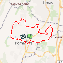
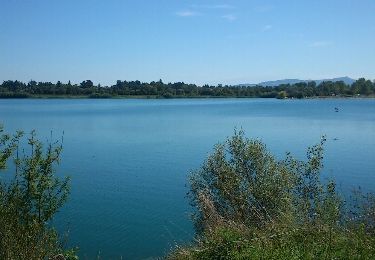
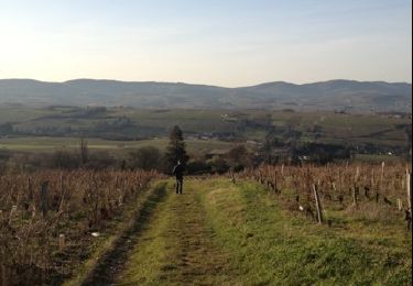
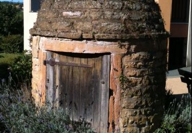
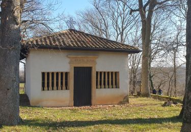
Trail Walking of 8.4 km to be discovered at Auvergne-Rhône-Alpes, Rhône, Pommiers. This trail is proposed by ANDREJAC.
Description
Départ mairie de Pommiers ; Bethléem, La Cheville, Chalier, Les Tours, Le Cochet, ND de Buisante, Les Mignonnes, Bel-Air, Gyre, retour par Montclair.
Positioning
Country:
France
Region :
Auvergne-Rhône-Alpes
Department/Province :
Rhône
Municipality :
Pommiers
Location:
Unknown
Start:(Dec)
Start:(UTM)
631255 ; 5090577 (31T) N.
Comments
Trails nearby
![Trail Walking Villefranche-sur-Saône - Itinérant Beaujolais etape 1 Villefranche sur Saone - Le Flagolet - Photo](https://media.geolcdn.com/t/375/260/265892a0-89c7-47ac-89f3-06f9bc929d8c.jpg&format=jpg&maxdim=2)
![Walking Walking](https://static1.geolcdn.com/sitytour/trail-icons/101.png)
Itinérant Beaujolais etape 1 Villefranche sur Saone - Le Flagolet
Walking
Medium
Villefranche-sur-Saône,
Auvergne-Rhône-Alpes,
Rhône,
France
![](/images/other/stat-length.png)
20 km | 25 km-effort
4h 43min
![](https://static1.geolcdn.com/siteimages/upload/files/16400158638029165_repeat_loop_refresh_sync_direction_icon.png)
No
![Trail Walking Lacenas - Lacenas (11 km - D 310 m) RG - Photo](https://media.geolcdn.com/t/375/260/620906a3-0ea4-4ca7-8578-340a8a98e518.jpg&format=jpg&maxdim=2)
![Walking Walking](https://static1.geolcdn.com/sitytour/trail-icons/101.png)
Lacenas (11 km - D 310 m) RG
Walking
Easy
Lacenas,
Auvergne-Rhône-Alpes,
Rhône,
France
![](/images/other/stat-length.png)
10.6 km | 14.7 km-effort
2h 38min
![](https://static1.geolcdn.com/siteimages/upload/files/16400158638029165_repeat_loop_refresh_sync_direction_icon.png)
Yes
![Trail Walking Porte des Pierres Dorées - Jarnioux (8,5 km - D. 249 m) - Photo](https://media.geolcdn.com/t/375/260/5f7dfffa-a5f2-424b-811f-de7ae78c4bcd.jpg&format=jpg&maxdim=2)
![Walking Walking](https://static1.geolcdn.com/sitytour/trail-icons/101.png)
Jarnioux (8,5 km - D. 249 m)
Walking
Porte des Pierres Dorées,
Auvergne-Rhône-Alpes,
Rhône,
France
![](/images/other/stat-length.png)
8.5 km | 11.8 km-effort
2h 42min
![](https://static1.geolcdn.com/siteimages/upload/files/16400158638029165_repeat_loop_refresh_sync_direction_icon.png)
Yes
![Trail Walking Porte des Pierres Dorées - Jarnioux 10.4 km - Photo](https://media.geolcdn.com/t/375/260/ext.jpg?maxdim=2&url=https%3A%2F%2Fservices.sitytrail.com%2FGeolivesWS%2FDownloadMedia.ashx%3FTrailID%3D885753%26Media%3D20180111164507.jpg)
![Walking Walking](https://static1.geolcdn.com/sitytour/trail-icons/101.png)
Jarnioux 10.4 km
Walking
Easy
Porte des Pierres Dorées,
Auvergne-Rhône-Alpes,
Rhône,
France
![](/images/other/stat-length.png)
10.4 km | 13.5 km-effort
2h 58min
![](https://static1.geolcdn.com/siteimages/upload/files/16400158638029165_repeat_loop_refresh_sync_direction_icon.png)
Yes
![Trail Walking Anse - anse - Photo](https://media.geolcdn.com/t/375/260/ext.jpg?maxdim=2&url=https%3A%2F%2Fservices.sitytrail.com%2FGeolivesWS%2FDownloadMedia.ashx%3FTrailID%3D213392%26Media%3Dfix__20130815144258.jpg)
![Walking Walking](https://static1.geolcdn.com/sitytour/trail-icons/101.png)
![Trail Walking Limas - Limas - Photo](https://media.geolcdn.com/t/375/260/ext.jpg?maxdim=2&url=https%3A%2F%2Fservices.sitytrail.com%2FGeolivesWS%2FDownloadMedia.ashx%3FTrailID%3D166962%26Media%3D20121223151415.jpg)
![Walking Walking](https://static1.geolcdn.com/sitytour/trail-icons/101.png)
![Trail Walking Porte des Pierres Dorées - Chemin du Tacot (1) - Photo](https://media.geolcdn.com/t/375/260/ext.jpg?maxdim=2&url=https%3A%2F%2Fstatic1.geolcdn.com%2Fsiteimages%2Fupload%2Ffiles%2F1553511878bg_sport_marche.png)
![Walking Walking](https://static1.geolcdn.com/sitytour/trail-icons/101.png)
Chemin du Tacot (1)
Walking
Medium
(1)
Porte des Pierres Dorées,
Auvergne-Rhône-Alpes,
Rhône,
France
![](/images/other/stat-length.png)
17.5 km | 22 km-effort
Unknown
![](https://static1.geolcdn.com/siteimages/upload/files/16400158638029165_repeat_loop_refresh_sync_direction_icon.png)
No
![Trail Walking Marcy - Marcy 2010-08-25 - Photo](https://media.geolcdn.com/t/375/260/ext.jpg?maxdim=2&url=https%3A%2F%2Fservices.sitytrail.com%2FGeolivesWS%2FDownloadMedia.ashx%3FTrailID%3D44760%26Media%3Dimage16.jpg)
![Walking Walking](https://static1.geolcdn.com/sitytour/trail-icons/101.png)
Marcy 2010-08-25
Walking
Very easy
Marcy,
Auvergne-Rhône-Alpes,
Rhône,
France
![](/images/other/stat-length.png)
4.5 km | 6.1 km-effort
Unknown
![](https://static1.geolcdn.com/siteimages/upload/files/16400158638029165_repeat_loop_refresh_sync_direction_icon.png)
Yes
![Trail Walking Alix - Alix - Frontenas - Photo](https://media.geolcdn.com/t/375/260/496609c5-72bc-4592-9af0-7046657eac3e.jpg&format=jpg&maxdim=2)
![Walking Walking](https://static1.geolcdn.com/sitytour/trail-icons/101.png)
Alix - Frontenas
Walking
Easy
Alix,
Auvergne-Rhône-Alpes,
Rhône,
France
![](/images/other/stat-length.png)
12.5 km | 15.3 km-effort
2h 55min
![](https://static1.geolcdn.com/siteimages/upload/files/16400158638029165_repeat_loop_refresh_sync_direction_icon.png)
Yes