


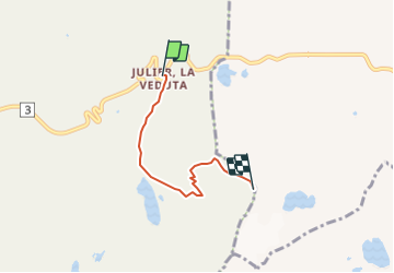

10 km | 17.8 km-effort


User


FREE GPS app for hiking
 SityTrail
IGN / Geographical institutes
SityTrail World
The world is yours!
Trail Other activity of 3.6 km to be discovered at Grisons, Albula, Surses. This trail is proposed by tammobile.
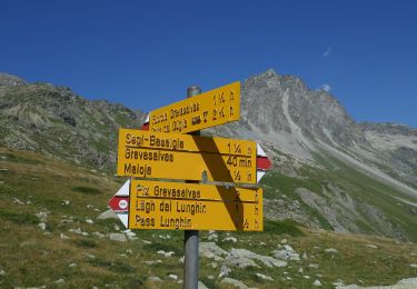
Vom Julier Hospitz in Richtung Leg Grevasalvas und anschliessender Anstieg.
On foot

Other activity

Mountain bike
Mountain bike

Walking
Other activity