


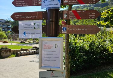
5.8 km | 7.3 km-effort


User


FREE GPS app for hiking
 SityTrail
IGN / Geographical institutes
SityTrail World
The world is yours!
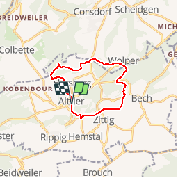
Trail Walking of 9.9 km to be discovered at Unknown, Canton Echternach, Bech. This trail is proposed by flip96.
Müllerthal Extra Trail C 10km.
Gestart in Altrier waar parkeerplaats is aan kruising Op der Schanz met Heeschbregerwee.
Mooie, eenvoudige wandeling.
Opmerkingen? flip96@home.nl

Walking

Walking

Walking

Walking

Walking

Walking

Other activity
Walking
Walking