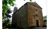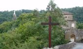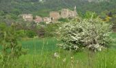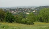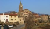

Coq'In 2013 - St Romain d'Ay

tracegps
User

Length
23 km

Max alt
647 m

Uphill gradient
701 m

Km-Effort
32 km

Min alt
381 m

Downhill gradient
702 m
Boucle
Yes
Creation date :
2014-12-10 00:00:00.0
Updated on :
2014-12-10 00:00:00.0
5h10
Difficulty : Difficult

FREE GPS app for hiking
About
Trail Walking of 23 km to be discovered at Auvergne-Rhône-Alpes, Ardèche, Saint-Romain-d'Ay. This trail is proposed by tracegps.
Description
La Coq'in randonnée est organisée par le village de St Romain d'Ay. L'ensemble du parcours se déroule sur des sentiers et chemins. Le circuit peut-être réduit à une petite boucle de 12,5 km.
Positioning
Country:
France
Region :
Auvergne-Rhône-Alpes
Department/Province :
Ardèche
Municipality :
Saint-Romain-d'Ay
Location:
Unknown
Start:(Dec)
Start:(UTM)
630636 ; 5002476 (31T) N.
Comments
Trails nearby
roche Péréandre, pont suspendu circuit


Running
Medium
Quintenas,
Auvergne-Rhône-Alpes,
Ardèche,
France

11.6 km | 16.1 km-effort
1h 35min
Yes
Saint-Romain-d'Ay petite boucle


Walking
Easy
Saint-Romain-d'Ay,
Auvergne-Rhône-Alpes,
Ardèche,
France

8.9 km | 12.4 km-effort
2h 29min
Yes
GRP Tour du bassin d'Annonay


Walking
Medium
Saint-Alban-d'Ay,
Auvergne-Rhône-Alpes,
Ardèche,
France

102 km | 145 km-effort
23h 36min
Yes
tour d'Annonay


Walking
Easy
Quintenas,
Auvergne-Rhône-Alpes,
Ardèche,
France

30 km | 38 km-effort
8h 10min
Yes
Suc de Vent - St Alban D''Ay


Walking
Medium
Saint-Alban-d'Ay,
Auvergne-Rhône-Alpes,
Ardèche,
France

24 km | 36 km-effort
8h 0min
Yes
satilleux Vérines mont Chaix le traiteur la garenne


Walking
Very difficult
Satillieu,
Auvergne-Rhône-Alpes,
Ardèche,
France

22 km | 34 km-effort
5h 31min
Yes

St Jeure d'Ay Royol Navas camping St Victor Chantelermuze les Chanaux Riolli...


Walking
Very difficult
Saint-Jeure-d'Ay,
Auvergne-Rhône-Alpes,
Ardèche,
France

22 km | 31 km-effort
7h 1min
Yes

Ardèche – Sources de la Cance en 3 jours


Horseback riding
Easy
Quintenas,
Auvergne-Rhône-Alpes,
Ardèche,
France

71 km | 103 km-effort
13h 32min
Yes
Quintenas rando


Walking
Quintenas,
Auvergne-Rhône-Alpes,
Ardèche,
France

16.6 km | 22 km-effort
6h 20min
Yes


 SityTrail


