![](/images/other/stat-length.png)
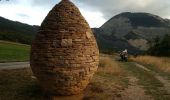
![Trail Cycle Saint-André-les-Alpes - Le col du Défend - St André les Alpes - Photo](https://media.geolcdn.com/t/1900/400/ext.pjpeg?maxdim=2&url=https%3A%2F%2Fservices.sitytrail.com%2FGeolivesWS%2FDownloadMedia.ashx%3FTrailID%3D191553%26Media%3D15169_5.jpg)
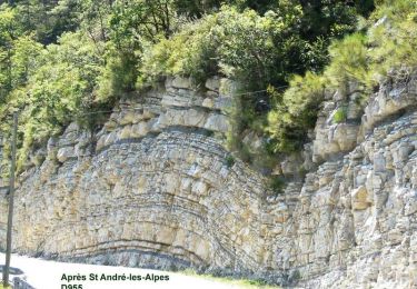
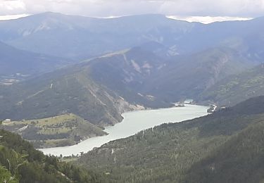
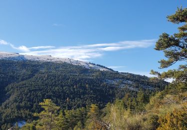
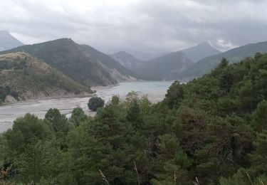
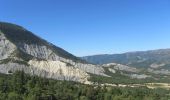
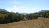
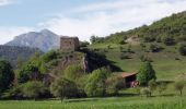
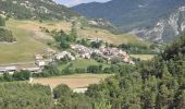
Le col du Défend - St André les Alpes
tracegps
User
![Length](/images/other/stat-length.png)
Length
48 km
![Max alt](https://static1.geolcdn.com/siteimages/upload/files/1508320355ic_sort_altitude_max_24dp.png)
Max alt
1275 m
![Uphill gradient](https://static1.geolcdn.com/siteimages/upload/files/1508320355ic_sort_den_pos_24dp.png)
Uphill gradient
841 m
![Km-Effort](/images/other/stat-length.png)
Km-Effort
59 km
![Min alt](https://static1.geolcdn.com/siteimages/upload/files/1508320355ic_sort_altitude_min_24dp.png)
Min alt
739 m
![Downhill gradient](https://static1.geolcdn.com/siteimages/upload/files/1508320355ic_sort_den_neg_24dp.png)
Downhill gradient
841 m
![Boucle](https://static1.geolcdn.com/siteimages/upload/files/16400158638029165_repeat_loop_refresh_sync_direction_icon.png)
Boucle
Yes
Creation date :
2014-12-10 00:00:00.0
Updated on :
2014-12-10 00:00:00.0
![Cycle](https://static1.geolcdn.com/sitytour/trail-icons/200.png)
3h30
Difficulty : Difficult
![Scan this QR Code to open this trail in the SityTrail application](https://capi.geolives.com/qq0zvz2zws4bq2lad0pu/sitytour/trails/191553/qr.png?size=200)
FREE GPS app for hiking
About
Trail Cycle of 48 km to be discovered at Provence-Alpes-Côte d'Azur, Alpes-de-Haute-Provence, Saint-André-les-Alpes. This trail is proposed by tracegps.
Description
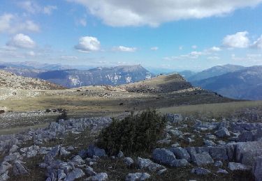
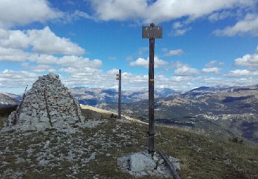
Ce circuit vous est proposé par l'Office de Tourisme de Saint-André Les Alpes. Départ de l'office de Tourisme, place Marcel Pastorelli. Le circuit fait grimper le col du Défend (1267m) sur les hauteurs de Lambruisse.
Positioning
Country:
France
Region :
Provence-Alpes-Côte d'Azur
Department/Province :
Alpes-de-Haute-Provence
Municipality :
Saint-André-les-Alpes
Location:
Unknown
Start:(Dec)
Start:(UTM)
300072 ; 4871241 (32T) N.
Comments
Trails nearby
![Trail Walking Saint-André-les-Alpes - SAINT ANDRE LES ALPES . COURCHONS O S - Photo](https://media.geolcdn.com/t/375/260/301ebef9-365b-4cb9-8055-4bb3429586a3.jpg&format=jpg&maxdim=2)
![Walking Walking](https://static1.geolcdn.com/sitytour/trail-icons/101.png)
SAINT ANDRE LES ALPES . COURCHONS O S
Walking
Medium
(1)
Saint-André-les-Alpes,
Provence-Alpes-Côte d'Azur,
Alpes-de-Haute-Provence,
France
![](/images/other/stat-length.png)
13.7 km | 22 km-effort
4h 12min
![](https://static1.geolcdn.com/siteimages/upload/files/16400158638029165_repeat_loop_refresh_sync_direction_icon.png)
Yes
![Trail Cycle Saint-André-les-Alpes - Le tour des Thorames - Saint André les Alpes - Photo](https://media.geolcdn.com/t/375/260/ext.jpg?maxdim=2&url=https%3A%2F%2Fservices.sitytrail.com%2FGeolivesWS%2FDownloadMedia.ashx%3FTrailID%3D112777%26Media%3D12327_6.jpg)
![Cycle Cycle](https://static1.geolcdn.com/sitytour/trail-icons/200.png)
Le tour des Thorames - Saint André les Alpes
Cycle
Medium
(2)
Saint-André-les-Alpes,
Provence-Alpes-Côte d'Azur,
Alpes-de-Haute-Provence,
France
![](/images/other/stat-length.png)
40 km | 48 km-effort
2h 30min
![](https://static1.geolcdn.com/siteimages/upload/files/16400158638029165_repeat_loop_refresh_sync_direction_icon.png)
Yes
![Trail Walking Moriez - MORIEZ. col des Robines , le tour du Chalvet o s - Photo](https://media.geolcdn.com/t/375/260/a5c641ba-061e-43f0-ac03-0a45ce36f90b.jpg&format=jpg&maxdim=2)
![Walking Walking](https://static1.geolcdn.com/sitytour/trail-icons/101.png)
MORIEZ. col des Robines , le tour du Chalvet o s
Walking
Difficult
Moriez,
Provence-Alpes-Côte d'Azur,
Alpes-de-Haute-Provence,
France
![](/images/other/stat-length.png)
12.2 km | 22 km-effort
3h 50min
![](https://static1.geolcdn.com/siteimages/upload/files/16400158638029165_repeat_loop_refresh_sync_direction_icon.png)
Yes
![Trail Walking Moriez - moriez parrioune grau de courchons 906m 16.5kms - Photo](https://media.geolcdn.com/t/375/260/ae0ddda8-dea0-48d5-b31d-a445b1c92964.jpg&format=jpg&maxdim=2)
![Walking Walking](https://static1.geolcdn.com/sitytour/trail-icons/101.png)
moriez parrioune grau de courchons 906m 16.5kms
Walking
Medium
Moriez,
Provence-Alpes-Côte d'Azur,
Alpes-de-Haute-Provence,
France
![](/images/other/stat-length.png)
16.1 km | 27 km-effort
6h 29min
![](https://static1.geolcdn.com/siteimages/upload/files/16400158638029165_repeat_loop_refresh_sync_direction_icon.png)
Yes
![Trail Walking Saint-André-les-Alpes - Saint André les Alpes -Corchon - Photo](https://media.geolcdn.com/t/375/260/a241be3c-50a1-4f1f-a307-0ae1d72c07ac.jpg&format=jpg&maxdim=2)
![Walking Walking](https://static1.geolcdn.com/sitytour/trail-icons/101.png)
Saint André les Alpes -Corchon
Walking
Very difficult
Saint-André-les-Alpes,
Provence-Alpes-Côte d'Azur,
Alpes-de-Haute-Provence,
France
![](/images/other/stat-length.png)
15 km | 23 km-effort
5h 13min
![](https://static1.geolcdn.com/siteimages/upload/files/16400158638029165_repeat_loop_refresh_sync_direction_icon.png)
No
![Trail Walking Saint-André-les-Alpes - sommet de l'Aup - Photo](https://media.geolcdn.com/t/375/260/ext.jpg?maxdim=2&url=https%3A%2F%2Fservices.sitytrail.com%2FGeolivesWS%2FDownloadMedia.ashx%3FTrailID%3D658593%26Media%3Dfix__20161010125600.jpg)
![Walking Walking](https://static1.geolcdn.com/sitytour/trail-icons/101.png)
sommet de l'Aup
Walking
Medium
Saint-André-les-Alpes,
Provence-Alpes-Côte d'Azur,
Alpes-de-Haute-Provence,
France
![](/images/other/stat-length.png)
26 km | 40 km-effort
5h 21min
![](https://static1.geolcdn.com/siteimages/upload/files/16400158638029165_repeat_loop_refresh_sync_direction_icon.png)
Yes
![Trail Walking Allons - puy de rent, descente par la colle - Photo](https://media.geolcdn.com/t/375/260/ext.jpg?maxdim=2&url=https%3A%2F%2Fservices.sitytrail.com%2FGeolivesWS%2FDownloadMedia.ashx%3FTrailID%3D658591%26Media%3Dfix__20160920124101.jpg)
![Walking Walking](https://static1.geolcdn.com/sitytour/trail-icons/101.png)
puy de rent, descente par la colle
Walking
Medium
Allons,
Provence-Alpes-Côte d'Azur,
Alpes-de-Haute-Provence,
France
![](/images/other/stat-length.png)
22 km | 38 km-effort
5h 40min
![](https://static1.geolcdn.com/siteimages/upload/files/16400158638029165_repeat_loop_refresh_sync_direction_icon.png)
Yes
![Trail Cycle Saint-André-les-Alpes - Le Col des Champs - St André les Alpes - Photo](https://media.geolcdn.com/t/375/260/ext.jpg?maxdim=2&url=https%3A%2F%2Fservices.sitytrail.com%2FGeolivesWS%2FDownloadMedia.ashx%3FTrailID%3D316949%26Media%3D16062_5.jpg)
![Cycle Cycle](https://static1.geolcdn.com/sitytour/trail-icons/200.png)
Le Col des Champs - St André les Alpes
Cycle
Difficult
Saint-André-les-Alpes,
Provence-Alpes-Côte d'Azur,
Alpes-de-Haute-Provence,
France
![](/images/other/stat-length.png)
119 km | 159 km-effort
7h 0min
![](https://static1.geolcdn.com/siteimages/upload/files/16400158638029165_repeat_loop_refresh_sync_direction_icon.png)
Yes
![Trail Cycle Saint-André-les-Alpes - Le Col des Lecques - St André-les-Alpes - Photo](https://media.geolcdn.com/t/375/260/ext.jpg?maxdim=2&url=https%3A%2F%2Fservices.sitytrail.com%2FGeolivesWS%2FDownloadMedia.ashx%3FTrailID%3D316938%26Media%3D16048_5.jpg)
![Cycle Cycle](https://static1.geolcdn.com/sitytour/trail-icons/200.png)
Le Col des Lecques - St André-les-Alpes
Cycle
Difficult
Saint-André-les-Alpes,
Provence-Alpes-Côte d'Azur,
Alpes-de-Haute-Provence,
France
![](/images/other/stat-length.png)
57 km | 72 km-effort
4h 30min
![](https://static1.geolcdn.com/siteimages/upload/files/16400158638029165_repeat_loop_refresh_sync_direction_icon.png)
Yes