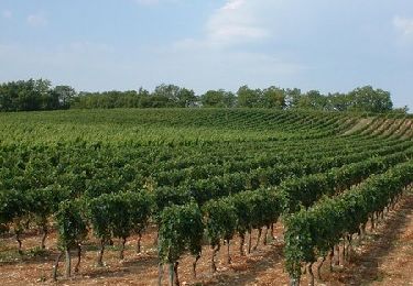
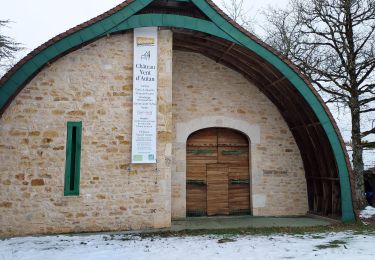
Trail Mountain bike Porte-du-Quercy - Boucle VTT de Bovila à Bagat en Quercy - Saint Matré - Photo

Boucle VTT de Bovila à Bagat en Quercy - Saint Matré

 tracegps
tracegps

User

© OpenStreetMap contributors
Length
Length
35 km
Max alt
Max alt
296 m
Uphill gradient
Uphill gradient
535 m
Km-Effort
Km-Effort  
42 km
Min alt
Min alt
189 m
Downhill gradient
Downhill gradient
534 m
Boucle
Boucle
Yes
Creation date :
2014-12-10 00:00:00.0
Updated on :
2014-12-10 00:00:00.0

(0 Reviews)

Mountain bike
Mountain bike
2h30
Difficulty : Difficult

Scan this QR Code to open this trail in the SityTrail application

FREE GPS app for hiking

Logo SityTrail SityTrail

IGN / Geographical institutes

Download SityTrail from the App Store Download SityTrail from Google Play

Logo SityTrail SityTrail World

The world is yours!

Download SityTrail from the App Store Download SityTrail from Google Play Download SityTrail on Huawei AppGallery

About

Trail Mountain bike of 35 km to be discovered at Occitania, Lot, Porte-du-Quercy. This trail is proposed by tracegps.

Description

Boucle de 35km au départ du château d'eau de Saint Matré, on peut se garer en venant de Villeneuve sur Lot. Aucun problème particulier si ce n'est la descente du calvaire de Bagat qui est un peu raide et caillouteuse sur le haut. Attention, lorsque le terrain est gras, à certains endroits, la terre est "amoureuse". Bonne balade !

Elevation profile

Photos

Positioning

Country:
France
Region :
Occitania
Department/Province :
Lot
Municipality :
Porte-du-Quercy
Location:
Unknown
Start:(UTM)
352166 ; 4917451 (31T) N.

Trails nearby

Trail Walking Porte-du-Quercy - 210530-PC11-circuit-de-creyssens-LE-BOULVE - Photo
Walking
alain2306

Walking

Medium
(2)
Porte-du-Quercy, Occitania, Lot, France
7.2 km | 9.5 km-effort
2h 9min
Yes
Trail Mountain bike Sérignac - De Sérignac à Bonnemaison - Photo
Mountain bike
tracegps

Mountain bike

Difficult
Sérignac, Occitania, Lot, France
36 km | 45 km-effort
2h 45min
Yes
Trail Walking Porte-du-Quercy - boulve 1 - Photo
Walking
saligne

Walking

Difficult
Porte-du-Quercy, Occitania, Lot, France
11.8 km | 15.9 km-effort
3h 5min
Yes
Trail Walking Porte-du-Quercy - Saint Matre - Photo
Walking
christiane01

Walking

Easy
Porte-du-Quercy, Occitania, Lot, France
5.2 km | 6 km-effort
1h 40min
Yes
Trail Mountain bike Montcuq-en-Quercy-Blanc - Le Moulin Bessou - Le Moulin de Bagor - Photo
Mountain bike
tracegps

Mountain bike

Medium
(1)
Montcuq-en-Quercy-Blanc, Occitania, Lot, France
12.8 km | 15.7 km-effort
2h 0min
Yes
Trail Walking Montcuq-en-Quercy-Blanc - Le Moulin Bessou - Le Moulin de Bagor - Photo
Walking
tracegps

Walking

Medium
Montcuq-en-Quercy-Blanc, Occitania, Lot, France
12.8 km | 15.7 km-effort
3h 30min
Yes
Trail Horseback riding Porte-du-Quercy - Etape 4 - Le Boulve / Saint Cyprien - Photo
Horseback riding
elsarose

Horseback riding

Medium
Porte-du-Quercy, Occitania, Lot, France
24 km | 30 km-effort
3h 59min
No
Trail Walking Porte-du-Quercy - Petits ruisseaux et Grandes Vignes - Photo
Walking
lacabanazaza

Walking

Difficult
Porte-du-Quercy, Occitania, Lot, France
11.2 km | 13.7 km-effort
3h 6min
Yes


Close
My subscriptions