Trail Walking Saint-Géry-Vers - La Via Arverna  (Vers - Cahors) - Photo

La Via Arverna (Vers - Cahors)

 tracegps
tracegps

User

© OpenStreetMap contributors
Length
Length
19.4 km
Max alt
Max alt
298 m
Uphill gradient
Uphill gradient
319 m
Km-Effort
Km-Effort  
24 km
Min alt
Min alt
112 m
Downhill gradient
Downhill gradient
326 m
Boucle
Boucle
No
Creation date :
2014-12-10 00:00:00.0
Updated on :
2014-12-10 00:00:00.0

(0 Reviews)

Walking
Walking
5h00
Difficulty : Difficult

Scan this QR Code to open this trail in the SityTrail application

FREE GPS app for hiking

Logo SityTrail SityTrail

IGN / Geographical institutes

Download SityTrail from the App Store Download SityTrail from Google Play

Logo SityTrail SityTrail World

The world is yours!

Download SityTrail from the App Store Download SityTrail from Google Play Download SityTrail on Huawei AppGallery

About

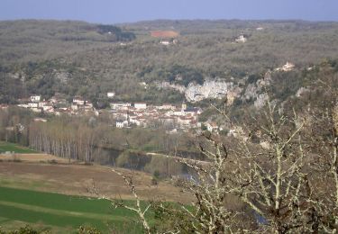
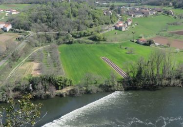
Trail Walking of 19.4 km to be discovered at Occitania, Lot, Saint-Géry-Vers. This trail is proposed by tracegps.

Description

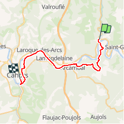
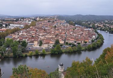
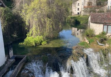
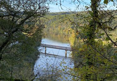
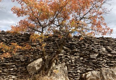
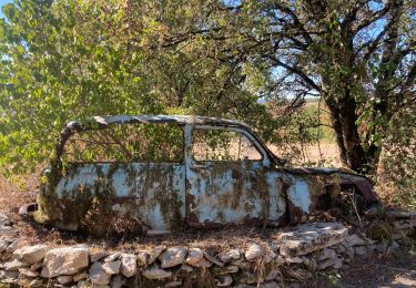
Étape 20 de la Via Arverna, chemin de Saint Jacques de Compostelle entre Clermont-Ferrand et Cahors. Dernière ligne droite se concluant par la fin de la Via Arverna à destination de Cahors. Le GR 36 et le Lot vous serviront de fil conducteur. Cette étape campagnarde sera une traversée des champs, de villages et de quelques chemins halage. L’arrivée sur la place Gambetta conclut un périple de plus de 500 km parcourus en 3 semaines ! Pour les plus courageux, il sera possible de suivre le GR 65 ou Via Podiensis en direction de Saint-Jacques-de-Compostelle. Il ne vous restera plus que 1 100 km à parcourir ! Retrouvez l'étape n° 20 sur le site de la «Via Arverna - chemin Saint-Jacques-de-Compostelle» ainsi qu'ICI sur le site de la « Via Arverna ».

Elevation profile

Photos

Positioning

Country:
France
Region :
Occitania
Department/Province :
Lot
Municipality :
Saint-Géry-Vers
Location:
Unknown
Start:(UTM)
384929 ; 4926863 (31T) N.

Trails nearby

Trail Walking Saint-Géry-Vers - Vers, St Gery  Vallée du Lot - Photo
Walking
tracegps

Walking

Difficult
(3)
Saint-Géry-Vers, Occitania, Lot, France
14.1 km | 19.8 km-effort
4h 0min
Yes
Trail Walking Saint-Géry-Vers - Causse de Vers-7539719 - Photo
Walking
houbart

Walking

Difficult
(1)
Saint-Géry-Vers, Occitania, Lot, France
11.6 km | 15.9 km-effort
3h 36min
Yes
Trail Walking Aujols - randogps46-388 - Photo
Walking
houbart

Walking

Difficult
(1)
Aujols, Occitania, Lot, France
11.9 km | 16.8 km-effort
3h 49min
Yes
Trail Walking Arcambal - Étape 5 Les Mazuts Cahen - Photo
Walking
GUIDE
nadinebondoux

Walking

Medium
Arcambal, Occitania, Lot, France
16.9 km | 21 km-effort
4h 40min
No
Trail Walking Saint-Géry-Vers - Boucle Vers - Merlan gr46 - Photo
Walking
Glurps

Walking

Easy
Saint-Géry-Vers, Occitania, Lot, France
14.7 km | 19.3 km-effort
4h 21min
Yes
Trail Walking Arcambal - Galessie les Mazuts Barouillet  - Photo
Walking
GUIDE
antignacs

Walking

Very easy
Arcambal, Occitania, Lot, France
10.7 km | 13.9 km-effort
2h 30min
Yes
Trail Walking Saint-Géry-Vers - Vers merlan pech picou - Photo
Walking
GUIDE
antignacs

Walking

Very easy
Saint-Géry-Vers, Occitania, Lot, France
10.2 km | 13.5 km-effort
2h 13min
No
Trail Electric bike Saint-Géry-Vers - St gery St cirq Cabreret  - Photo
Electric bike
GUIDE
antignacs

Electric bike

Very easy
Saint-Géry-Vers, Occitania, Lot, France
39 km | 51 km-effort
3h 24min
Yes
Trail Walking Saint-Géry-Vers - Moulin de Nouaillac - Photo
Walking
ricou1964

Walking

Medium
(1)
Saint-Géry-Vers, Occitania, Lot, France
13.3 km | 18.5 km-effort
4h 0min
Yes


Close
My subscriptions