Trail Walking Saint-Bonnet-le-Troncy - Le radar - Photo
 redtek
redtek

User

© OpenStreetMap contributors
Length
Length
13.1 km
Max alt
Max alt
902 m
Uphill gradient
Uphill gradient
537 m
Km-Effort
Km-Effort  
20 km
Min alt
Min alt
556 m
Downhill gradient
Downhill gradient
537 m
Boucle
Boucle
Yes
Creation date :
2016-06-11 00:00:00.0
Updated on :
2016-06-11 00:00:00.0

(0 Reviews)

Walking
Walking
3h00
Difficulty : Medium

Scan this QR Code to open this trail in the SityTrail application

FREE GPS app for hiking

Logo SityTrail SityTrail

IGN / Geographical institutes

Download SityTrail from the App Store Download SityTrail from Google Play

Logo SityTrail SityTrail World

The world is yours!

Download SityTrail from the App Store Download SityTrail from Google Play Download SityTrail on Huawei AppGallery

About

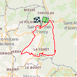
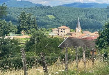
Trail Walking of 13.1 km to be discovered at Auvergne-Rhône-Alpes, Rhône, Saint-Bonnet-le-Troncy. This trail is proposed by redtek.

Description

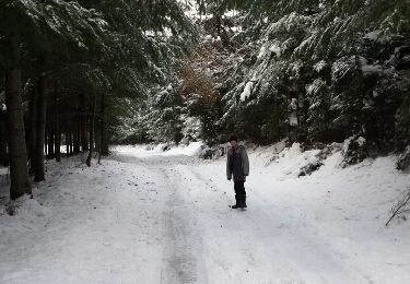
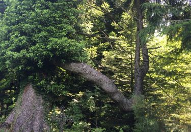
Beau parcours avec une première partie en forêt puis une seconde plus exposée à travers champs. Les routes empruntées par le parcours ont très peu de circulation, je n''ai croisé aucune voiture lorsque j''ai fait la ballade !
Réalisé en 2h30 à marche soutenue, la ballade présente un  bon dénivelé, attention aux petites jambes !
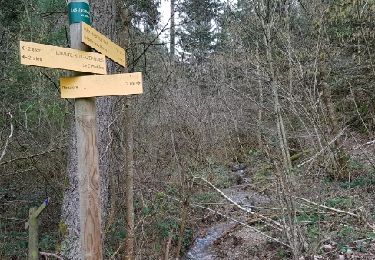
La partie la moins évidente est celle qui se situe entre le radar et Barbery. Les chemins ne sont pas tous entretenus et beaucoup de croisements compliquent la navigation !

Elevation profile

Positioning

Country:
France
Region :
Auvergne-Rhône-Alpes
Department/Province :
Rhône
Municipality :
Saint-Bonnet-le-Troncy
Location:
Unknown
Start:(UTM)
610473 ; 5104680 (31T) N.

Trails nearby

Trail Walking Ranchal - Ranchal village vert  - Photo
Walking
tracegps

Walking

Medium
(1)
Ranchal, Auvergne-Rhône-Alpes, Rhône, France
10.2 km | 14.2 km-effort
2h 0min
Yes
Trail Walking Ranchal - Col de favardy - Photo
Walking
redtek

Walking

Easy
Ranchal, Auvergne-Rhône-Alpes, Rhône, France
8.7 km | 12.6 km-effort
2h 39min
Yes
Trail Walking Saint-Bonnet-le-Troncy - rançon 2 - Photo
Walking
redtek

Walking

Easy
Saint-Bonnet-le-Troncy, Auvergne-Rhône-Alpes, Rhône, France
5.4 km | 7.9 km-effort
1h 39min
Yes
Trail Walking Saint-Bonnet-le-Troncy - petit radar - Photo
Walking
redtek

Walking

Medium
Saint-Bonnet-le-Troncy, Auvergne-Rhône-Alpes, Rhône, France
6.3 km | 10.2 km-effort
1h 53min
Yes
Trail Walking Saint-Nizier-d'Azergues - Saint-Nizier-d'Azergues (14 km - D. 577 m) - Photo
Walking
Thomasdanielle

Walking

Very difficult
Saint-Nizier-d'Azergues, Auvergne-Rhône-Alpes, Rhône, France
14.2 km | 22 km-effort
4h 58min
Yes
Trail Walking Ranchal - Ranchal  (18 km - D. 520 m) - Photo
Walking
Thomasdanielle

Walking

Difficult
Ranchal, Auvergne-Rhône-Alpes, Rhône, France
17.6 km | 25 km-effort
5h 59min
Yes
Trail Walking Lamure-sur-Azergues - Reco rando La Mure sur Azergue - Photo
Walking
Arthurjcm

Walking

Medium
(1)
Lamure-sur-Azergues, Auvergne-Rhône-Alpes, Rhône, France
10.7 km | 16.6 km-effort
2h 45min
Yes
Trail Walking Saint-Vincent-de-Reins - saint-Vincent-de-Reins (21,9 km - D. 779 m) - Photo
Walking
Thomasdanielle

Walking

Medium
Saint-Vincent-de-Reins, Auvergne-Rhône-Alpes, Rhône, France
22 km | 32 km-effort
6h 44min
Yes
Trail Walking Ranchal - Ranchal (15 km - D. 433 m) - Photo
Walking
Thomasdanielle

Walking

Very difficult
Ranchal, Auvergne-Rhône-Alpes, Rhône, France
15.4 km | 21 km-effort
4h 49min
Yes


Close
My subscriptions