![](/images/other/stat-length.png)
![Trail Walking La Roche-en-Ardenne - Boucle - Forêts et plateaux - Tronçon 1 - La Roche-en-Ardenne - Laneuville-au-Bois - Photo](https://media.geolcdn.com/t/1900/400/ext.pjpeg?maxdim=2&url=https%3A%2F%2Fservices.sitytrail.com%2FGeolivesWS%2FDownloadMedia.ashx%3FTrailID%3D186877%26Media%3D80244b71-ecc8-42d3-a18e-c78f291ea9dc.jpg)
Boucle - Forêts et plateaux - Tronçon 1 - La Roche-en-Ardenne - Laneuville-au-Bois
Escapardenne
Escapardenne, évadez-vous du quotidien GUIDE+
![Length](/images/other/stat-length.png)
![Max alt](https://static1.geolcdn.com/siteimages/upload/files/1508320355ic_sort_altitude_max_24dp.png)
![Uphill gradient](https://static1.geolcdn.com/siteimages/upload/files/1508320355ic_sort_den_pos_24dp.png)
![Km-Effort](/images/other/stat-length.png)
![Min alt](https://static1.geolcdn.com/siteimages/upload/files/1508320355ic_sort_altitude_min_24dp.png)
![Downhill gradient](https://static1.geolcdn.com/siteimages/upload/files/1508320355ic_sort_den_neg_24dp.png)
![Boucle](https://static1.geolcdn.com/siteimages/upload/files/16400158638029165_repeat_loop_refresh_sync_direction_icon.png)
![Walking](https://static1.geolcdn.com/sitytour/trail-icons/101.png)
--
Difficulty : Unknown
![Scan this QR Code to open this trail in the SityTrail application](https://capi.geolives.com/qq0zvz2zws4bq2lad0pu/sitytour/trails/186877/qr.png?size=200)
FREE GPS app for hiking
About
Trail Walking of 21 km to be discovered at Wallonia, Luxembourg, La Roche-en-Ardenne. This trail is proposed by Escapardenne.
Description
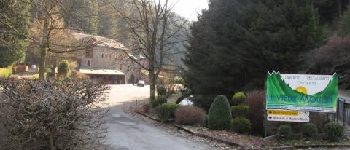
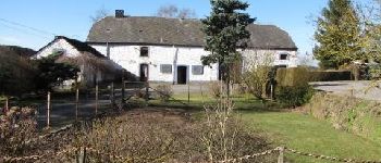
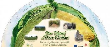
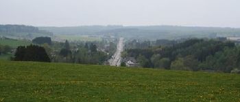
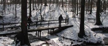
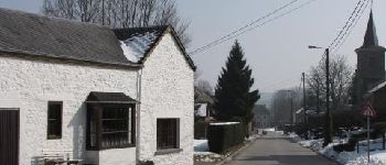
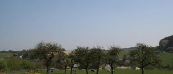
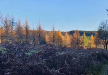
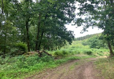
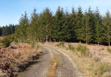
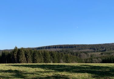
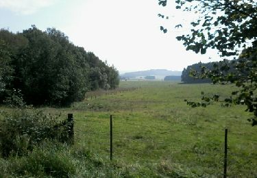
Tronçon 1 de la Boucle "Des profondeurs de la forêt aux paysages de plateaux" (98 Km)Au départ de La Roche-en-Ardenne, la boucle grimpe directement sur les plateaux de l’Ardenne centrale en passant par les villages de Hives et de Lavaux. Après une incursion en forêt, le tracé débouche sur la commune de Tenneville avec ses paysages agricoles, son ancienne chaussée et ses nombreuses vues très lointaines. La randonnée passe ensuite à proximité du village de Tenneville puis rejoint celui de Laneuville-au-Bois à travers la forêt.
Points of interest
Positioning
Comments
Trails nearby
![Trail Walking La Roche-en-Ardenne - RB-Lu-05 - Au gré de l’Ourthe, la balade des panoramas - Photo](https://media.geolcdn.com/t/375/260/ext.jpg?maxdim=2&url=https%3A%2F%2Fservices.sitytrail.com%2FGeolivesWS%2FDownloadMedia.ashx%3FTrailID%3D179614%26Media%3Ddb2598db-79d7-4bc8-afb7-55d65e443283.jpg)
![Walking Walking](https://static1.geolcdn.com/sitytour/trail-icons/101.png)
Walking
![](/images/other/stat-length.png)
![](https://static1.geolcdn.com/siteimages/upload/files/16400158638029165_repeat_loop_refresh_sync_direction_icon.png)
![Trail Walking La Roche-en-Ardenne - rando samrée 26/11/2020 - Photo](https://media.geolcdn.com/t/375/260/b9b92636-327b-470f-9fef-3742386ec0a6.jpg&format=jpg&maxdim=2)
![Walking Walking](https://static1.geolcdn.com/sitytour/trail-icons/101.png)
Walking
![](/images/other/stat-length.png)
![](https://static1.geolcdn.com/siteimages/upload/files/16400158638029165_repeat_loop_refresh_sync_direction_icon.png)
![Trail Walking La Roche-en-Ardenne - Samree-maboge-Samree - Photo](https://media.geolcdn.com/t/375/260/b1140dd6-ef3b-4be2-9da7-c3279afff05d.jpeg&format=jpg&maxdim=2)
![Walking Walking](https://static1.geolcdn.com/sitytour/trail-icons/101.png)
Walking
![](/images/other/stat-length.png)
![](https://static1.geolcdn.com/siteimages/upload/files/16400158638029165_repeat_loop_refresh_sync_direction_icon.png)
![Trail Walking La Roche-en-Ardenne - Balade à Samrée - Photo](https://media.geolcdn.com/t/375/260/8ac758ba-e05d-40e0-9a71-4c66a47c27c2.jpg&format=jpg&maxdim=2)
![Walking Walking](https://static1.geolcdn.com/sitytour/trail-icons/101.png)
Walking
![](/images/other/stat-length.png)
![](https://static1.geolcdn.com/siteimages/upload/files/16400158638029165_repeat_loop_refresh_sync_direction_icon.png)
![Trail Walking La Roche-en-Ardenne - Celtes et Ourthe - Photo](https://media.geolcdn.com/t/375/260/ext.jpg?maxdim=2&url=https%3A%2F%2Fservices.sitytrail.com%2FGeolivesWS%2FDownloadMedia.ashx%3FTrailID%3D854402%26Media%3Dfix__20171030123801.jpg)
![Walking Walking](https://static1.geolcdn.com/sitytour/trail-icons/101.png)
Walking
![](/images/other/stat-length.png)
![](https://static1.geolcdn.com/siteimages/upload/files/16400158638029165_repeat_loop_refresh_sync_direction_icon.png)
![Trail Walking La Roche-en-Ardenne - Un petit tour dans les fagnes de la goutte en partant de Samree - Photo](https://media.geolcdn.com/t/375/260/faa437e4-187a-4ff0-9cbb-6255b11e3348.jpg&format=jpg&maxdim=2)
![Walking Walking](https://static1.geolcdn.com/sitytour/trail-icons/101.png)
Walking
![](/images/other/stat-length.png)
![](https://static1.geolcdn.com/siteimages/upload/files/16400158638029165_repeat_loop_refresh_sync_direction_icon.png)
![Trail Walking La Roche-en-Ardenne - très belle - Photo](https://media.geolcdn.com/t/375/260/20ac222d-4563-44a0-a49e-63d4fb5a1b07.jpg&format=jpg&maxdim=2)
![Walking Walking](https://static1.geolcdn.com/sitytour/trail-icons/101.png)
Walking
![](/images/other/stat-length.png)
![](https://static1.geolcdn.com/siteimages/upload/files/16400158638029165_repeat_loop_refresh_sync_direction_icon.png)
![Trail Walking La Roche-en-Ardenne - buisson - nagimont - Ortho - Photo](https://media.geolcdn.com/t/375/260/ext.jpg?maxdim=2&url=https%3A%2F%2Fservices.sitytrail.com%2FGeolivesWS%2FDownloadMedia.ashx%3FTrailID%3D343702%26Media%3Dfix__20140909123303.jpg)
![Walking Walking](https://static1.geolcdn.com/sitytour/trail-icons/101.png)
Walking
![](/images/other/stat-length.png)
![](https://static1.geolcdn.com/siteimages/upload/files/16400158638029165_repeat_loop_refresh_sync_direction_icon.png)
![Walking Walking](https://static1.geolcdn.com/sitytour/trail-icons/101.png)
Walking
![](/images/other/stat-length.png)
![](https://static1.geolcdn.com/siteimages/upload/files/16400158638029165_repeat_loop_refresh_sync_direction_icon.png)