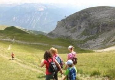
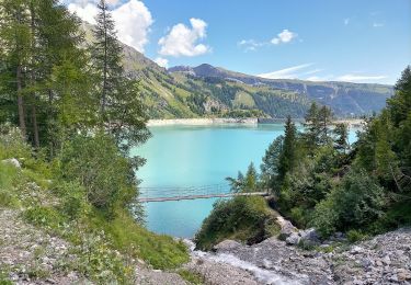
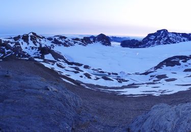
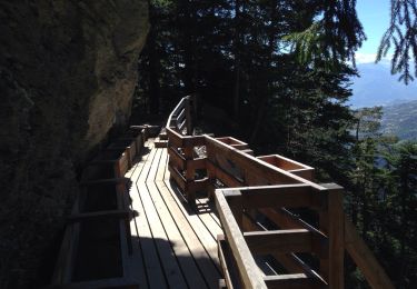
Trail Other activity Lenk - Wildstrubel (3''243 m)  2/2 - Photo
 Romrando
Romrando

User

© OpenStreetMap contributors
Length
Length
14 km
Max alt
Max alt
3231 m
Uphill gradient
Uphill gradient
613 m
Km-Effort
Km-Effort  
28 km
Min alt
Min alt
1103 m
Downhill gradient
Downhill gradient
2291 m
Boucle
Boucle
No
Creation date :
2014-12-11 00:00:00.0
Updated on :
2014-12-11 00:00:00.0

(0 Reviews)

Other activity
Other activity
--
Difficulty : Unknown

Scan this QR Code to open this trail in the SityTrail application

FREE GPS app for hiking

Logo SityTrail SityTrail

IGN / Geographical institutes

Download SityTrail from the App Store Download SityTrail from Google Play

Logo SityTrail SityTrail World

The world is yours!

Download SityTrail from the App Store Download SityTrail from Google Play Download SityTrail on Huawei AppGallery

About

Trail Other activity of 14 km to be discovered at Bern, Obersimmental-Saanen administrative district, Lenk. This trail is proposed by Romrando.

Description

Source:geocities.com/romrando

Etape 2/2

Itinéraire de montagne engagé avec marche sur glacier. Connaissance alpine nécessaire. Se renseigner à l''avance sur l''état du glacier. Ne pas s''y engager par temps incertain ou sans matériel s''il y subsiste de la neige.

De la cabane Wildstrubel on franchit le petit col à l''E puis par une courte descente on rejoint le glacier que l''on suit vers l''E puis en direction de la base du Wildstrubel (sans danger lorsqu''il est découvert, corde dans les autres cas).

- ATTENTION ! redoutable piège par brouillard !!!  

Par l''arête SW on gagne le sommet par un sentier mal marqué au début.

De là descente possible avec équipement (corde, crampons) et connaissance alpine sur la Lämmernhütte puis la Gemmi.

Autrement on revient sur ses pas jusqu''à un pointe au pied de l''arête SW et de là on plonge vers le NW par un sentier morrainique jusqu''au Flueseeli.

Un bon sentier franchit ensuite le ressaut rocheux qui domine le Rezliberg. De là on peut soit rejoindre Iffigenalp vers l''W par le franchissement du Ritzmad (450 m déniv. montée), soit rejoindre La Lenk par les "Simmenfälle".

Elevation profile

Positioning

Country:
Switzerland
Region :
Bern
Department/Province :
Obersimmental-Saanen administrative district
Municipality :
Lenk
Location:
Unknown
Start:(UTM)
382203 ; 5137683 (32T) N.

Trails nearby

Trail Walking Crans-Montana - Sentier de Huiton - Photo
Walking
GUIDE+

Walking

Very easy
(2)
Crans-Montana, Valais/Wallis, Sierre, Switzerland
7.1 km | 10.9 km-effort
2h 17min
No
Trail On foot Lenk - Lenk (Ritzdole) - Lenk (Simmenfälle) - Photo
On foot
GUIDE+

On foot

Easy
Lenk, Bern, Obersimmental-Saanen administrative district, Switzerland
8.2 km | 14.6 km-effort
3h 19min
No
Trail On foot Icogne - Er de Chermignon-Pra du Taillour - Photo
On foot
GUIDE+

On foot

Easy
Icogne, Valais/Wallis, Sierre, Switzerland
6.4 km | 10.2 km-effort
2h 19min
No
Trail On foot Crans-Montana - Plaine Morte-Les Violettes - Photo
On foot
GUIDE+

On foot

Easy
Crans-Montana, Valais/Wallis, Sierre, Switzerland
4.5 km | 11.5 km-effort
2h 36min
No
Trail Walking Icogne - Bisse du Ro - Photo
Walking
danihz

Walking

Easy
Icogne, Valais/Wallis, Sierre, Switzerland
8.8 km | 14.3 km-effort
3h 10min
No
Trail On foot Lenk - Iffigenalp-Stierenläger - Photo
On foot
GUIDE+

On foot

Easy
Lenk, Bern, Obersimmental-Saanen administrative district, Switzerland
3.3 km | 10.3 km-effort
2h 20min
No
Trail Walking Ayent - Le rawil - Photo
Walking
suzanne.bron

Walking

Medium
(1)
Ayent, Valais/Wallis, Hérens, Switzerland
5.8 km | 9 km-effort
2h 24min
Yes
Trail Nordic walking Ayent - 05.08.20 bisse d'Ayen depuis le barrage  - Photo
Nordic walking
suzanne.bron

Nordic walking

Very easy
Ayent, Valais/Wallis, Hérens, Switzerland
12.3 km | 18.5 km-effort
3h 46min
No
Trail Other activity Crans-Montana - Piste de Luge de l''Aminona - Photo
Other activity
GUIDE+

Other activity

Very easy
Crans-Montana, Valais/Wallis, Sierre, Switzerland
7.3 km | 10.2 km-effort
1h 47min
No


Close
My subscriptions