![](/images/other/stat-length.png)
![Trail Walking Guidel - Guidel-Plage - Photo](https://media.geolcdn.com/t/1900/400/ext.pjpeg?maxdim=2&url=https%3A%2F%2Fstatic1.geolcdn.com%2Fsiteimages%2Fupload%2Ffiles%2F1553511878bg_sport_marche.png)
Guidel-Plage
CHEVE
User
![Length](/images/other/stat-length.png)
Length
12.2 km
![Max alt](https://static1.geolcdn.com/siteimages/upload/files/1508320355ic_sort_altitude_max_24dp.png)
Max alt
48 m
![Uphill gradient](https://static1.geolcdn.com/siteimages/upload/files/1508320355ic_sort_den_pos_24dp.png)
Uphill gradient
168 m
![Km-Effort](/images/other/stat-length.png)
Km-Effort
14.4 km
![Min alt](https://static1.geolcdn.com/siteimages/upload/files/1508320355ic_sort_altitude_min_24dp.png)
Min alt
2 m
![Downhill gradient](https://static1.geolcdn.com/siteimages/upload/files/1508320355ic_sort_den_neg_24dp.png)
Downhill gradient
167 m
![Boucle](https://static1.geolcdn.com/siteimages/upload/files/16400158638029165_repeat_loop_refresh_sync_direction_icon.png)
Boucle
Yes
Creation date :
2014-12-10 00:00:00.0
Updated on :
2014-12-10 00:00:00.0
![Walking](https://static1.geolcdn.com/sitytour/trail-icons/101.png)
3h13
Difficulty : Easy
![Scan this QR Code to open this trail in the SityTrail application](https://capi.geolives.com/qq0zvz2zws4bq2lad0pu/sitytour/trails/185360/qr.png?size=200)
FREE GPS app for hiking
About
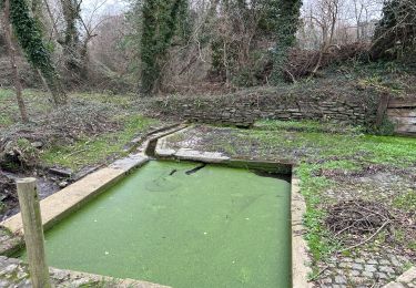
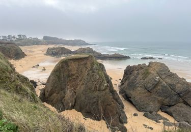
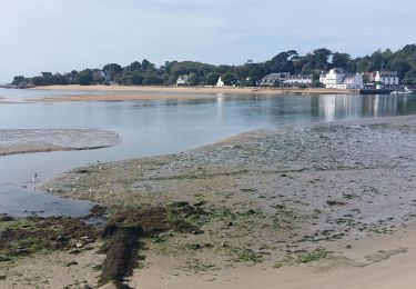
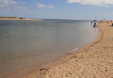
Trail Walking of 12.2 km to be discovered at Brittany, Morbihan, Guidel. This trail is proposed by CHEVE.
Description
Randonnée à peine modifiée de du circuit N°7 proposé par l'Office de Tourisme du Pays de Lorient.
Voir aussi une autre rando allongée dans ce même secteur.
Points of interest
Positioning
Country:
France
Region :
Brittany
Department/Province :
Morbihan
Municipality :
Guidel
Location:
Unknown
Start:(Dec)
Start:(UTM)
460594 ; 5291145 (30T) N.
Comments
Trails nearby
![Trail On foot Plœmeur - De la côte bleue aux collines blanches - Photo](https://media.geolcdn.com/t/375/260/b1cbbfe3-b17d-4626-90da-fc66faf0ad01.jpeg&format=jpg&maxdim=2)
![On foot On foot](https://static1.geolcdn.com/sitytour/trail-icons/100.png)
De la côte bleue aux collines blanches
On foot
Easy
Plœmeur,
Brittany,
Morbihan,
France
![](/images/other/stat-length.png)
9.1 km | 10 km-effort
2h 16min
![](https://static1.geolcdn.com/siteimages/upload/files/16400158638029165_repeat_loop_refresh_sync_direction_icon.png)
No
![Trail Walking Guidel - PR_56_Guidel_DA_04_Circuit3a_De-Guidel-Centre-Vers-La-Laita_20240510 - Photo](https://media.geolcdn.com/t/375/260/fd655af4-6a2a-49f0-825f-e8fdebea6460.jpg&format=jpg&maxdim=2)
![Walking Walking](https://static1.geolcdn.com/sitytour/trail-icons/101.png)
PR_56_Guidel_DA_04_Circuit3a_De-Guidel-Centre-Vers-La-Laita_20240510
Walking
Easy
Guidel,
Brittany,
Morbihan,
France
![](/images/other/stat-length.png)
14.7 km | 17.9 km-effort
4h 3min
![](https://static1.geolcdn.com/siteimages/upload/files/16400158638029165_repeat_loop_refresh_sync_direction_icon.png)
Yes
![Trail Walking Clohars-Carnoët - Le Pouldu - Photo](https://media.geolcdn.com/t/375/260/1a38db66-97d5-4b5b-9eac-2a7eff6538ed.jpg&format=jpg&maxdim=2)
![Walking Walking](https://static1.geolcdn.com/sitytour/trail-icons/101.png)
![Trail Walking Guidel - PR_56_Guidel_CA_03_Circuit3a_Autour-De-L-Etang-De-Lannenec_20240428 - Photo](https://media.geolcdn.com/t/375/260/6e0f082b-d9fc-4937-a2ef-b1992f251e56.jpg&format=jpg&maxdim=2)
![Walking Walking](https://static1.geolcdn.com/sitytour/trail-icons/101.png)
PR_56_Guidel_CA_03_Circuit3a_Autour-De-L-Etang-De-Lannenec_20240428
Walking
Easy
Guidel,
Brittany,
Morbihan,
France
![](/images/other/stat-length.png)
10.2 km | 11.7 km-effort
2h 39min
![](https://static1.geolcdn.com/siteimages/upload/files/16400158638029165_repeat_loop_refresh_sync_direction_icon.png)
No
![Trail Walking Guidel - Guidel plage 7,6 km - Photo](https://media.geolcdn.com/t/375/260/ea313e26-3f1c-4186-89bc-ac39bff3fa8a.jpg&format=jpg&maxdim=2)
![Walking Walking](https://static1.geolcdn.com/sitytour/trail-icons/101.png)
Guidel plage 7,6 km
Walking
Easy
Guidel,
Brittany,
Morbihan,
France
![](/images/other/stat-length.png)
7.6 km | 8.5 km-effort
2h 11min
![](https://static1.geolcdn.com/siteimages/upload/files/16400158638029165_repeat_loop_refresh_sync_direction_icon.png)
Yes
![Trail Walking Clohars-Carnoët - Pouldu port peintres 6,3 km - Photo](https://media.geolcdn.com/t/375/260/d878685e-3577-4835-a424-00b6066e1383.jpg&format=jpg&maxdim=2)
![Walking Walking](https://static1.geolcdn.com/sitytour/trail-icons/101.png)
Pouldu port peintres 6,3 km
Walking
Easy
Clohars-Carnoët,
Brittany,
Finistère,
France
![](/images/other/stat-length.png)
6.3 km | 7.2 km-effort
2h 12min
![](https://static1.geolcdn.com/siteimages/upload/files/16400158638029165_repeat_loop_refresh_sync_direction_icon.png)
Yes
![Trail Walking Clohars-Carnoët - Pouldu Roche Percée et retour 9,5 km - Photo](https://media.geolcdn.com/t/375/260/9c185896-328f-4e1d-8063-56e555ea4d34.jpg&format=jpg&maxdim=2)
![Walking Walking](https://static1.geolcdn.com/sitytour/trail-icons/101.png)
Pouldu Roche Percée et retour 9,5 km
Walking
Medium
Clohars-Carnoët,
Brittany,
Finistère,
France
![](/images/other/stat-length.png)
9.5 km | 10.7 km-effort
2h 46min
![](https://static1.geolcdn.com/siteimages/upload/files/16400158638029165_repeat_loop_refresh_sync_direction_icon.png)
Yes
![Trail Walking Guidel - PR_56_Guidel_BA_02_Circuit3b_Entre-Loch-Et-Laita_20231004 - Photo](https://media.geolcdn.com/t/375/260/c4260127-a5b9-4007-9324-09ddf3ba24ca.jpg&format=jpg&maxdim=2)
![Walking Walking](https://static1.geolcdn.com/sitytour/trail-icons/101.png)
PR_56_Guidel_BA_02_Circuit3b_Entre-Loch-Et-Laita_20231004
Walking
Easy
Guidel,
Brittany,
Morbihan,
France
![](/images/other/stat-length.png)
13.4 km | 15.7 km-effort
3h 34min
![](https://static1.geolcdn.com/siteimages/upload/files/16400158638029165_repeat_loop_refresh_sync_direction_icon.png)
Yes
![Trail Walking Guidel - laita - Photo](https://media.geolcdn.com/t/375/260/d2fc7529-c784-40ff-828a-4079bf6b08e9.jpg&format=jpg&maxdim=2)
![Walking Walking](https://static1.geolcdn.com/sitytour/trail-icons/101.png)