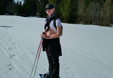
Trail Other activity Jaun - Hochmatt (2''151 m) - Photo
 Romrando
Romrando

User

© OpenStreetMap contributors
Length
Length
7.9 km
Max alt
Max alt
2139 m
Uphill gradient
Uphill gradient
795 m
Km-Effort
Km-Effort  
18.5 km
Min alt
Min alt
1392 m
Downhill gradient
Downhill gradient
767 m
Boucle
Boucle
No
Creation date :
2014-12-11 00:00:00.0
Updated on :
2014-12-11 00:00:00.0

(0 Reviews)

Other activity
Other activity
--
Difficulty : Unknown

Scan this QR Code to open this trail in the SityTrail application

FREE GPS app for hiking

Logo SityTrail SityTrail

IGN / Geographical institutes

Download SityTrail from the App Store Download SityTrail from Google Play

Logo SityTrail SityTrail World

The world is yours!

Download SityTrail from the App Store Download SityTrail from Google Play Download SityTrail on Huawei AppGallery

About

Trail Other activity of 7.9 km to be discovered at Fribourg, Gruyère District, Jaun. This trail is proposed by Romrando.

Description

Source:geocities.com/romrando - 2.8.05

Très belle petite sortie en terre fribourgeoise. Mais çà ne manque pas de caractère. Et quel point de vue !

Point de Départ : En voiture par Bulle puis Charmey jusqu''à Im Fang où l''on prend à droite une petite route étroite et sinueuse qui conduit près de l''alpage de "Schänis" à 1''400 m (parking obligatoire).

Par la route gagner l''alpage de Schänis puis à droite suivre un chemin peu marqué mais bien balisé (marques rouge et blanc). La montée se déroule sur un terrain raide et presque directement vers le sommet. On passe un petit bois puis on rejoint un autre alpage. Partir à gauche et remonter le long d''une petite combe puis passer une fausse arête vers la gauche pour gagner de grandes pentes herbeuses. Les remonter quelque peu vers la gauche puis franchement à droite pour rejoindre l''arête sommitale (poteau) d''où l''on découvre un splendide coup d''oeil. Suivre l''arête jusqu''au premier sommet.

Par delà les Gastlosen, les alpes se découvrent petit à petit, d''abord avec le Balmhorn, le Weisshorn et le Wildstrubel Au sommet vous avez alors la totale de l''Eiger au Mont-Blanc. (Compter 1h 30 à 2 heures). Repérer au SW le Vanil Noir, but d''une prochaine sortie.

Par la crête rejoindre le vrai sommet vers l''W puis toujours par l''arête commencer la descente qui conduit jusqu''à un col. De là par le chemin vers l''E puis la route carrossable on rejoint le point de départ par les alpages du "Lapé" puis du "Gros Adrey".

Elevation profile

Positioning

Country:
Switzerland
Region :
Fribourg
Department/Province :
Gruyère District
Municipality :
Jaun
Location:
Unknown
Start:(UTM)
365857 ; 5159462 (32T) N.

Trails nearby

Trail Touring skiing Saanen - abländschen - Photo
Touring skiing
baruc

Touring skiing

Medium
Saanen, Bern, Obersimmental-Saanen administrative district, Switzerland
8.5 km | 14 km-effort
3h 59min
Yes
Trail Walking Jaun - Alpenhüttenzauber: 4 Tage Voralpen von Charmey nach Wimmis - Photo
Walking
GUIDE+

Walking

Very easy
Jaun, Fribourg, Gruyère District, Switzerland
13.2 km | 24 km-effort
Unknown
No
Trail Walking Jaun - YHH088 Tour des Gastlosen - Photo
Walking
yveshumbert

Walking

Very difficult
Jaun, Fribourg, Gruyère District, Switzerland
11.4 km | 22 km-effort
4h 44min
Yes
Trail Other activity Jaun - Tour des Gastlosen - Photo
Other activity
pawenger

Other activity

Very easy
Jaun, Fribourg, Gruyère District, Switzerland
11.6 km | 22 km-effort
4h 59min
Yes
Trail Winter sports Jaun - Chalet du Soldat2010-02-28  - Photo
Winter sports
pawenger

Winter sports

Very easy
Jaun, Fribourg, Gruyère District, Switzerland
4.1 km | 9.1 km-effort
1h 36min
No
Trail Other activity Jaun - Chalet du Soldat - Photo
Other activity
Mangold

Other activity

Very easy
Jaun, Fribourg, Gruyère District, Switzerland
5.5 km | 12.5 km-effort
Unknown
Yes
Trail Other activity Jaun - Ascension_09_3 - Photo
Other activity
pierrepraz

Other activity

Very easy
Jaun, Fribourg, Gruyère District, Switzerland
22 km | 35 km-effort
Unknown
No
Trail Other activity Jaun - Gastlosen - tour des - Photo
Other activity
pierrepraz

Other activity

Very easy
Jaun, Fribourg, Gruyère District, Switzerland
10.8 km | 21 km-effort
Unknown
Yes
Trail Other activity Jaun - Jaun - Chalet du soldat - Photo
Other activity
pierrepraz

Other activity

Very easy
Jaun, Fribourg, Gruyère District, Switzerland
5.9 km | 13.6 km-effort
Unknown
No


Close
My subscriptions