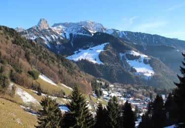
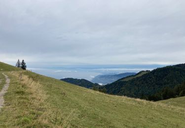
Trail Walking Montreux - YHH014 Dent de Jaman - Photo
© OpenStreetMap contributors
Length
Length
9.2 km
Max alt
Max alt
1862 m
Uphill gradient
Uphill gradient
888 m
Km-Effort
Km-Effort  
21 km
Min alt
Min alt
987 m
Downhill gradient
Downhill gradient
810 m
Boucle
Boucle
No
Creation date :
2014-12-11 00:00:00.0
Updated on :
2014-12-11 00:00:00.0

(0 Reviews)

Walking
Walking
4h52
Difficulty : Unknown

Scan this QR Code to open this trail in the SityTrail application

FREE GPS app for hiking

Logo SityTrail SityTrail

IGN / Geographical institutes

Download SityTrail from the App Store Download SityTrail from Google Play

Logo SityTrail SityTrail World

The world is yours!

Download SityTrail from the App Store Download SityTrail from Google Play Download SityTrail on Huawei AppGallery

About

Trail Walking of 9.2 km to be discovered at Vaud, District de la Riviera-Pays-d’Enhaut, Montreux. This trail is proposed by yveshumbert.

Description

Pour faire cette boucle, il faut parquer sa voiture à la gare de Montreux et de là prendre le train jusqu’au Avant (25 minutes). De la gare on suit une route goudronnée, qui part plein Est. Après environ 2 km, on quitte la route dans un tournant pour descendre par un sentier au bord d’une petite rivière. Une fois la rivière franchie, le sentier remonte. Le sentier coupe par 3 fois la route qui monte au Col de Jaman. Arrivé au col de Jaman, on passe devant l’auberge, puis on recommence à monter, par moment vous aurez une belle vue sur le lac. Arrivé au pied de la dent, il vous faudra environ 20 minutes pour la gravir. De temps en temps il faudra vous aider des mains.  Une fois redescendu vous pourrez aller vous restaurer au restaurant qui se trouvent sur la ligne de train du Rocher de Naye. Pour le retour le chemin  vous suivrez plus ou moins la ligne de chemin de fer qui redescend à Caux. Vue imprenable sur le lac Léman. A Caux vous reprendrez le chemin de fer pour Montreux (possibilité de descendre à pied).

Elevation profile

Positioning

Country:
Switzerland
Region :
Vaud
Department/Province :
District de la Riviera-Pays-d’Enhaut
Municipality :
Montreux
Location:
Unknown
Start:(UTM)
342174 ; 5146473 (32T) N.

Trails nearby

Trail Walking Montreux - Montreux - Villeneuve - Le Bouveret - Photo
Walking
GUIDE+

Walking

Very easy
(1)
Montreux, Vaud, District de la Riviera-Pays-d’Enhaut, Switzerland
14.5 km | 16.4 km-effort
Unknown
No
Trail On foot Montreux - Sentier des Narcisses - Photo
On foot
GUIDE+

On foot

Easy
Montreux, Vaud, District de la Riviera-Pays-d’Enhaut, Switzerland
5.4 km | 9.8 km-effort
2h 13min
Yes
Trail Walking Montreux - Le PACCOTA  - Photo
Walking
GioA10

Walking

Easy
Montreux, Vaud, District de la Riviera-Pays-d’Enhaut, Switzerland
5 km | 7.2 km-effort
1h 54min
Yes
Trail Walking Veytaux - st_Rochers-de-Naye - Photo
Walking
GUIDE+

Walking

Very easy
Veytaux, Vaud, District de la Riviera-Pays-d’Enhaut, Switzerland
6.4 km | 11.1 km-effort
1h 42min
No
Trail Mountain bike Blonay - Les Pléiades - Photo
Mountain bike
GUIDE+

Mountain bike

Very easy
Blonay, Vaud, District de la Riviera-Pays-d’Enhaut, Switzerland
35 km | 44 km-effort
11h 26min
No
Trail Walking Montreux - Dent de Jaman - Rochers - de Naye - Photo
Walking
GUIDE+

Walking

Very easy
(1)
Montreux, Vaud, District de la Riviera-Pays-d’Enhaut, Switzerland
3.4 km | 6.6 km-effort
Unknown
No
Trail Walking Montreux - Rando Caux Jaman Nayes - Photo
Walking
Fab-Oz

Walking

Difficult
Montreux, Vaud, District de la Riviera-Pays-d’Enhaut, Switzerland
15.8 km | 29 km-effort
4h 17min
Yes
Trail On foot Montreux - Les Gorges du Chauderon - Photo
On foot
famiski

On foot

Easy
Montreux, Vaud, District de la Riviera-Pays-d’Enhaut, Switzerland
6.7 km | 11.8 km-effort
2h 40min
Yes
Trail On foot Montreux - Itinéraire course à pied : Boucle Hauts-de-Caux - Sonchaux - Photo
On foot
famiski

On foot

Easy
Montreux, Vaud, District de la Riviera-Pays-d’Enhaut, Switzerland
9.8 km | 15.4 km-effort
3h 30min
Yes


Close
My subscriptions