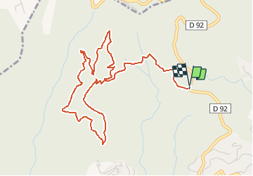
9 km | 14.2 km-effort
Grand Duc Alternatif
exxonz
User
Length
6.4 km
Max alt
395 m
Uphill gradient
204 m
Km-Effort
9.1 km
Min alt
248 m
Downhill gradient
203 m
Boucle
Yes
Creation date :
2014-12-10 00:00:00.0
Updated on :
2014-12-10 00:00:00.0
2h00
Difficulty : Unknown
FREE GPS app for hiking
About
Trail Walking of 6.4 km to be discovered at Provence-Alpes-Côte d'Azur, Maritime Alps, Mandelieu-la-Napoule. This trail is proposed by exxonz.
Description
Grand Duc Alternatif
Positioning
Country:
France
Region :
Provence-Alpes-Côte d'Azur
Department/Province :
Maritime Alps
Municipality :
Mandelieu-la-Napoule
Location:
Unknown
Start:(Dec)
Start:(UTM)
331882 ; 4824560 (32T) N.
Comments
Trails nearby
Mont Saint Martin
Walking
Easy
(1)
Mandelieu-la-Napoule,
Provence-Alpes-Côte d'Azur,
Maritime Alps,
France
3h 0min
Yes
Tanneron les mimosas
Walking
Very easy
(1)
Tanneron,
Provence-Alpes-Côte d'Azur,
Var,
France
12 km | 17.8 km-effort
3h 25min
Yes
Tanneron - petite boucle 12-02-2022
Walking
Easy
Tanneron,
Provence-Alpes-Côte d'Azur,
Var,
France
7.5 km | 10.8 km-effort
2h 0min
Yes
"Les oeufs de bouc"
Walking
Medium
Mandelieu-la-Napoule,
Provence-Alpes-Côte d'Azur,
Maritime Alps,
France
14.5 km | 22 km-effort
6h 42min
Yes
Grand Duc
Walking
Medium
Mandelieu-la-Napoule,
Provence-Alpes-Côte d'Azur,
Maritime Alps,
France
8.9 km | 12.5 km-effort
2h 47min
Yes
Crêtes du Tanneron
Walking
Difficult
Tanneron,
Provence-Alpes-Côte d'Azur,
Var,
France
14.9 km | 21 km-effort
5h 5min
Yes
châteaux de la Napoule
Walking
Easy
Mandelieu-la-Napoule,
Provence-Alpes-Côte d'Azur,
Maritime Alps,
France
5.6 km | 7.8 km-effort
2h 23min
Yes
Tanneron
sport
Very easy
Tanneron,
Provence-Alpes-Côte d'Azur,
Var,
France
9.7 km | 13.9 km-effort
Unknown
Yes
2024-02-16 Tanneron Mimosas
Walking
Medium
Tanneron,
Provence-Alpes-Côte d'Azur,
Var,
France
11.1 km | 17.8 km-effort
4h 2min
Yes
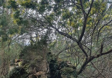
belle rando, et beau point vue, sentier facile.