![](/images/other/stat-length.png)
![Trail Walking Longpont - en forêt de Retz_16_Longpont_carrefour du Chapeau des Cordeliers_AR - Photo](https://media.geolcdn.com/t/1900/400/ext.pjpeg?maxdim=2&url=https%3A%2F%2Fservices.sitytrail.com%2FGeolivesWS%2FDownloadMedia.ashx%3FTrailID%3D182212%26Media%3D2d0dac56-d4ae-4d3e-ac16-36962e613620.jpg)
en forêt de Retz_16_Longpont_carrefour du Chapeau des Cordeliers_AR
en forêt de Retz
forêts de France
![Length](/images/other/stat-length.png)
![Max alt](https://static1.geolcdn.com/siteimages/upload/files/1508320355ic_sort_altitude_max_24dp.png)
![Uphill gradient](https://static1.geolcdn.com/siteimages/upload/files/1508320355ic_sort_den_pos_24dp.png)
![Km-Effort](/images/other/stat-length.png)
![Min alt](https://static1.geolcdn.com/siteimages/upload/files/1508320355ic_sort_altitude_min_24dp.png)
![Downhill gradient](https://static1.geolcdn.com/siteimages/upload/files/1508320355ic_sort_den_neg_24dp.png)
![Boucle](https://static1.geolcdn.com/siteimages/upload/files/16400158638029165_repeat_loop_refresh_sync_direction_icon.png)
![Walking](https://static1.geolcdn.com/sitytour/trail-icons/101.png)
3h17
Difficulty : Difficult
![Scan this QR Code to open this trail in the SityTrail application](https://capi.geolives.com/qq0zvz2zws4bq2lad0pu/sitytour/trails/182212/qr.png?size=200)
FREE GPS app for hiking
About
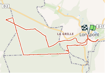
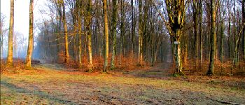
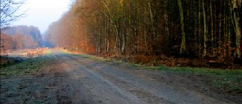
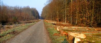
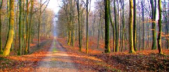
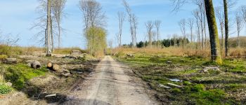
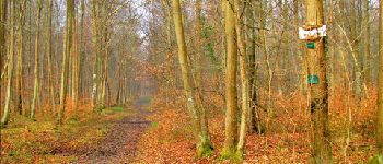
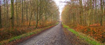
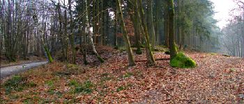
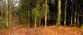
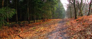
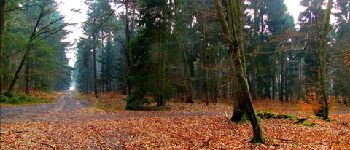
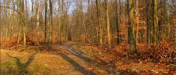
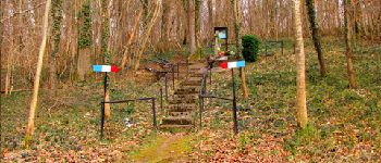
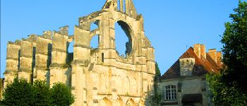
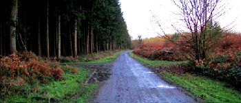
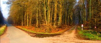
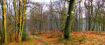
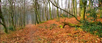
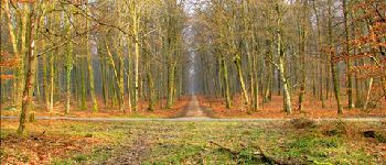
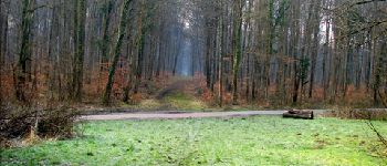
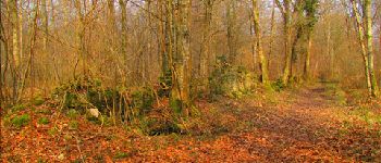
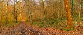
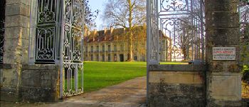
Trail Walking of 12.4 km to be discovered at Hauts-de-France, Aisne, Longpont. This trail is proposed by en forêt de Retz.
Description
voir aussi:
http://foret-de-retz.over-blog.com/
04/2013
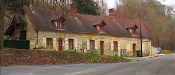
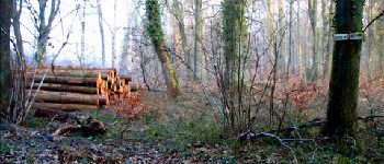
Au départ de l''abbaye de Longpont, rejoindre le GR11A aux "trois maisons". Suivre jusqu''au vieux chemin de Longpont. Sur ce chemin, prendre la laie des Grands Charmes au carrefour Bosc jusqu''au carrefour de la grosse Pierre. Prendre la laie de la Croix Pain Tendre jusqu''au carrefour du Hibou. Suivre la route de Chavigny jusqu''au carrefour de Chavigny. Prendre la laie des Monthieux jusqu''au carrefour du Chapeau des Cordeliers. Suivre la laie des Cordeliers jusqu''au carrefour des Chouettes. Prendre la laie de la Belle Epine jusqu''au carrefour de la Croix Bacquet. Suivre la route du Pendu jusqu''au carrefour du Pendu. Joindre la laie du vieux Mur (GPS conseillé). Après quelques centaines de mètres, prendre sur la droite en direction du monument de l''Aviateur puis suivre la route de Corcy en direction de Longpont. Au carrefour, tourner à droite sur la D2 et continuer jusqu''au pont surplombant la voie ferrée. Retour ensuite sur Longpont par la D2.
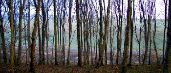
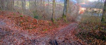
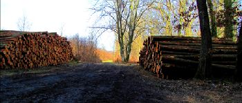
Points of interest
Positioning
Comments
Trails nearby
![Trail Walking Longpont - en forêt de Retz_19_Longpont_carrefour de Vauvaudran_AR - Photo](https://media.geolcdn.com/t/375/260/ext.jpg?maxdim=2&url=https%3A%2F%2Fservices.sitytrail.com%2FGeolivesWS%2FDownloadMedia.ashx%3FTrailID%3D210065%26Media%3D7400f5f3-6e68-4369-80be-a6f995897023.JPG)
![Walking Walking](https://static1.geolcdn.com/sitytour/trail-icons/101.png)
Walking
![](/images/other/stat-length.png)
![](https://static1.geolcdn.com/siteimages/upload/files/16400158638029165_repeat_loop_refresh_sync_direction_icon.png)
![Trail Walking Corcy - FLEURY .AISNE - Photo](https://media.geolcdn.com/t/375/260/761ff574-2cac-48f6-adc9-2cc5319599a5.jpg&format=jpg&maxdim=2)
![Walking Walking](https://static1.geolcdn.com/sitytour/trail-icons/101.png)
Walking
![](/images/other/stat-length.png)
![](https://static1.geolcdn.com/siteimages/upload/files/16400158638029165_repeat_loop_refresh_sync_direction_icon.png)
![Trail Walking Corcy - en forêt de Retz_91_04_2022_la Laie de la Belle Epine - Photo](https://media.geolcdn.com/t/375/260/28921992-4eb0-4c37-93fe-d10d0fd6e5c8.jpg&format=jpg&maxdim=2)
![Walking Walking](https://static1.geolcdn.com/sitytour/trail-icons/101.png)
Walking
![](/images/other/stat-length.png)
![](https://static1.geolcdn.com/siteimages/upload/files/16400158638029165_repeat_loop_refresh_sync_direction_icon.png)
![Trail On foot Puiseux-en-Retz - Route du Faîte - Photo](https://media.geolcdn.com/t/375/260/ed0a74b8-9801-4168-82e4-02efd0513983.jpeg&format=jpg&maxdim=2)
![On foot On foot](https://static1.geolcdn.com/sitytour/trail-icons/100.png)
On foot
![](/images/other/stat-length.png)
![](https://static1.geolcdn.com/siteimages/upload/files/16400158638029165_repeat_loop_refresh_sync_direction_icon.png)
![Trail On foot Longpont - en forêt de Retz_22_Longpont_Rond d'Orléans_AR - Photo](https://media.geolcdn.com/t/375/260/ext.jpg?maxdim=2&url=https%3A%2F%2Fservices.sitytrail.com%2FGeolivesWS%2FDownloadMedia.ashx%3FTrailID%3D262872%26Media%3D1ba3644a-d1e0-4418-a1a0-81ea6ad854f5.jpg)
![On foot On foot](https://static1.geolcdn.com/sitytour/trail-icons/100.png)
On foot
![](/images/other/stat-length.png)
![](https://static1.geolcdn.com/siteimages/upload/files/16400158638029165_repeat_loop_refresh_sync_direction_icon.png)
![Walking Walking](https://static1.geolcdn.com/sitytour/trail-icons/101.png)
Walking
![](/images/other/stat-length.png)
![](https://static1.geolcdn.com/siteimages/upload/files/16400158638029165_repeat_loop_refresh_sync_direction_icon.png)
![Walking Walking](https://static1.geolcdn.com/sitytour/trail-icons/101.png)
Walking
![](/images/other/stat-length.png)
![](https://static1.geolcdn.com/siteimages/upload/files/16400158638029165_repeat_loop_refresh_sync_direction_icon.png)
![Trail Walking Montgobert - en forêt de Retz_75_promenade familiale tout temps - Photo](https://media.geolcdn.com/t/375/260/ext.jpg?maxdim=2&url=https%3A%2F%2Fservices.sitytrail.com%2FGeolivesWS%2FDownloadMedia.ashx%3FTrailID%3D1095148%26Media%3D5f33be5a-4c31-4cd8-bb37-b8a410cfd5a0.JPG)
![Walking Walking](https://static1.geolcdn.com/sitytour/trail-icons/101.png)
Walking
![](/images/other/stat-length.png)
![](https://static1.geolcdn.com/siteimages/upload/files/16400158638029165_repeat_loop_refresh_sync_direction_icon.png)
![Trail Walking Longpont - en forêt de Retz_73_ballade (5) en toute saison - Photo](https://media.geolcdn.com/t/375/260/ext.jpg?maxdim=2&url=https%3A%2F%2Fservices.sitytrail.com%2FGeolivesWS%2FDownloadMedia.ashx%3FTrailID%3D1090338%26Media%3D6ce3ff2f-f287-4e28-8f30-4085ee0fb282.JPG)
![Walking Walking](https://static1.geolcdn.com/sitytour/trail-icons/101.png)
Walking
![](/images/other/stat-length.png)
![](https://static1.geolcdn.com/siteimages/upload/files/16400158638029165_repeat_loop_refresh_sync_direction_icon.png)