Trail Other activity Scuol - SCA-30-A-S-charl - Lü - Photo
 Dgubler
Dgubler

User

© OpenStreetMap contributors
Length
Length
13.2 km
Max alt
Max alt
2250 m
Uphill gradient
Uphill gradient
507 m
Km-Effort
Km-Effort  
19.6 km
Min alt
Min alt
1812 m
Downhill gradient
Downhill gradient
404 m
Boucle
Boucle
No
Creation date :
2014-12-11 00:00:00.0
Updated on :
2014-12-11 00:00:00.0

(0 Reviews)

Other activity
Other activity
--
Difficulty : Unknown

Scan this QR Code to open this trail in the SityTrail application

FREE GPS app for hiking

Logo SityTrail SityTrail

IGN / Geographical institutes

Download SityTrail from the App Store Download SityTrail from Google Play

Logo SityTrail SityTrail World

The world is yours!

Download SityTrail from the App Store Download SityTrail from Google Play Download SityTrail on Huawei AppGallery

About

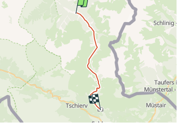
Trail Other activity of 13.2 km to be discovered at Grisons, Region Engiadina Bassa/Val Müstair, Scuol. This trail is proposed by Dgubler.

Description

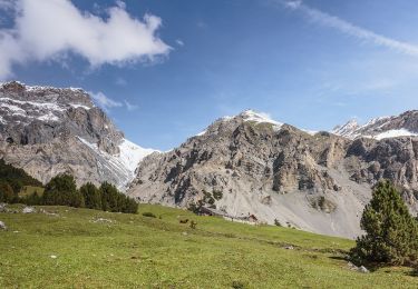
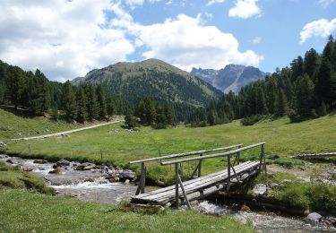
Le passage de l''antique sentier muletier du Pass da Costainas et de la mythique forêt d''arolles de God Tamangur. Axel avait 3 ans et demi le 13 août 2002, aussi n''en avons-nous fait que quelques centaines de mètres à S-charl, mais nous reviendrons!

Pass da Costainas was a major mule trail to Italy before the construction of the Il Fuorn road. The trail starts in S-charl, where the last Swiss bear was shot in 1904. Only a few weeks ago (I''m writing this early August 2005) did a  bear appear again in Switzerland, oddly in the same area, coming from Italy.

"Rumantschs, da pro! - Spendrai tras voss''amur nos linguach de la mort da Tamangur!"

Elevation profile

Positioning

Country:
Switzerland
Region :
Grisons
Department/Province :
Region Engiadina Bassa/Val Müstair
Municipality :
Scuol
Location:
Unknown
Start:(UTM)
602015 ; 5174412 (32T) N.

Trails nearby

Trail On foot Scuol - Alp Sesvenna - Fuorcla Sesvenna - Photo
On foot
GUIDE+

On foot

Easy
Scuol, Grisons, Region Engiadina Bassa/Val Müstair, Switzerland
5.3 km | 12.5 km-effort
2h 50min
No
Trail On foot Scuol - Alp Sesvenna - Rims - Photo
On foot
GUIDE+

On foot

Easy
Scuol, Grisons, Region Engiadina Bassa/Val Müstair, Switzerland
4.1 km | 12.6 km-effort
2h 51min
No
Trail On foot Scuol - Plan d'Immez - Cruschetta - Photo
On foot
GUIDE+

On foot

Easy
Scuol, Grisons, Region Engiadina Bassa/Val Müstair, Switzerland
3.3 km | 6.5 km-effort
1h 28min
No
Trail Walking Scuol - st_weekend09_np - Photo
Walking
GUIDE+

Walking

Very easy
Scuol, Grisons, Region Engiadina Bassa/Val Müstair, Switzerland
13.2 km | 19.7 km-effort
3h 47min
No
Trail Other activity Scuol - GR S-charl Tamangur Münstertal und zurück - Photo
Other activity
hrb

Other activity

Very easy
Scuol, Grisons, Region Engiadina Bassa/Val Müstair, Switzerland
24 km | 36 km-effort
Unknown
Yes
Trail Other activity Scuol - GR S-charl  Val Minger - Photo
Other activity
hrb

Other activity

Very easy
Scuol, Grisons, Region Engiadina Bassa/Val Müstair, Switzerland
16.8 km | 28 km-effort
Unknown
No


Close
My subscriptions