


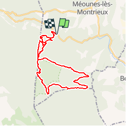

17.2 km | 26 km-effort


User


FREE GPS app for hiking
 SityTrail
IGN / Geographical institutes
SityTrail World
The world is yours!
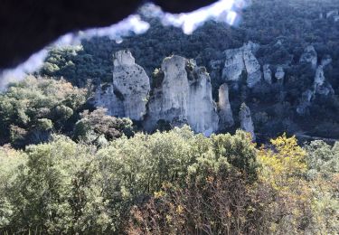
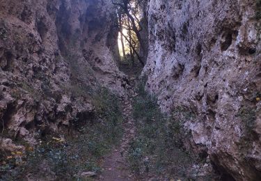
Trail Walking of 17.5 km to be discovered at Provence-Alpes-Côte d'Azur, Var, Méounes-lès-Montrieux. This trail is proposed by jmheydorff.
départ 2° gué (cote 253) de Montrieux, sur D 202, 2 kms W de la RD 554.
faire les crêtes du Grand et du Petit Puy, puis la crête de la barre des bidoufles -très difficile - on met les mains souvent
Walking
Walking
Walking

Walking
Running
Trail

Walking

Running

Other activity