![](/images/other/stat-length.png)
![Trail Walking Florennes - RB-Na-15 Campagnes et forêts de l’Entre-Sambre-et-Meuse - Photo](https://media.geolcdn.com/t/1900/400/ext.pjpeg?maxdim=2&url=https%3A%2F%2Fservices.sitytrail.com%2FGeolivesWS%2FDownloadMedia.ashx%3FTrailID%3D179641%26Media%3Dcd0eccee-617e-4840-aac3-bf752b2b2900.jpg)
RB-Na-15 Campagnes et forêts de l’Entre-Sambre-et-Meuse
GR Rando
Randonnez sur et autour des GR ® wallons (Sentiers de Grande Randonnée). PRO
![Length](/images/other/stat-length.png)
![Max alt](https://static1.geolcdn.com/siteimages/upload/files/1508320355ic_sort_altitude_max_24dp.png)
![Uphill gradient](https://static1.geolcdn.com/siteimages/upload/files/1508320355ic_sort_den_pos_24dp.png)
![Km-Effort](/images/other/stat-length.png)
![Min alt](https://static1.geolcdn.com/siteimages/upload/files/1508320355ic_sort_altitude_min_24dp.png)
![Downhill gradient](https://static1.geolcdn.com/siteimages/upload/files/1508320355ic_sort_den_neg_24dp.png)
![Boucle](https://static1.geolcdn.com/siteimages/upload/files/16400158638029165_repeat_loop_refresh_sync_direction_icon.png)
![Walking](https://static1.geolcdn.com/sitytour/trail-icons/101.png)
5h59
Difficulty : Easy
![Scan this QR Code to open this trail in the SityTrail application](https://capi.geolives.com/qq0zvz2zws4bq2lad0pu/sitytour/trails/179641/qr.png?size=200)
FREE GPS app for hiking
About
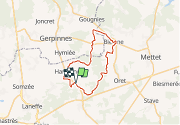
Trail Walking of 23 km to be discovered at Wallonia, Namur, Florennes. This trail is proposed by GR Rando.
Description
Hanzinelle – Hanzinne – Fromiée – Biesme – Hanzinelle
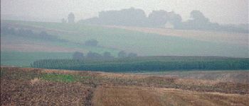
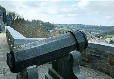
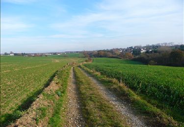
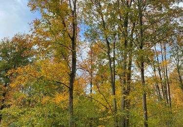
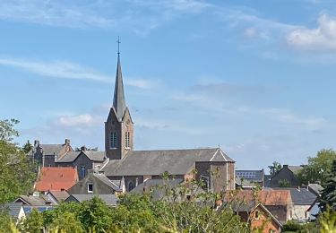
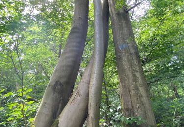
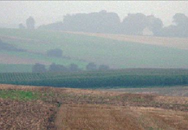
Cette randonnée vous mènera dans quelques beaux coins de l’Entre-Sambre-et-Meuse. L’itinéraire, qui parcourt une région assez méconnue, ne manque pourtant pas de charme. Il vous promène par champs et bois à travers un paysage modérément vallonné. Ici, le randonneur est bien chez lui : c’est le pays des marches militaires. Si Gerpinnes, à quelques kilomètres, est célèbre pour le Tour Sainte- Rolende, Hanzinelle a aussi sa marche Saint-Christophe.
Cartographie et documentation:
Carte IGN au 1 : 20 000, 53/1-2 « Hanzinelle – Mettet ». Topo-guides des
GR 125 « Tour de l’Entre-Sambre-et-Meuse »,
GR 129 « La Belgique en diagonale – Tronçon Ellezelles – Dinant ».
Où se désaltérer et se restaurer :
Le coin est pauvre en ressources « touristiques ». Hanzinelle a un bistrot. Celui de Biesme a fermé récemment (2007). Mais hors RB de 200 m, en suivant la rue du Mont vers la gauche, le randonneur trouvera l’hospitalité à la cafétéria de la plaine de sports.
Positioning
Comments
Trails nearby
![Trail Walking Gerpinnes - RB-HA-07 – Raccourci - Val de Sambre et Thudinie - Photo](https://media.geolcdn.com/t/375/260/ext.jpg?maxdim=2&url=https%3A%2F%2Fservices.sitytrail.com%2FGeolivesWS%2FDownloadMedia.ashx%3FTrailID%3D218725%26Media%3D62f2327c-676f-4ebe-a1e1-c69d1a3c316d.jpg)
![Walking Walking](https://static1.geolcdn.com/sitytour/trail-icons/101.png)
Walking
![](/images/other/stat-length.png)
![](https://static1.geolcdn.com/siteimages/upload/files/16400158638029165_repeat_loop_refresh_sync_direction_icon.png)
![Trail Walking Gerpinnes - RB-HA-07 - Val de Sambre et Thudinie - Photo](https://media.geolcdn.com/t/375/260/ext.jpg?maxdim=2&url=https%3A%2F%2Fservices.sitytrail.com%2FGeolivesWS%2FDownloadMedia.ashx%3FTrailID%3D179600%26Media%3D62f2327c-676f-4ebe-a1e1-c69d1a3c316d.jpg)
![Walking Walking](https://static1.geolcdn.com/sitytour/trail-icons/101.png)
Walking
![](/images/other/stat-length.png)
![](https://static1.geolcdn.com/siteimages/upload/files/16400158638029165_repeat_loop_refresh_sync_direction_icon.png)
![Trail Walking Walcourt - De Laneffe à Fraire par bois et campagnes - Photo](https://media.geolcdn.com/t/375/260/ext.jpg?maxdim=2&url=https%3A%2F%2Fservices.sitytrail.com%2FGeolivesWS%2FDownloadMedia.ashx%3FTrailID%3D95170%26Media%3Ddbcce443-4e55-417a-979c-b5ffbc4c1513.JPG)
![Walking Walking](https://static1.geolcdn.com/sitytour/trail-icons/101.png)
Walking
![](/images/other/stat-length.png)
![](https://static1.geolcdn.com/siteimages/upload/files/16400158638029165_repeat_loop_refresh_sync_direction_icon.png)
![Trail Walking Gerpinnes - 100 pc forestier - Photo](https://media.geolcdn.com/t/375/260/359c3f01-a3f3-427a-96cf-dcc1c9f53ce0.jpg&format=jpg&maxdim=2)
![Walking Walking](https://static1.geolcdn.com/sitytour/trail-icons/101.png)
Walking
![](/images/other/stat-length.png)
![](https://static1.geolcdn.com/siteimages/upload/files/16400158638029165_repeat_loop_refresh_sync_direction_icon.png)
![Walking Walking](https://static1.geolcdn.com/sitytour/trail-icons/101.png)
Walking
![](/images/other/stat-length.png)
![](https://static1.geolcdn.com/siteimages/upload/files/16400158638029165_repeat_loop_refresh_sync_direction_icon.png)
![Trail Walking Gerpinnes - Fromiée Belle haie GR129 - Photo](https://media.geolcdn.com/t/375/260/ef988689-339a-488a-975c-45144631053a.jpg&format=jpg&maxdim=2)
![Walking Walking](https://static1.geolcdn.com/sitytour/trail-icons/101.png)
Walking
![](/images/other/stat-length.png)
![](https://static1.geolcdn.com/siteimages/upload/files/16400158638029165_repeat_loop_refresh_sync_direction_icon.png)
![Trail Walking Florennes - RB-Na-15 Raccourci - Campagnes et forêts de l’Entre-Sambre-et-Meuse - Photo](https://media.geolcdn.com/t/375/260/ext.jpg?maxdim=2&url=https%3A%2F%2Fservices.sitytrail.com%2FGeolivesWS%2FDownloadMedia.ashx%3FTrailID%3D213765%26Media%3Dbdd90a99-a997-460a-a12d-eae6fea055d6.jpg)
![Walking Walking](https://static1.geolcdn.com/sitytour/trail-icons/101.png)
Walking
![](/images/other/stat-length.png)
![](https://static1.geolcdn.com/siteimages/upload/files/16400158638029165_repeat_loop_refresh_sync_direction_icon.png)
![Trail Road bike Gerpinnes - Biesme-Prée-Wagnèe-Mettet-Oret et retour - Photo](https://media.geolcdn.com/t/375/260/5584c0c6-120b-437c-af02-3c7470394634.jpg&format=jpg&maxdim=2)
![Road bike Road bike](https://static1.geolcdn.com/sitytour/trail-icons/201.png)
Road bike
![](/images/other/stat-length.png)
![](https://static1.geolcdn.com/siteimages/upload/files/16400158638029165_repeat_loop_refresh_sync_direction_icon.png)
![Trail Walking Florennes - D'Hanzinelle à Thy-le-Bauduin par la vallée de la Thyria - Photo](https://media.geolcdn.com/t/375/260/ext.jpg?maxdim=2&url=https%3A%2F%2Fstatic1.geolcdn.com%2Fsiteimages%2Fupload%2Ffiles%2F1553511878bg_sport_marche.png)
![Walking Walking](https://static1.geolcdn.com/sitytour/trail-icons/101.png)
Walking
![](/images/other/stat-length.png)
![](https://static1.geolcdn.com/siteimages/upload/files/16400158638029165_repeat_loop_refresh_sync_direction_icon.png)
mooie wandeling, veel en mooie natuur.
Beaux paysages enneigés - Belle rando
randonnée cool
rando très charmante très variée magnifique campagne petit village et sous bois