![](/images/other/stat-length.png)
![Trail Walking Soignies - RB-Ha-04 - Châteaux dans la campagne sonégienne - Photo](https://media.geolcdn.com/t/1900/400/ext.pjpeg?maxdim=2&url=https%3A%2F%2Fservices.sitytrail.com%2FGeolivesWS%2FDownloadMedia.ashx%3FTrailID%3D179597%26Media%3D21fa5ff4-e4a0-4b44-a2ce-de058db06825.jpg)
RB-Ha-04 - Châteaux dans la campagne sonégienne
GR Rando
Randonnez sur et autour des GR ® wallons (Sentiers de Grande Randonnée). PRO
![Length](/images/other/stat-length.png)
![Max alt](https://static1.geolcdn.com/siteimages/upload/files/1508320355ic_sort_altitude_max_24dp.png)
![Uphill gradient](https://static1.geolcdn.com/siteimages/upload/files/1508320355ic_sort_den_pos_24dp.png)
![Km-Effort](/images/other/stat-length.png)
![Min alt](https://static1.geolcdn.com/siteimages/upload/files/1508320355ic_sort_altitude_min_24dp.png)
![Downhill gradient](https://static1.geolcdn.com/siteimages/upload/files/1508320355ic_sort_den_neg_24dp.png)
![Boucle](https://static1.geolcdn.com/siteimages/upload/files/16400158638029165_repeat_loop_refresh_sync_direction_icon.png)
![Walking](https://static1.geolcdn.com/sitytour/trail-icons/101.png)
5h02
Difficulty : Very difficult
![Scan this QR Code to open this trail in the SityTrail application](https://capi.geolives.com/qq0zvz2zws4bq2lad0pu/sitytour/trails/179597/qr.png?size=200)
FREE GPS app for hiking
About
Trail Walking of 19.7 km to be discovered at Wallonia, Hainaut, Soignies. This trail is proposed by GR Rando.
Description
Chaussée-Notre-Dame – Thoricourt – Cambron-Saint-Vincent – Froidmont – Louvignies – Chaussée-Notre-Dame
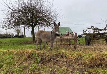
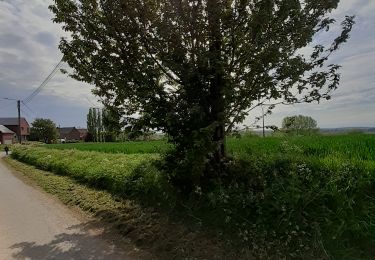
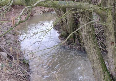
Cet itinéraire parcourt les douces ondulations de la campagne sonégienne.
La vieille ville de Soignies, comme Lessines, est ceinturée de carrières.
Mais tout alentour s’étend une région très champêtre propice à la randonnée.
Est-ce cette quiétude qui explique le nombre de châteaux implantés dans cette région? Thoricourt, Lombise, Louvignies… Depuis longtemps, ces belles demeures s’égrènent dans cette plaisante campagne hainuyère. Ce n’en est pas le moindre attrait. Attre n’est pas très éloigné, ni même Beloeil. Le randonneur goûtera le charme discret de ces sentiers, chemins rustiques et petites routes tranquilles qui l’emmèneront hors du temps.
Cartographie et documentation:
Carte IGN au 1 : 20 000, 38/7-8 « Lens – Soignies ».
Topo-guide des GR 123/121 « Tour du Hainaut occidental ».
Où se désaltérer et se restaurer :
Le randonneur ne trouvera guère de point de chute sur cet itinéraire. À Thoricourt,
un café se situe sur la belle place en face de l’église ; mais c’est bien tôt pour y faire déjà halte. Lombise possède un bon restaurant, surtout ouvert le week-end.
Choisissez donc une belle journée pour casser la croûte dans un coin nature de cette charmante région.
Positioning
Comments
Trails nearby
![Trail Walking Silly - Graty - bois d’Enghien - Graty - Photo](https://media.geolcdn.com/t/375/260/7271ef7d-a5b1-459f-b9eb-91dd19972deb.jpg&format=jpg&maxdim=2)
![Walking Walking](https://static1.geolcdn.com/sitytour/trail-icons/101.png)
Walking
![](/images/other/stat-length.png)
![](https://static1.geolcdn.com/siteimages/upload/files/16400158638029165_repeat_loop_refresh_sync_direction_icon.png)
![Trail On foot Silly - Thoricourt, its pathways and wooded hills - Photo](https://media.geolcdn.com/t/375/260/ext.jpg?maxdim=2&url=https%3A%2F%2Fpivotmedia.tourismewallonie.be%2FANX-02-03WK-008K%2FANX-02-03WK-008K.JPG)
![On foot On foot](https://static1.geolcdn.com/sitytour/trail-icons/100.png)
On foot
![](/images/other/stat-length.png)
![](https://static1.geolcdn.com/siteimages/upload/files/16400158638029165_repeat_loop_refresh_sync_direction_icon.png)
![Trail Walking Soignies - RB-Ha-04 - Raccourci - Châteaux dans la campagne sonégienne - Photo](https://media.geolcdn.com/t/375/260/ext.jpg?maxdim=2&url=https%3A%2F%2Fservices.sitytrail.com%2FGeolivesWS%2FDownloadMedia.ashx%3FTrailID%3D217839%26Media%3D21fa5ff4-e4a0-4b44-a2ce-de058db06825.jpg)
![Walking Walking](https://static1.geolcdn.com/sitytour/trail-icons/101.png)
Walking
![](/images/other/stat-length.png)
![](https://static1.geolcdn.com/siteimages/upload/files/16400158638029165_repeat_loop_refresh_sync_direction_icon.png)
![Trail Walking Soignies - Horrues 14,5 km - Photo](https://media.geolcdn.com/t/375/260/4296edbd-7b6f-49bd-89e4-aba51d84c626.jpg&format=jpg&maxdim=2)
![Walking Walking](https://static1.geolcdn.com/sitytour/trail-icons/101.png)
Walking
![](/images/other/stat-length.png)
![](https://static1.geolcdn.com/siteimages/upload/files/16400158638029165_repeat_loop_refresh_sync_direction_icon.png)
![Trail Walking Soignies - Autour du Grand Pont - Photo](https://media.geolcdn.com/t/375/260/0e9b2b89-cfcc-4492-b4cb-7034c330aa56.jpg&format=jpg&maxdim=2)
![Walking Walking](https://static1.geolcdn.com/sitytour/trail-icons/101.png)
Walking
![](/images/other/stat-length.png)
![](https://static1.geolcdn.com/siteimages/upload/files/16400158638029165_repeat_loop_refresh_sync_direction_icon.png)
![Trail Walking Soignies - Neufvilles 16 km - Photo](https://media.geolcdn.com/t/375/260/d720281b-a172-4419-8ccc-794cd94d7af8.jpg&format=jpg&maxdim=2)
![Walking Walking](https://static1.geolcdn.com/sitytour/trail-icons/101.png)
Walking
![](/images/other/stat-length.png)
![](https://static1.geolcdn.com/siteimages/upload/files/16400158638029165_repeat_loop_refresh_sync_direction_icon.png)
![Trail On foot Soignies - balade du Pont Wazon - Photo](https://media.geolcdn.com/t/375/260/1e67ae7d-584c-41b3-a9df-b2b447d671d2.jpg&format=jpg&maxdim=2)
![On foot On foot](https://static1.geolcdn.com/sitytour/trail-icons/100.png)
On foot
![](/images/other/stat-length.png)
![](https://static1.geolcdn.com/siteimages/upload/files/16400158638029165_repeat_loop_refresh_sync_direction_icon.png)
![Trail Walking Silly - silly05042021 - Photo](https://media.geolcdn.com/t/375/260/ext.jpg?maxdim=2&url=https%3A%2F%2Fstatic1.geolcdn.com%2Fsiteimages%2Fupload%2Ffiles%2F1553511878bg_sport_marche.png)
![Walking Walking](https://static1.geolcdn.com/sitytour/trail-icons/101.png)
Walking
![](/images/other/stat-length.png)
![](https://static1.geolcdn.com/siteimages/upload/files/16400158638029165_repeat_loop_refresh_sync_direction_icon.png)
![Trail Walking Silly - Promenade Piedescaus à Graty - Photo](https://media.geolcdn.com/t/375/260/35c2b61a-3aa0-4b66-a60f-4fd0125ea9f5.jpg&format=jpg&maxdim=2)
![Walking Walking](https://static1.geolcdn.com/sitytour/trail-icons/101.png)
Walking
![](/images/other/stat-length.png)
![](https://static1.geolcdn.com/siteimages/upload/files/16400158638029165_repeat_loop_refresh_sync_direction_icon.png)