![](/images/other/stat-length.png)
Milpattes - 04032013
© OpenStreetMap contributors
![Walking](https://static1.geolcdn.com/sitytour/trail-icons/101.png)
Walking
2h06
Difficulty : Medium
![Length](/images/other/stat-length.png)
Length
8.5 km
![Max alt](https://static1.geolcdn.com/siteimages/upload/files/1508320355ic_sort_altitude_max_24dp.png)
Max alt
53 m
![Uphill gradient](https://static1.geolcdn.com/siteimages/upload/files/1508320355ic_sort_den_pos_24dp.png)
Uphill gradient
66 m
![Km-Effort](/images/other/stat-length.png)
Km-Effort
9.4 km
![Min alt](https://static1.geolcdn.com/siteimages/upload/files/1508320355ic_sort_altitude_min_24dp.png)
Min alt
23 m
![Downhill gradient](https://static1.geolcdn.com/siteimages/upload/files/1508320355ic_sort_den_neg_24dp.png)
Downhill gradient
68 m
![Boucle](https://static1.geolcdn.com/siteimages/upload/files/16400158638029165_repeat_loop_refresh_sync_direction_icon.png)
Boucle
Yes
Creation date :
2014-12-10 00:00:00.0
Updated on :
2014-12-10 00:00:00.0
![Walking](https://static1.geolcdn.com/sitytour/trail-icons/101.png)
2h06
Difficulty : Medium
![Scan this QR Code to open this trail in the SityTrail application](https://capi.geolives.com/qq0zvz2zws4bq2lad0pu/sitytour/trails/178129/qr.png?size=200)
FREE GPS app for hiking
About
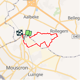
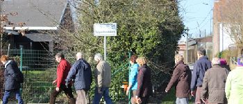
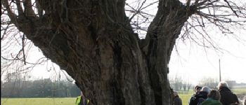
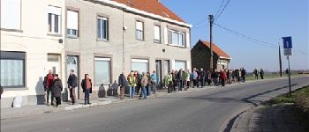
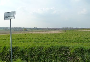
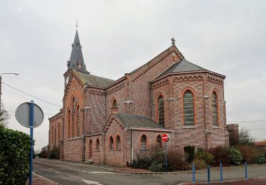
Trail Walking of 8.5 km to be discovered at Wallonia, Hainaut, Mouscron. This trail is proposed by jacques.moulin@hotmail.com.
Description
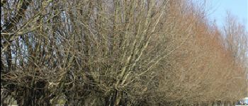
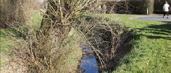
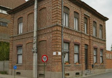
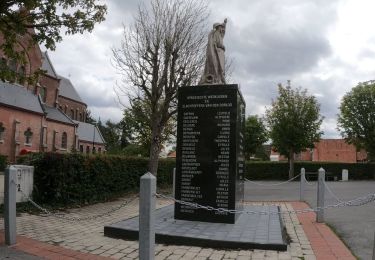
Du Petit Cornil, on rejoint la rue de la Royenne pour remonter jusqu''en Flandre. En passant par le Piro Lannoy, on rejoint Rollegem en empruntant divers sentiers dallés. Après le centre sportif, on reprend plein Ouest et toujours par des sentiers dallés on remonte progressivement jusqu''à l''arrière des Ets Depoortere avant de rejoindre notre point de départ.
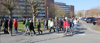
Points of interest
Positioning
Country:
Belgium
Region :
Wallonia
Department/Province :
Hainaut
Municipality :
Mouscron
Location:
Mouscron
Start:(Dec)
Start:(UTM)
515665 ; 5623454 (31U) N.
Comments
Trails nearby
![Trail On foot Kortrijk - Markebeekpad - Photo](https://media.geolcdn.com/t/375/260/e7c7bf34-88a3-4b33-97ab-5fbbd87b7c1d.jpeg&format=jpg&maxdim=2)
![On foot On foot](https://static1.geolcdn.com/sitytour/trail-icons/100.png)
Markebeekpad
On foot
Easy
Kortrijk,
Flanders,
West Flanders,
Belgium
![](/images/other/stat-length.png)
4.3 km | 5 km-effort
1h 8min
![](https://static1.geolcdn.com/siteimages/upload/files/16400158638029165_repeat_loop_refresh_sync_direction_icon.png)
Yes
![Trail On foot Menin - Smokkelaarspad - Photo](https://media.geolcdn.com/t/375/260/dfeb53ad-0f3e-45a5-b15b-6104366d05fc.jpeg&format=jpg&maxdim=2)
![On foot On foot](https://static1.geolcdn.com/sitytour/trail-icons/100.png)
Smokkelaarspad
On foot
Easy
Menin,
Flanders,
West Flanders,
Belgium
![](/images/other/stat-length.png)
10.3 km | 11.2 km-effort
2h 32min
![](https://static1.geolcdn.com/siteimages/upload/files/16400158638029165_repeat_loop_refresh_sync_direction_icon.png)
Yes
![Trail On foot Menin - Preshoekpad - Photo](https://media.geolcdn.com/t/375/260/853ea2e0-d894-4cfc-bc99-fc78368c5def.jpeg&format=jpg&maxdim=2)
![On foot On foot](https://static1.geolcdn.com/sitytour/trail-icons/100.png)
![Trail On foot Menin - Kortewagenpad Lauwe - Photo](https://media.geolcdn.com/t/375/260/f545b169-9dc5-48d6-bcd5-5fdbffb4f316.jpeg&format=jpg&maxdim=2)
![On foot On foot](https://static1.geolcdn.com/sitytour/trail-icons/100.png)
Kortewagenpad Lauwe
On foot
Easy
Menin,
Flanders,
West Flanders,
Belgium
![](/images/other/stat-length.png)
13 km | 14.4 km-effort
3h 16min
![](https://static1.geolcdn.com/siteimages/upload/files/16400158638029165_repeat_loop_refresh_sync_direction_icon.png)
Yes
![Trail Walking Menin - DKP2013 - Photo](https://media.geolcdn.com/t/375/260/ext.jpg?maxdim=2&url=https%3A%2F%2Fstatic1.geolcdn.com%2Fsiteimages%2Fupload%2Ffiles%2F1553511878bg_sport_marche.png)
![Walking Walking](https://static1.geolcdn.com/sitytour/trail-icons/101.png)
DKP2013
Walking
Very easy
(3)
Menin,
Flanders,
West Flanders,
Belgium
![](/images/other/stat-length.png)
7.7 km | 8.4 km-effort
1h 38min
![](https://static1.geolcdn.com/siteimages/upload/files/16400158638029165_repeat_loop_refresh_sync_direction_icon.png)
No
![Trail Walking Mouscron - Milpattes - 21012013 - Photo](https://media.geolcdn.com/t/375/260/ext.jpg?maxdim=2&url=https%3A%2F%2Fservices.sitytrail.com%2FGeolivesWS%2FDownloadMedia.ashx%3FTrailID%3D177547%26Media%3Da7417999-4fc1-43d3-88c3-3df18a4067b6.JPG)
![Walking Walking](https://static1.geolcdn.com/sitytour/trail-icons/101.png)
Milpattes - 21012013
Walking
Easy
Mouscron,
Wallonia,
Hainaut,
Belgium
![](/images/other/stat-length.png)
6 km | 6.7 km-effort
1h 28min
![](https://static1.geolcdn.com/siteimages/upload/files/16400158638029165_repeat_loop_refresh_sync_direction_icon.png)
Yes
![Trail Walking Menin - Milpattes - 19112012 - Photo](https://media.geolcdn.com/t/375/260/ext.jpg?maxdim=2&url=https%3A%2F%2Fservices.sitytrail.com%2FGeolivesWS%2FDownloadMedia.ashx%3FTrailID%3D163481%26Media%3Dbc875ad0-3971-4ad9-ab3d-580b96ef771d.jpg)
![Walking Walking](https://static1.geolcdn.com/sitytour/trail-icons/101.png)
Milpattes - 19112012
Walking
Very easy
Menin,
Flanders,
West Flanders,
Belgium
![](/images/other/stat-length.png)
7.7 km | 8.3 km-effort
1h 49min
![](https://static1.geolcdn.com/siteimages/upload/files/16400158638029165_repeat_loop_refresh_sync_direction_icon.png)
Yes
![Trail Walking Kortrijk - bellegem marche - Photo](https://media.geolcdn.com/t/375/260/ext.jpg?maxdim=2&url=https%3A%2F%2Fstatic1.geolcdn.com%2Fsiteimages%2Fupload%2Ffiles%2F1553511878bg_sport_marche.png)
![Walking Walking](https://static1.geolcdn.com/sitytour/trail-icons/101.png)
bellegem marche
Walking
Easy
Kortrijk,
Flanders,
West Flanders,
Belgium
![](/images/other/stat-length.png)
8.9 km | 10.5 km-effort
1h 58min
![](https://static1.geolcdn.com/siteimages/upload/files/16400158638029165_repeat_loop_refresh_sync_direction_icon.png)
Yes
![Trail Road bike Mouscron - Mouscron Tournai Mouscron - Photo](https://media.geolcdn.com/t/375/260/ext.jpg?maxdim=2&url=https%3A%2F%2Fstatic1.geolcdn.com%2Fsiteimages%2Fupload%2Ffiles%2F1524743154velo.jpg)
![Road bike Road bike](https://static1.geolcdn.com/sitytour/trail-icons/201.png)
Mouscron Tournai Mouscron
Road bike
Very easy
Mouscron,
Wallonia,
Hainaut,
Belgium
![](/images/other/stat-length.png)
53 km | 57 km-effort
3h 48min
![](https://static1.geolcdn.com/siteimages/upload/files/16400158638029165_repeat_loop_refresh_sync_direction_icon.png)
Yes