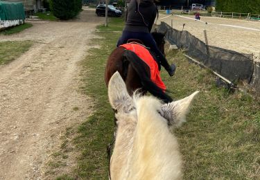
Trail Walking Saint-Marcel-lès-Valence - Balade VSM N° 10 le trou du renard - Photo

Balade VSM N° 10 le trou du renard

© OpenStreetMap contributors
Length
Length
5.9 km
Max alt
Max alt
162 m
Uphill gradient
Uphill gradient
35 m
Km-Effort
Km-Effort  
6.3 km
Min alt
Min alt
140 m
Downhill gradient
Downhill gradient
35 m
Boucle
Boucle
Yes
Creation date :
2014-12-10 00:00:00.0
Updated on :
2014-12-10 00:00:00.0

(1 Reviews)

Walking
Walking
1h22
Difficulty : Very easy

Scan this QR Code to open this trail in the SityTrail application

FREE GPS app for hiking

Logo SityTrail SityTrail

IGN / Geographical institutes

Download SityTrail from the App Store Download SityTrail from Google Play

Logo SityTrail SityTrail World

The world is yours!

Download SityTrail from the App Store Download SityTrail from Google Play Download SityTrail on Huawei AppGallery

About

Trail Walking of 5.9 km to be discovered at Auvergne-Rhône-Alpes, Drôme, Saint-Marcel-lès-Valence. This trail is proposed by michelguilhou.

Description

Départ place de la mairie.
Se diriger en direction de la salle culturelle ‘’ Espace Liberté ‘’. Au petit rond point prendre à gauche rue de la liberté, passez devant « L’espace Liberté » et continuez à suivre la rue de la liberté sur 850 m.
1- A la fin de la route prendre à gauche la rue ‘Topaze’ puis la première à droite ‘Emile Zola’
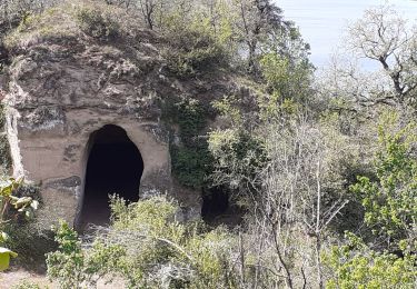
2- Vous coupez la route goudronnée pour continuer tout droit sur le chemin, après avoir fait une petite descente goudronnée. On retrouve un chemin de terre puis plus loin sur votre gauche, dans le talus vous remarquerez des trous : ce sont des terriers à renards (d’où le nom du chemin ). Ils peuvent être dissimulés par la végétation.
3– Continuez le chemin jusqu’à l’intersection d’une petite route goudronnée. Tournez à droite et suivre le chemin de terre jusqu’à la voie ferrée (
4-Il est possible, ici, de faire un aller-retour pour éviter la route ( assez passante)
Passez sous le pont de la voie ferrée, vous arrivez sur une route goudronnée, continuez sur la droite pour faire la montée. Après avoir parcouru environ 800 mètres, vous rejoignez la route de Bourg-lès-Valence à St Marcel.
5- Au niveau du rond point, prendre à droite et se diriger vers le pont du chemin de fer. Par mesure de sécurité faire la petite montée à gauche de la chaussée pour ne pas avoir à traverser sur le pont où la visibilité n’est pas bonne. Continuez pour reprendre à gauche le point 2  pour retour sur la mairie

Elevation profile

Points of interest

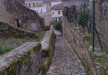
Point of interest Saint-Marcel-lès-Valence - point  N°1 - Photo
michelguilhou
SAINT-MARCEL-LÈS-VALENCE 
Point of interest Saint-Marcel-lès-Valence - Point 2 - Photo
michelguilhou
SAINT-MARCEL-LÈS-VALENCE 
Point of interest Saint-Marcel-lès-Valence - point 3 - Photo
michelguilhou
SAINT-MARCEL-LÈS-VALENCE 
Point of interest Saint-Marcel-lès-Valence - point 4 - Photo
michelguilhou
SAINT-MARCEL-LÈS-VALENCE 
Point of interest Saint-Marcel-lès-Valence -  point 5 - Photo
michelguilhou
SAINT-MARCEL-LÈS-VALENCE 
Point of interest Saint-Marcel-lès-Valence -  point 6 - Photo
michelguilhou
SAINT-MARCEL-LÈS-VALENCE 
Point of interest Saint-Marcel-lès-Valence -  point 6 - Photo
michelguilhou
SAINT-MARCEL-LÈS-VALENCE 

Positioning

Country:
France
Region :
Auvergne-Rhône-Alpes
Department/Province :
Drôme
Municipality :
Saint-Marcel-lès-Valence
Location:
Unknown
Start:(UTM)
654136 ; 4981598 (31T) N.

Comments

Please log in to post a review or rate the element


Trails nearby

Trail Walking Châteauneuf-sur-Isère - Châteauneuf d isere le chemin des carriers - Photo
Walking
meillon

Walking

Very easy
(1)
Châteauneuf-sur-Isère, Auvergne-Rhône-Alpes, Drôme, France
9.4 km | 12.6 km-effort
4h 25min
Yes
Trail Walking Saint-Marcel-lès-Valence - Balade  VSM N° 5 -  pour rejoindre le Guimand - Photo
Walking
michelguilhou

Walking

Very easy
(2)
Saint-Marcel-lès-Valence, Auvergne-Rhône-Alpes, Drôme, France
9.5 km | 10 km-effort
2h 15min
Yes
Trail Walking Châteauneuf-sur-Isère - 26 Châteauneuf didier - Photo
Walking
GUIDE
randodyssée

Walking

Easy
Châteauneuf-sur-Isère, Auvergne-Rhône-Alpes, Drôme, France
6.6 km | 9.4 km-effort
2h 40min
Yes
Trail Walking Châteauneuf-sur-Isère - Châteauneuf/isere - Photo
Walking
cousam

Walking

Easy
Châteauneuf-sur-Isère, Auvergne-Rhône-Alpes, Drôme, France
10.6 km | 14.8 km-effort
3h 39min
Yes
Trail Walking Saint-Marcel-lès-Valence - Vers le Guimand - Photo
Walking
bernadette revoux

Walking

Very easy
Saint-Marcel-lès-Valence, Auvergne-Rhône-Alpes, Drôme, France
12.5 km | 13.2 km-effort
3h 1min
No
Trail Walking Châteauneuf-sur-Isère - 26 château Neuf sur Isère 08 05 21 - Photo
Walking
GUIDE
randodyssée

Walking

Very easy
Châteauneuf-sur-Isère, Auvergne-Rhône-Alpes, Drôme, France
5.5 km | 8 km-effort
2h 7min
Yes
Trail Mountain bike Valence - Grande Traversée des PréAlpes à VTT : Valence - Gap - Sisteron - Photo
Mountain bike
tracegps

Mountain bike

Very difficult
(1)
Valence, Auvergne-Rhône-Alpes, Drôme, France
366 km | 505 km-effort
48h 0min
No
Trail Mountain bike Valence - Grande Traversée des PréAlpes à VTT : Valence - Livron sur Drôme - Photo
Mountain bike
tracegps

Mountain bike

Medium
Valence, Auvergne-Rhône-Alpes, Drôme, France
32 km | 34 km-effort
2h 0min
No
Trail Horseback riding Bourg-lès-Valence - Télégraphe  - Photo
Horseback riding
002019.2b494ff34774424a8b2d13bb4038e044.1757

Horseback riding

Medium
Bourg-lès-Valence, Auvergne-Rhône-Alpes, Drôme, France
13.7 km | 15.2 km-effort
1h 51min
Yes


Close
My subscriptions