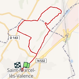
![](/images/other/stat-length.png)
![Trail Walking Saint-Marcel-lès-Valence - Balade VSM N°3 les blanc Chambaud - Photo](https://media.geolcdn.com/t/1900/400/ext.pjpeg?maxdim=2&url=https%3A%2F%2Fstatic1.geolcdn.com%2Fsiteimages%2Fupload%2Ffiles%2F1553511878bg_sport_marche.png)
Balade VSM N°3 les blanc Chambaud
michelguilhou
User
![Length](/images/other/stat-length.png)
![Max alt](https://static1.geolcdn.com/siteimages/upload/files/1508320355ic_sort_altitude_max_24dp.png)
![Uphill gradient](https://static1.geolcdn.com/siteimages/upload/files/1508320355ic_sort_den_pos_24dp.png)
![Km-Effort](/images/other/stat-length.png)
![Min alt](https://static1.geolcdn.com/siteimages/upload/files/1508320355ic_sort_altitude_min_24dp.png)
![Downhill gradient](https://static1.geolcdn.com/siteimages/upload/files/1508320355ic_sort_den_neg_24dp.png)
![Boucle](https://static1.geolcdn.com/siteimages/upload/files/16400158638029165_repeat_loop_refresh_sync_direction_icon.png)
![Walking](https://static1.geolcdn.com/sitytour/trail-icons/101.png)
2h30
Difficulty : Easy
![Scan this QR Code to open this trail in the SityTrail application](https://capi.geolives.com/qq0zvz2zws4bq2lad0pu/sitytour/trails/174188/qr.png?size=200)
FREE GPS app for hiking
About
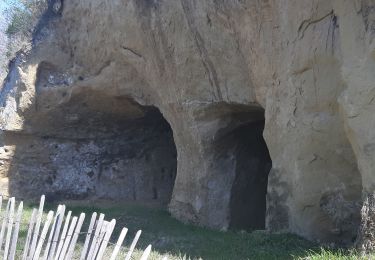
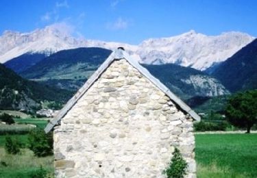
Trail Walking of 9.4 km to be discovered at Auvergne-Rhône-Alpes, Drôme, Saint-Marcel-lès-Valence. This trail is proposed by michelguilhou.
Description
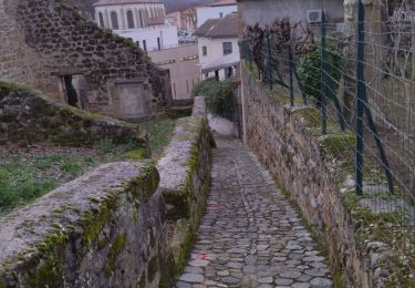
) Direction Eglise, devant la boulangerie à Gauche , le « Pass’âge ». A la sortie, traverser et contourner la chapelle côté HLM puis reprendre la rue et longer la voie ferrée sur 900 mètres. Après avoir passé sur le carrefour de la route de Chateauneuf, prendre le deuxième chemin sur la gauche (1)
2) Sur la Gauche au moment où vous attaquez la montée, se trouve la ferme des Grandes Terres. Sur le plateau lorsque vous arrivez sur la route, tourner à Droite direction « Les Blancs »(3)
50 mètres après être passé entre des bâtiments prendre le chemin sur la Gauche (4)
(5) Arrivant sur la route goudronnée face à une borne d’incendie, tourner à Droite.
(6) Continuer sur la route jusqu’au point n°6, prendre la route goudronnée sur la Droite(direction Chambaud)
(7) Retrouvant la route tourner à Gauche et parcourir 50 mètres : au carrefour filer tout droit, vous empruntez alors un chemin de terre en laissant sur la droite deux maisons.
Sur ce chemin, à Gauche, vous découvrez en contre-bas une jolie plaine Chateauneuvoise. En décrivant une courbe sur la Droite ce chemin débouche sur une route goudronnée, prendre à Droite en laissant sur votre gauche la route descendante.
Attention...Après avoir parcouru 400 mètres pratiquement en bas de la descente, laisser la route et
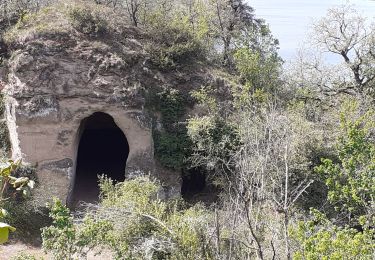
(8)prendre à Droite le petit chemin montant (en face du conteneur poubelle), une courbe à Gauche et filer tout droit. Sur votre gauche vous pouvez observer la gare TGV. Ce chemin a un certain charme (bordé sur la droite de maisons dont certaines ont du cachet) puis vous passez sous une haie d’arbres.
(9) En arrivant dans le hameau de Chambaud poursuivre jusqu’à la jonction avec la route descendante, prendre à Gauche (un puits se trouve sur la gauche)
En fin de descente du hameau, face à un mur de pierres, continuer la route sur la Gauche en laissant sur la Droite le chemin donnant accès à la maison bourgeoise de Chambaud.
(10) Au « cédez le passage » prendre la route sur la Droite longeant l’ancien canal de la Bourne. Il vous reste 2,3 kms à parcourir pour rentrer.
Au croisement, après le panneau (attention sortie de camions) filer tout droit.
Après être passé devant la Chapelle, sur votre Gauche vous empruntez à nouveau le Pass’âge pour regagner la place de la Mairie
Points of interest
Positioning
Comments
Trails nearby
![Trail Walking Châteauneuf-sur-Isère - Châteauneuf d isere le chemin des carriers - Photo](https://media.geolcdn.com/t/375/260/ext.jpg?maxdim=2&url=https%3A%2F%2Fstatic1.geolcdn.com%2Fsiteimages%2Fupload%2Ffiles%2F1553511878bg_sport_marche.png)
![Walking Walking](https://static1.geolcdn.com/sitytour/trail-icons/101.png)
Walking
![](/images/other/stat-length.png)
![](https://static1.geolcdn.com/siteimages/upload/files/16400158638029165_repeat_loop_refresh_sync_direction_icon.png)
![Trail Walking Saint-Marcel-lès-Valence - Balade VSM N° 5 - pour rejoindre le Guimand - Photo](https://media.geolcdn.com/t/375/260/ext.jpg?maxdim=2&url=https%3A%2F%2Fstatic1.geolcdn.com%2Fsiteimages%2Fupload%2Ffiles%2F1553511878bg_sport_marche.png)
![Walking Walking](https://static1.geolcdn.com/sitytour/trail-icons/101.png)
Walking
![](/images/other/stat-length.png)
![](https://static1.geolcdn.com/siteimages/upload/files/16400158638029165_repeat_loop_refresh_sync_direction_icon.png)
![Trail Walking Châteauneuf-sur-Isère - 26 Châteauneuf didier - Photo](https://media.geolcdn.com/t/375/260/a4c5edcc-8f3c-45e2-8c8a-8f7fc0f64334.jpg&format=jpg&maxdim=2)
![Walking Walking](https://static1.geolcdn.com/sitytour/trail-icons/101.png)
Walking
![](/images/other/stat-length.png)
![](https://static1.geolcdn.com/siteimages/upload/files/16400158638029165_repeat_loop_refresh_sync_direction_icon.png)
![Trail Walking Châteauneuf-sur-Isère - Châteauneuf/isere - Photo](https://media.geolcdn.com/t/375/260/231a22ca-832d-4248-a718-db7a90127622.jpg&format=jpg&maxdim=2)
![Walking Walking](https://static1.geolcdn.com/sitytour/trail-icons/101.png)
Walking
![](/images/other/stat-length.png)
![](https://static1.geolcdn.com/siteimages/upload/files/16400158638029165_repeat_loop_refresh_sync_direction_icon.png)
![Trail Walking Saint-Marcel-lès-Valence - Vers le Guimand - Photo](https://media.geolcdn.com/t/375/260/57b98d48-2046-42f0-8662-00caa40854e6.jpg&format=jpg&maxdim=2)
![Walking Walking](https://static1.geolcdn.com/sitytour/trail-icons/101.png)
Walking
![](/images/other/stat-length.png)
![](https://static1.geolcdn.com/siteimages/upload/files/16400158638029165_repeat_loop_refresh_sync_direction_icon.png)
![Trail Walking Châteauneuf-sur-Isère - le chemin des carriers à Châteauneuf-sur-Isère - Photo](https://media.geolcdn.com/t/375/260/cb23e02f-b5eb-4dbe-8338-aa328ff00145.jpg&format=jpg&maxdim=2)
![Walking Walking](https://static1.geolcdn.com/sitytour/trail-icons/101.png)
Walking
![](/images/other/stat-length.png)
![](https://static1.geolcdn.com/siteimages/upload/files/16400158638029165_repeat_loop_refresh_sync_direction_icon.png)
![Trail Walking Châteauneuf-sur-Isère - 26 château Neuf sur Isère 08 05 21 - Photo](https://media.geolcdn.com/t/375/260/ext.jpg?maxdim=2&url=https%3A%2F%2Fstatic1.geolcdn.com%2Fsiteimages%2Fupload%2Ffiles%2F1553511878bg_sport_marche.png)
![Walking Walking](https://static1.geolcdn.com/sitytour/trail-icons/101.png)
Walking
![](/images/other/stat-length.png)
![](https://static1.geolcdn.com/siteimages/upload/files/16400158638029165_repeat_loop_refresh_sync_direction_icon.png)
![Trail Mountain bike Valence - Grande Traversée des PréAlpes à VTT : Valence - Gap - Sisteron - Photo](https://media.geolcdn.com/t/375/260/ext.jpg?maxdim=2&url=https%3A%2F%2Fservices.sitytrail.com%2FGeolivesWS%2FDownloadMedia.ashx%3FTrailID%3D102172%26Media%3D2562_2.jpg)
![Mountain bike Mountain bike](https://static1.geolcdn.com/sitytour/trail-icons/202.png)
Mountain bike
![](/images/other/stat-length.png)
![](https://static1.geolcdn.com/siteimages/upload/files/16400158638029165_repeat_loop_refresh_sync_direction_icon.png)
![Trail Mountain bike Valence - Grande Traversée des PréAlpes à VTT : Valence - Livron sur Drôme - Photo](https://media.geolcdn.com/t/375/260/ext.jpg?maxdim=2&url=https%3A%2F%2Fservices.sitytrail.com%2FGeolivesWS%2FDownloadMedia.ashx%3FTrailID%3D102153%26Media%3D2543_2.jpg)
![Mountain bike Mountain bike](https://static1.geolcdn.com/sitytour/trail-icons/202.png)
Mountain bike
![](/images/other/stat-length.png)
![](https://static1.geolcdn.com/siteimages/upload/files/16400158638029165_repeat_loop_refresh_sync_direction_icon.png)