![](/images/other/stat-length.png)
![Trail Mountain bike Cabrerets - Forêt domaniale de Cabrerets - Photo](https://media.geolcdn.com/t/1900/400/ext.pjpeg?maxdim=2&url=https%3A%2F%2Fservices.sitytrail.com%2FGeolivesWS%2FDownloadMedia.ashx%3FTrailID%3D173110%26Media%3D14658_6.jpg)
Forêt domaniale de Cabrerets
tracegps
User
![Length](/images/other/stat-length.png)
![Max alt](https://static1.geolcdn.com/siteimages/upload/files/1508320355ic_sort_altitude_max_24dp.png)
![Uphill gradient](https://static1.geolcdn.com/siteimages/upload/files/1508320355ic_sort_den_pos_24dp.png)
![Km-Effort](/images/other/stat-length.png)
![Min alt](https://static1.geolcdn.com/siteimages/upload/files/1508320355ic_sort_altitude_min_24dp.png)
![Downhill gradient](https://static1.geolcdn.com/siteimages/upload/files/1508320355ic_sort_den_neg_24dp.png)
![Boucle](https://static1.geolcdn.com/siteimages/upload/files/16400158638029165_repeat_loop_refresh_sync_direction_icon.png)
![Mountain bike](https://static1.geolcdn.com/sitytour/trail-icons/202.png)
49m
Difficulty : Medium
![Scan this QR Code to open this trail in the SityTrail application](https://capi.geolives.com/qq0zvz2zws4bq2lad0pu/sitytour/trails/173110/qr.png?size=200)
FREE GPS app for hiking
About
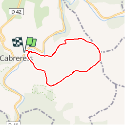
Trail Mountain bike of 6 km to be discovered at Occitania, Lot, Cabrerets. This trail is proposed by tracegps.
Description
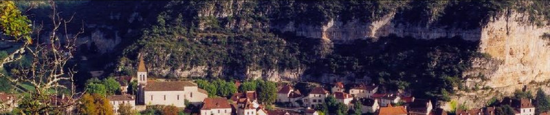
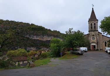
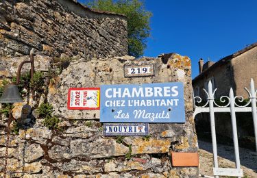
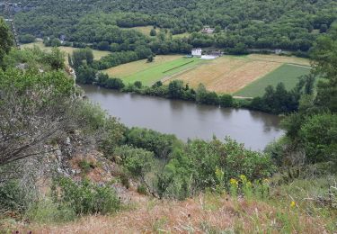
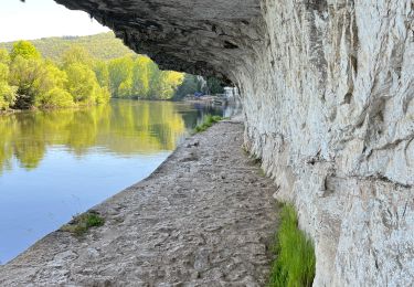
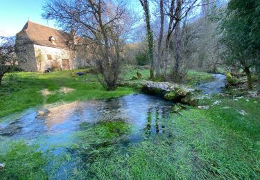
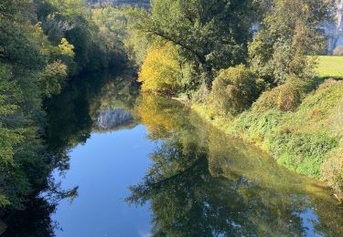
Départ le long de la D41 à Cabrerets à proximité du pont. On monte beaucoup au début, avec un beau point de vue sur la vallée, puis ça grimpe. Ensuite, le plat (tout est relatif) persiste un moment avant de redescendre sur Cabrerets. C'est un bon petit tour à faire dans cette forêt domaniale de Monclair, si on est sur place. De plus la source de la chèvre blanche, au village, est une très bonne eau potable, pour vous déshydrater en début ou en fin de parcours.
Positioning
Comments
Trails nearby
![Trail Walking Saint-Cirq-Lapopie - Circuit sud de St Cirq Lapopie - Photo](https://media.geolcdn.com/t/375/260/ext.jpg?maxdim=2&url=https%3A%2F%2Fservices.sitytrail.com%2FGeolivesWS%2FDownloadMedia.ashx%3FTrailID%3D136873%26Media%3D13540_3.jpg)
![Walking Walking](https://static1.geolcdn.com/sitytour/trail-icons/101.png)
Walking
![](/images/other/stat-length.png)
![](https://static1.geolcdn.com/siteimages/upload/files/16400158638029165_repeat_loop_refresh_sync_direction_icon.png)
![Trail Walking Bouziès - St Cirq Lapopie - Photo](https://media.geolcdn.com/t/375/260/44c160a2-93bf-4659-a751-61d8e3a0eb0e.jpg&format=jpg&maxdim=2)
![Walking Walking](https://static1.geolcdn.com/sitytour/trail-icons/101.png)
Walking
![](/images/other/stat-length.png)
![](https://static1.geolcdn.com/siteimages/upload/files/16400158638029165_repeat_loop_refresh_sync_direction_icon.png)
![Trail Walking Cabrerets - Etape 3 Cabrenets Bouziès St Cirq Bouziés - Photo](https://media.geolcdn.com/t/375/260/eb50dffb-c87e-4a9e-b7bf-cb556263d54c.jpg&format=jpg&maxdim=2)
![Walking Walking](https://static1.geolcdn.com/sitytour/trail-icons/101.png)
Walking
![](/images/other/stat-length.png)
![](https://static1.geolcdn.com/siteimages/upload/files/16400158638029165_repeat_loop_refresh_sync_direction_icon.png)
![Trail Walking Bouziès - Étape 4 Bouziès Les Mazuts - Photo](https://media.geolcdn.com/t/375/260/0fdee0ad-1a12-42b8-a827-ee8edec2f1aa.jpg&format=jpg&maxdim=2)
![Walking Walking](https://static1.geolcdn.com/sitytour/trail-icons/101.png)
Walking
![](/images/other/stat-length.png)
![](https://static1.geolcdn.com/siteimages/upload/files/16400158638029165_repeat_loop_refresh_sync_direction_icon.png)
![Trail Walking Cabrerets - Lot CABRERET BEARD - Photo](https://media.geolcdn.com/t/375/260/8fbbbeec-d494-492c-8bdb-b53bc7ff4969.jpg&format=jpg&maxdim=2)
![Walking Walking](https://static1.geolcdn.com/sitytour/trail-icons/101.png)
Walking
![](/images/other/stat-length.png)
![](https://static1.geolcdn.com/siteimages/upload/files/16400158638029165_repeat_loop_refresh_sync_direction_icon.png)
![Trail sport Saint-Cirq-Lapopie - 20240422 St Cirq - Vers - Photo](https://media.geolcdn.com/t/375/260/c7c2d083-3a15-4ad8-8255-9f2c2d891e51.jpg&format=jpg&maxdim=2)
sport
![](/images/other/stat-length.png)
![](https://static1.geolcdn.com/siteimages/upload/files/16400158638029165_repeat_loop_refresh_sync_direction_icon.png)
![Trail sport Cabrerets - 20240421 Cabrerets - St Cirq - Photo](https://media.geolcdn.com/t/375/260/d84c365c-9ae9-4395-be90-dbc8ee116e29.jpg&format=jpg&maxdim=2)
sport
![](/images/other/stat-length.png)
![](https://static1.geolcdn.com/siteimages/upload/files/16400158638029165_repeat_loop_refresh_sync_direction_icon.png)
![Trail Walking Cabrerets - Cabrerets Liauzu - Photo](https://media.geolcdn.com/t/375/260/9e8b98bf-3708-4f84-b612-7eff50bf29ed.jpg&format=jpg&maxdim=2)
![Walking Walking](https://static1.geolcdn.com/sitytour/trail-icons/101.png)
Walking
![](/images/other/stat-length.png)
![](https://static1.geolcdn.com/siteimages/upload/files/16400158638029165_repeat_loop_refresh_sync_direction_icon.png)
![Trail Walking Bouziès - Bouzies St Cirq Conduche - Photo](https://media.geolcdn.com/t/375/260/2aaa2ad3-04a4-48d5-bfb5-10fb0e32fe3f.jpg&format=jpg&maxdim=2)
![Walking Walking](https://static1.geolcdn.com/sitytour/trail-icons/101.png)
Walking
![](/images/other/stat-length.png)
![](https://static1.geolcdn.com/siteimages/upload/files/16400158638029165_repeat_loop_refresh_sync_direction_icon.png)