![](/images/other/stat-length.png)
![Trail Walking Ghisoni - Punta a a Cappella - Photo](https://media.geolcdn.com/t/1900/400/ext.pjpeg?maxdim=2&url=https%3A%2F%2Fservices.sitytrail.com%2FGeolivesWS%2FDownloadMedia.ashx%3FTrailID%3D172934%26Media%3D14410_6.jpg)
Punta a a Cappella
tracegps
User
![Length](/images/other/stat-length.png)
![Max alt](https://static1.geolcdn.com/siteimages/upload/files/1508320355ic_sort_altitude_max_24dp.png)
![Uphill gradient](https://static1.geolcdn.com/siteimages/upload/files/1508320355ic_sort_den_pos_24dp.png)
![Km-Effort](/images/other/stat-length.png)
![Min alt](https://static1.geolcdn.com/siteimages/upload/files/1508320355ic_sort_altitude_min_24dp.png)
![Downhill gradient](https://static1.geolcdn.com/siteimages/upload/files/1508320355ic_sort_den_neg_24dp.png)
![Boucle](https://static1.geolcdn.com/siteimages/upload/files/16400158638029165_repeat_loop_refresh_sync_direction_icon.png)
![Walking](https://static1.geolcdn.com/sitytour/trail-icons/101.png)
8h00
Difficulty : Medium
![Scan this QR Code to open this trail in the SityTrail application](https://capi.geolives.com/qq0zvz2zws4bq2lad0pu/sitytour/trails/172934/qr.png?size=200)
FREE GPS app for hiking
About
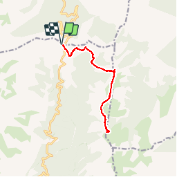
Trail Walking of 13.7 km to be discovered at Corsica, Haute-Corse, Ghisoni. This trail is proposed by tracegps.
Description
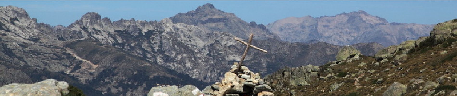
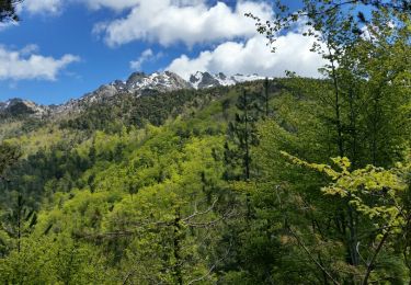
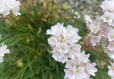
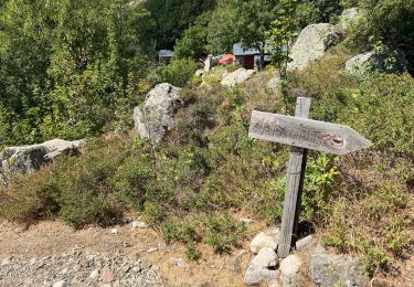
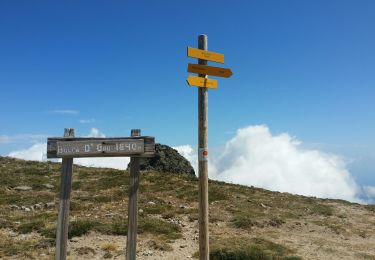
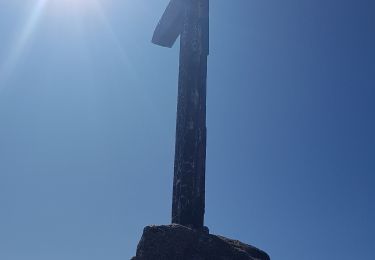
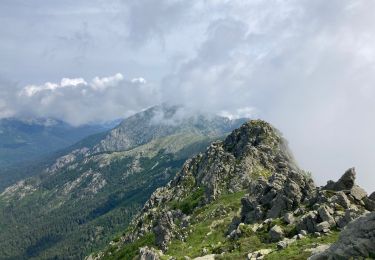
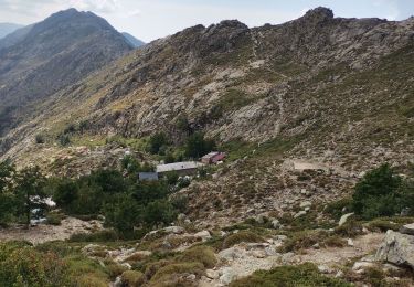
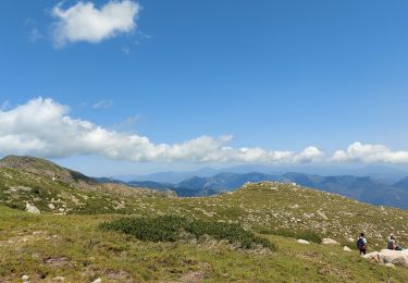
Avec ses 2041 mètres d'altitude, Punta a a Cappella est le point culminant du chaînon dominant la micro-région du Fiumorbo sur la cote Est de la Corse. Ce sommet offre un panorama exceptionnel, non seulement sur la côte, mais aussi sur Monte Renoso et les massifs qui entourent ce dernier et sur de nombreux sommets plus éloignés. A l'exception de l'ascension finale, le cheminement emprunte le GR20 et ne présente donc aucune difficulté d'orientation tout en proposant un environnement agréable et varié. Ce sommet mériterait de faire partie des grandes classiques parmi les randonnées en Corse. D'autres photos et le récit de la randonnée ICI .
Positioning
Comments
Trails nearby
![Trail Walking Ghisoni - Ballade col de Verde - Photo](https://media.geolcdn.com/t/375/260/ext.jpg?maxdim=2&url=https%3A%2F%2Fservices.sitytrail.com%2FGeolivesWS%2FDownloadMedia.ashx%3FTrailID%3D744648%26Media%3Dfix__20170502131131.jpg)
![Walking Walking](https://static1.geolcdn.com/sitytour/trail-icons/101.png)
Walking
![](/images/other/stat-length.png)
![](https://static1.geolcdn.com/siteimages/upload/files/16400158638029165_repeat_loop_refresh_sync_direction_icon.png)
![Trail Walking Palneca - Col de Verde usciulu - Photo](https://media.geolcdn.com/t/375/260/301cd8a5-6815-4753-af34-c00c3e606eef.jpg&format=jpg&maxdim=2)
![Walking Walking](https://static1.geolcdn.com/sitytour/trail-icons/101.png)
Walking
![](/images/other/stat-length.png)
![](https://static1.geolcdn.com/siteimages/upload/files/16400158638029165_repeat_loop_refresh_sync_direction_icon.png)
![Trail Walking Palneca - 4 eta gr 20 Col de veldre - Campanelle Ghisoni - Photo](https://media.geolcdn.com/t/375/260/d73dd86c-631f-4221-a7b2-80803b3374d4.jpg&format=jpg&maxdim=2)
![Walking Walking](https://static1.geolcdn.com/sitytour/trail-icons/101.png)
Walking
![](/images/other/stat-length.png)
![](https://static1.geolcdn.com/siteimages/upload/files/16400158638029165_repeat_loop_refresh_sync_direction_icon.png)
![Trail Walking Ghisoni - Punta della Cappella - Photo](https://media.geolcdn.com/t/375/260/b0627339-bfc3-48ce-9e26-aff4c52887b6.jpg&format=jpg&maxdim=2)
![Walking Walking](https://static1.geolcdn.com/sitytour/trail-icons/101.png)
Walking
![](/images/other/stat-length.png)
![](https://static1.geolcdn.com/siteimages/upload/files/16400158638029165_repeat_loop_refresh_sync_direction_icon.png)
![Trail Walking Ghisoni - Punta della Capella - Photo](https://media.geolcdn.com/t/375/260/43f42ff0-4eb4-49e1-9226-6a10021577d7.jpg&format=jpg&maxdim=2)
![Walking Walking](https://static1.geolcdn.com/sitytour/trail-icons/101.png)
Walking
![](/images/other/stat-length.png)
![](https://static1.geolcdn.com/siteimages/upload/files/16400158638029165_repeat_loop_refresh_sync_direction_icon.png)
![Trail Via ferrata Palneca - San Pietro di Verde-Usciolu - Photo](https://media.geolcdn.com/t/375/260/ext.jpg?maxdim=2&url=https%3A%2F%2Fstatic1.geolcdn.com%2Fsiteimages%2Fupload%2Ffiles%2F1545311037marcheuse_200dpi.jpg)
![Via ferrata Via ferrata](https://static1.geolcdn.com/sitytour/trail-icons/902.png)
Via ferrata
![](/images/other/stat-length.png)
![](https://static1.geolcdn.com/siteimages/upload/files/16400158638029165_repeat_loop_refresh_sync_direction_icon.png)
![Trail Walking Palneca - Refuge Ociolu - refuge de Croci - Photo](https://media.geolcdn.com/t/375/260/a6277725-171e-41ee-94d1-f0665e362f84.jpg&format=jpg&maxdim=2)
![Walking Walking](https://static1.geolcdn.com/sitytour/trail-icons/101.png)
Walking
![](/images/other/stat-length.png)
![](https://static1.geolcdn.com/siteimages/upload/files/16400158638029165_repeat_loop_refresh_sync_direction_icon.png)
![Trail Walking Palneca - GR20 Corse étape 12 - Photo](https://media.geolcdn.com/t/375/260/bdd30a52-dbc4-4710-adad-9564b2b81567.jpg&format=jpg&maxdim=2)
![Walking Walking](https://static1.geolcdn.com/sitytour/trail-icons/101.png)
Walking
![](/images/other/stat-length.png)
![](https://static1.geolcdn.com/siteimages/upload/files/16400158638029165_repeat_loop_refresh_sync_direction_icon.png)
![Trail Walking Ghisoni - Lac de Rina - Photo](https://media.geolcdn.com/t/375/260/838c6d6b-4d89-436b-83d0-814ad5e01bc5.jpg&format=jpg&maxdim=2)
![Walking Walking](https://static1.geolcdn.com/sitytour/trail-icons/101.png)
Walking
![](/images/other/stat-length.png)
![](https://static1.geolcdn.com/siteimages/upload/files/16400158638029165_repeat_loop_refresh_sync_direction_icon.png)