


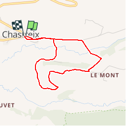

17.7 km | 24 km-effort

User


FREE GPS app for hiking
 SityTrail
IGN / Geographical institutes
SityTrail World
The world is yours!
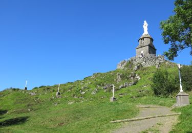
Trail Mountain bike of 3.8 km to be discovered at Auvergne-Rhône-Alpes, Puy-de-Dôme, Chastreix. This trail is proposed by tracegps.
Circuit officiel labellisé par la Fédération Française de Cyclisme. Secteur nature chargé d'histoire offrant une vue exceptionnelle sur des espaces protégés et ruraux. Départ place du village, devant l'église. . Téléchargez le plan des circuits.


Walking

Walking

On foot
On foot
On foot
On foot

On foot
Walking
Walking