


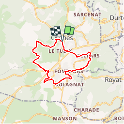

10.8 km | 16.4 km-effort

User


FREE GPS app for hiking
 SityTrail
IGN / Geographical institutes
SityTrail World
The world is yours!
Trail Walking of 12.5 km to be discovered at Auvergne-Rhône-Alpes, Puy-de-Dôme, Orcines. This trail is proposed by tracegps.
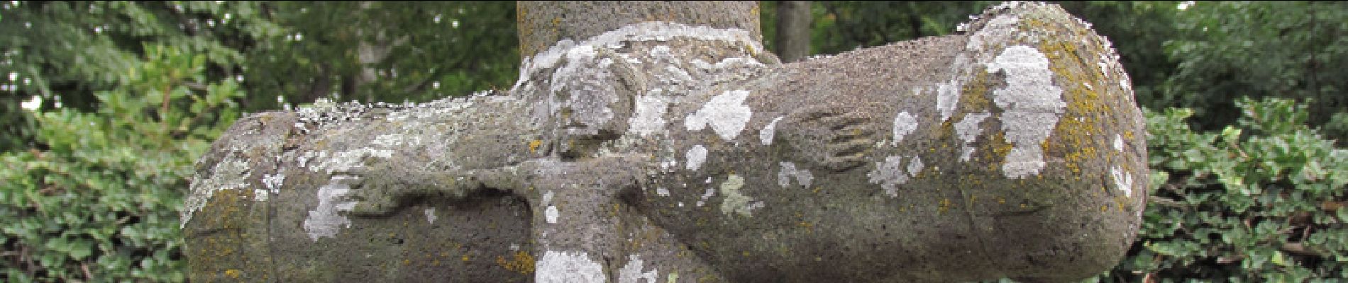
Agréable randonnée au pied du Puy de Dome. On chemine sur des chemins variés : ancienne voie romaine,larges chemins, route parfois. On découvre de nombreuses curiosités : croix, lavoir, etc...


Walking

Walking

Walking

Walking

Walking

Walking

Walking

Walking

Walking