Trail Walking Bellecombe-en-Bauges - La Pointe de Banc Plat, 1907m - Photo

La Pointe de Banc Plat, 1907m

 tracegps
tracegps

User

© OpenStreetMap contributors
Length
Length
12.7 km
Max alt
Max alt
1887 m
Uphill gradient
Uphill gradient
799 m
Km-Effort
Km-Effort  
23 km
Min alt
Min alt
1186 m
Downhill gradient
Downhill gradient
799 m
Boucle
Boucle
Yes
Creation date :
2014-12-10 00:00:00.0
Updated on :
2014-12-10 00:00:00.0

(1 Reviews)

Walking
Walking
6h00
Difficulty : Medium

Scan this QR Code to open this trail in the SityTrail application

FREE GPS app for hiking

Logo SityTrail SityTrail

IGN / Geographical institutes

Download SityTrail from the App Store Download SityTrail from Google Play

Logo SityTrail SityTrail World

The world is yours!

Download SityTrail from the App Store Download SityTrail from Google Play Download SityTrail on Huawei AppGallery

About

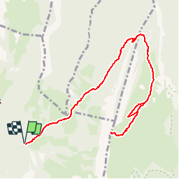
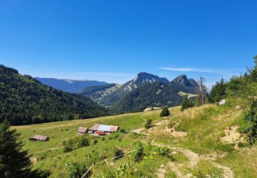
Trail Walking of 12.7 km to be discovered at Auvergne-Rhône-Alpes, Savoy, Bellecombe-en-Bauges. This trail is proposed by tracegps.

Description

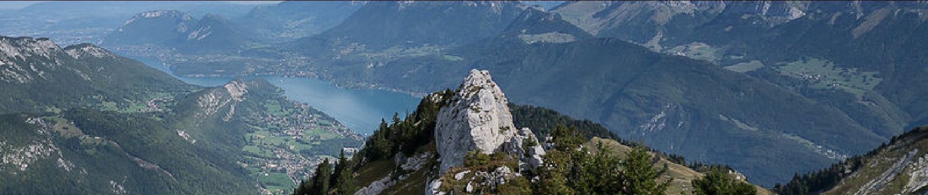
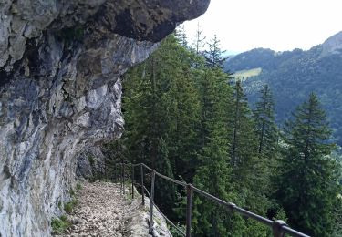
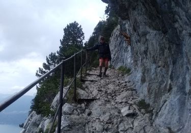
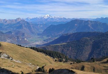
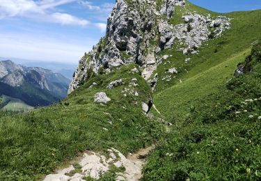
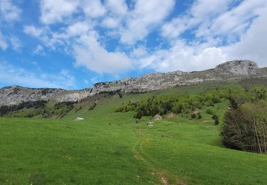
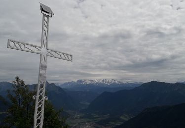
Bauges Nord. L'ascension depuis le Reposoir, lieu-dit de Bellecombe-en-Bauges, passe par le Col de Bornette pour emprunter aux Ailes du Nant, un sentier absent d'IGN. Le passage économise une centaine de mètres de dénivelé pour atteindre le pittoresque chemin de la Combe, taillé dans le rocher de la falaise pour offrir aux troupeaux un accès à l'alpage. Par le chalet-refuge de la Combe, une piste récente parcourt la Montagne du Charbon pour retrouver le vieux sentier qui donne accès aux pentes herbeuses sous le sommet de la Pointe de Banc Plat. Le retour se fait par le même itinéraire. Description complète sur sentier-nature.com : La Pointe de Banc Plat, 1907m. Avertissement [Facile]. Certains passages de cet itinéraire de montagne sont escarpés et/ou très exposés, il est déconseillé aux enfants non accompagnés et aux personnes sujettes au vertige. Pour votre sécurité, nous vous invitons à respecter les règles suivantes : être bien chaussé, ne pas s'engager par mauvais temps, ne pas s'écarter de l'itinéraire ni des sentiers.

Elevation profile

Photos

Positioning

Country:
France
Region :
Auvergne-Rhône-Alpes
Department/Province :
Savoy
Municipality :
Bellecombe-en-Bauges
Location:
Unknown
Start:(UTM)
280093 ; 5067744 (32T) N.

Comments

Please log in to post a review or rate the element


Trails nearby

Trail Walking Bellecombe-en-Bauges - Pointe de Banc Plat en boucle  - Photo
Walking
GUIDE
nadd73

Walking

Difficult
Bellecombe-en-Bauges, Auvergne-Rhône-Alpes, Savoy, France
13.8 km | 27 km-effort
4h 1min
Yes
Trail Touring skiing Bellecombe-en-Bauges - la dent des portes et sous le Trelod - Photo
Touring skiing
GUIDE
nadd73

Touring skiing

Medium
Bellecombe-en-Bauges, Auvergne-Rhône-Alpes, Savoy, France
12.9 km | 29 km-effort
3h 52min
Yes
Trail Walking Bellecombe-en-Bauges - Banc plat boucle - Photo
Walking
GUIDE
nadd73

Walking

Difficult
Bellecombe-en-Bauges, Auvergne-Rhône-Alpes, Savoy, France
10.7 km | 21 km-effort
4h 52min
Yes
Trail Walking Doucy-en-Bauges - 2015-09-11 Marche Mont Trelod - Photo
Walking
GUIDE
holtzv

Walking

Medium
(1)
Doucy-en-Bauges, Auvergne-Rhône-Alpes, Savoy, France
12.4 km | 28 km-effort
5h 25min
Yes
Trail Walking Bellecombe-en-Bauges - Dent des portes e Mont Trelod  - Photo
Walking
GUIDE
nadd73

Walking

Medium
Bellecombe-en-Bauges, Auvergne-Rhône-Alpes, Savoy, France
14.3 km | 31 km-effort
4h 42min
No
Trail Walking Doucy-en-Bauges - 250524 Le Trelod et la Dents des Portes - Photo
Walking
mzonzon05

Walking

Very difficult
Doucy-en-Bauges, Auvergne-Rhône-Alpes, Savoy, France
11.9 km | 28 km-effort
6h 9min
Yes
Trail Walking Bellecombe-en-Bauges - La croix du Roy  - Photo
Walking
Annie21

Walking

Medium
Bellecombe-en-Bauges, Auvergne-Rhône-Alpes, Savoy, France
16 km | 26 km-effort
5h 30min
Yes
Trail Walking Bellecombe-en-Bauges - Tour de BancPlat, Dent des portes en partant du petit reposoir  - Photo
Walking
Zasa

Walking

Medium
Bellecombe-en-Bauges, Auvergne-Rhône-Alpes, Savoy, France
18.4 km | 34 km-effort
6h 0min
Yes
Trail Walking Bellecombe-en-Bauges - 73 banc plat dent de porte  - Photo
Walking
GUIDE
randodyssée

Walking

Medium
Bellecombe-en-Bauges, Auvergne-Rhône-Alpes, Savoy, France
14.9 km | 28 km-effort
8h 33min
Yes


Close
My subscriptions