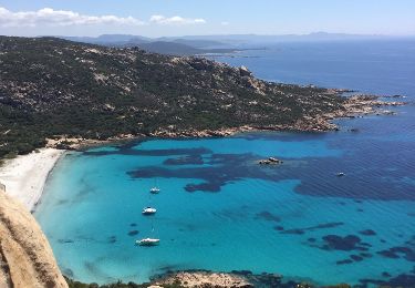
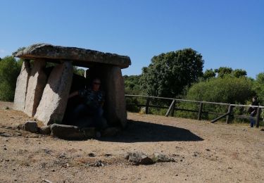
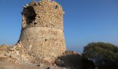
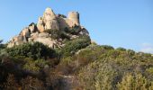
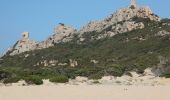
Trail Walking Sartène - La tour génoise de Roccapina - Photo

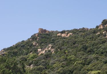
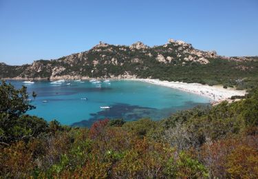
La tour génoise de Roccapina

 tracegps
tracegps

User

© OpenStreetMap contributors
Length
Length
4.4 km
Max alt
Max alt
112 m
Uphill gradient
Uphill gradient
177 m
Km-Effort
Km-Effort  
6.8 km
Min alt
Min alt
0 m
Downhill gradient
Downhill gradient
175 m
Boucle
Boucle
Yes
Creation date :
2014-12-10 00:00:00.0
Updated on :
2014-12-10 00:00:00.0

(2 Reviews)

Walking
Walking
1h30
Difficulty : Medium

Scan this QR Code to open this trail in the SityTrail application

FREE GPS app for hiking

Logo SityTrail SityTrail
IGN / Geographical institutes

Download SityTrail from the App Store Download SityTrail from Google Play

Logo SityTrail SityTrail World

The world is yours!

Download SityTrail from the App Store Download SityTrail from Google Play Download SityTrail on Huawei AppGallery

About

Trail Walking of 4.4 km to be discovered at Corsica, South Corsica, Sartène. This trail is proposed by tracegps.

Description

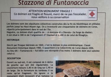
La tour génoise de Roccapina, située sur une colline à 134 mètres d’altitude offre un panorama sublime sur la côte entre Capo di Feno et Capu di Zivia. De plus elle domine deux plages splendides, celle de Roccapina à l’est et celle d’Erbaju au nord-ouest. Son accès, possible depuis chacune de ces deux plages, nécessite quelques efforts. Cette trace GPS propose une boucle de 4,5km passant par la tour génoise et les deux plages. Pour rejoindre la plage de Roccapina, il faudra auparavant emprunter une piste, en relativement bon état, au départ de la N196 près de l’auberge de Corali. Voir Entre Roccapina et la Plage d'Erbaju.

Elevation profile

Photos

Points of interest

Point of interest Sartène - Tour génoise Roccapina - Photo
tracegps

Positioning

Country:
France
Region :
Corsica
Department/Province :
South Corsica
Municipality :
Sartène
Location:
Unknown
Start:(UTM)
494640 ; 4594081 (32T) N.

Comments

Please log in to post a review or rate the element


énorme


Trails nearby

Trail Walking Sartène - Entre Roccapina et la Plage d'Erbaju - Photo
Walking
tracegps

Walking

Medium
(4)
Sartène, Corsica, South Corsica, France
4.7 km | 7 km-effort
1h 30min
Yes
Trail Walking Sartène - Plages de Roccapina et d'Erbaju - Photo
Walking
Bart2015

Walking

Medium
Sartène, Corsica, South Corsica, France
5.9 km | 8.4 km-effort
1h 54min
Yes
Trail Walking Monacia-d'Aullène - De Furnellu à Roccapina - Photo
Walking
tracegps

Walking

Medium
(1)
Monacia-d'Aullène, Corsica, South Corsica, France
9.9 km | 11.7 km-effort
3h 0min
No
Trail Walking Sartène - 20210615 site préhistorique de Cauria - Photo
Walking
ThonyM

Walking

Easy
Sartène, Corsica, South Corsica, France
2.3 km | 2.8 km-effort
35min
No
Trail Walking Sartène - Corse - Rocapina - plage d Erbaju - Photo
Walking
chris13370

Walking

Easy
Sartène, Corsica, South Corsica, France
6.4 km | 9.2 km-effort
2h 0min
No
Trail Walking Sartène - rocapina  - Photo
Walking
dindou67

Walking

Very easy
(1)
Sartène, Corsica, South Corsica, France
5.6 km | 8.1 km-effort
1h 44min
Yes
Trail Walking Sartène - punta di grecu 2022 - Photo
Walking
philippenl

Walking

Medium
Sartène, Corsica, South Corsica, France
6.8 km | 9.4 km-effort
2h 14min
Yes
Trail Walking Sartène - 271 mai21 - Photo
Walking
habby

Walking

Very easy
Sartène, Corsica, South Corsica, France
2.9 km | 3.6 km-effort
1h 6min
No
Trail Walking Monacia-d'Aullène - roccapina 2021 - Photo
Walking
philippenl

Walking

Difficult
Monacia-d'Aullène, Corsica, South Corsica, France
10.3 km | 14.2 km-effort
3h 12min
Yes


Close
My subscriptions