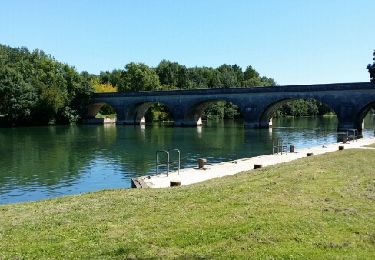

Boucle vélo à Jarnac (23C)

tracegps
User

Length
46 km

Max alt
54 m

Uphill gradient
313 m

Km-Effort
51 km

Min alt
9 m

Downhill gradient
313 m
Boucle
Yes
Creation date :
2014-12-10 00:00:00.0
Updated on :
2014-12-10 00:00:00.0
2h30
Difficulty : Medium

FREE GPS app for hiking
About
Trail Cycle of 46 km to be discovered at New Aquitaine, Charente, Jarnac. This trail is proposed by tracegps.
Description
Circuit proposé par l'Office de Tourisme de la Communauté de Communes de Jarnac. Départ place du Général de Gaulle à Jarnac. Retrouvez le plan du circuit sur le site de l'Office de Tourisme de la Communauté de Communes de Jarnac.
Positioning
Country:
France
Region :
New Aquitaine
Department/Province :
Charente
Municipality :
Jarnac
Location:
Unknown
Start:(Dec)
Start:(UTM)
720456 ; 5062536 (30T) N.
Comments
Trails nearby

Jarnac amont


Walking
Easy
Bassac,
New Aquitaine,
Charente,
France

11.6 km | 12.3 km-effort
2h 50min
Yes

Bourg Charente


Walking
Very easy
Bourg-Charente,
New Aquitaine,
Charente,
France

12.4 km | 13.9 km-effort
3h 3min
Yes

Circuit des Pierrères - Jarnac


Walking
Difficult
Jarnac,
New Aquitaine,
Charente,
France

13.1 km | 14.8 km-effort
3h 15min
Yes

bbb


Other activity
Very easy
Graves-Saint-Amant,
New Aquitaine,
Charente,
France

33 km | 37 km-effort
1h 41min
Yes


Bourg-Charente Jarnac aller-retour


Walking
Easy
Bourg-Charente,
New Aquitaine,
Charente,
France

9.1 km | 9.8 km-effort
1h 48min
Yes

GR4-74 - Jarnac - Cognac


Walking
Very difficult
Jarnac,
New Aquitaine,
Charente,
France

18.2 km | 20 km-effort
4h 30min
No

mainxe


Walking
Very easy
Mainxe-Gondeville,
New Aquitaine,
Charente,
France

12.5 km | 14 km-effort
2h 50min
Yes

chez Roland billard Saint-Preuil


Road bike
Medium
Mainxe-Gondeville,
New Aquitaine,
Charente,
France

28 km | 32 km-effort
1h 14min
Yes


 SityTrail


