Trail Running Chassal-Molinges - Le Grand Bois - Molinges - Photo
 tracegps
tracegps

User

© OpenStreetMap contributors
Length
Length
6.2 km
Max alt
Max alt
633 m
Uphill gradient
Uphill gradient
330 m
Km-Effort
Km-Effort  
10.6 km
Min alt
Min alt
337 m
Downhill gradient
Downhill gradient
326 m
Boucle
Boucle
Yes
Creation date :
2014-12-10 00:00:00.0
Updated on :
2014-12-10 00:00:00.0

(0 Reviews)

Running
Running
49m
Difficulty : Difficult

Scan this QR Code to open this trail in the SityTrail application

FREE GPS app for hiking

Logo SityTrail SityTrail

IGN / Geographical institutes

Download SityTrail from the App Store Download SityTrail from Google Play

Logo SityTrail SityTrail World

The world is yours!

Download SityTrail from the App Store Download SityTrail from Google Play Download SityTrail on Huawei AppGallery

About

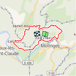
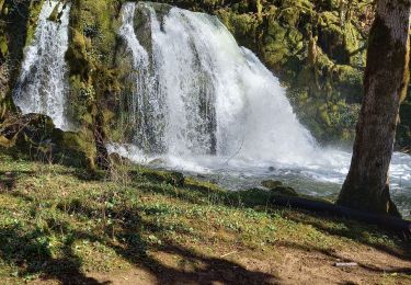
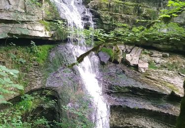
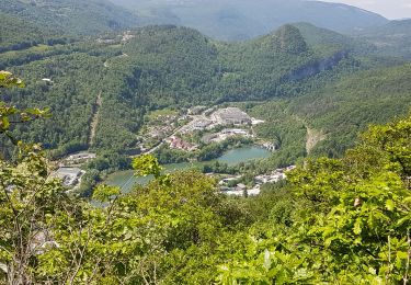
Trail Running of 6.2 km to be discovered at Bourgogne-Franche-Comté, Jura, Chassal-Molinges. This trail is proposed by tracegps.

Description

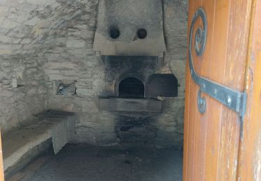
En vacances dans le Jura, j'ai fait ce parcours qui emprunte une partie du GR de Pays. Très agréable car à l'ombre. Du Pavillon suivre le Gr de Pays jusqu'au Granges de Chiriat. Prendre ensuite le sentier qui monte à droite direction St Romain. Au sommet rester à droite pour retrouver un sentier qui redescend sur Molinges par la combe de Barbe.

Elevation profile

Photos

Positioning

Country:
France
Region :
Bourgogne-Franche-Comté
Department/Province :
Jura
Municipality :
Chassal-Molinges
Location:
Molinges
Start:(UTM)
712417 ; 5137618 (31T) N.

Trails nearby

Trail Walking Martigna - rando a martgna dans le jura - Photo
Walking
colomb24

Walking

Easy
Martigna, Bourgogne-Franche-Comté, Jura, France
13.8 km | 18.3 km-effort
5h 7min
Yes
Trail Walking Viry - Siege - Photo
Walking
Jackoyo

Walking

Medium
Viry, Bourgogne-Franche-Comté, Jura, France
7.6 km | 11.5 km-effort
2h 28min
Yes
Trail Walking Jeurre - partis de jeurre ensuite la chapelle Saint Romain et la cascade de l enragé  - Photo
Walking
colomb24

Walking

Medium
Jeurre, Bourgogne-Franche-Comté, Jura, France
18 km | 25 km-effort
5h 9min
Yes
Trail Walking Coteaux du Lizon - gorges du Lison . départ de Saint lupicin - Photo
Walking
colomb24

Walking

Medium
Coteaux du Lizon, Bourgogne-Franche-Comté, Jura, France
18 km | 26 km-effort
5h 55min
No
Trail Walking Coteaux du Lizon - les gorges du lison - Photo
Walking
colomb24

Walking

Very easy
Coteaux du Lizon, Bourgogne-Franche-Comté, Jura, France
18.6 km | 26 km-effort
7h 0min
Yes
Trail Walking Chassal-Molinges - molinges-st-romain - Photo
Walking
jean-paul.borges

Walking

Easy
(1)
Chassal-Molinges, Bourgogne-Franche-Comté, Jura, France
9.5 km | 15.4 km-effort
3h 5min
Yes
Trail Walking Lavans-lès-Saint-Claude - Vers la chapelle Saint-Romain et retour par le village... - Photo
Walking
fizz1212

Walking

Easy
Lavans-lès-Saint-Claude, Bourgogne-Franche-Comté, Jura, France
2.8 km | 4 km-effort
2h 16min
Yes
Trail Walking Lavans-lès-Saint-Claude - Lison Avignon Ponthoux - Photo
Walking
HB01

Walking

Difficult
Lavans-lès-Saint-Claude, Bourgogne-Franche-Comté, Jura, France
17.6 km | 28 km-effort
5h 16min
Yes
Trail Walking Saint-Claude - Pont de Lison Ponthoux  - Photo
Walking
Jackoyo

Walking

Difficult
Saint-Claude, Bourgogne-Franche-Comté, Jura, France
10 km | 16.3 km-effort
2h 49min
No


Close
My subscriptions