![](/images/other/stat-length.png)
![Trail Walking Mortemer - Aux sources de l'Eaulne - Mortemer - Photo](https://media.geolcdn.com/t/1900/400/ext.pjpeg?maxdim=2&url=https%3A%2F%2Fservices.sitytrail.com%2FGeolivesWS%2FDownloadMedia.ashx%3FTrailID%3D172522%26Media%3D13881_5.jpg)
Aux sources de l'Eaulne - Mortemer
tracegps
User
![Length](/images/other/stat-length.png)
Length
10.7 km
![Max alt](https://static1.geolcdn.com/siteimages/upload/files/1508320355ic_sort_altitude_max_24dp.png)
Max alt
234 m
![Uphill gradient](https://static1.geolcdn.com/siteimages/upload/files/1508320355ic_sort_den_pos_24dp.png)
Uphill gradient
167 m
![Km-Effort](/images/other/stat-length.png)
Km-Effort
12.9 km
![Min alt](https://static1.geolcdn.com/siteimages/upload/files/1508320355ic_sort_altitude_min_24dp.png)
Min alt
124 m
![Downhill gradient](https://static1.geolcdn.com/siteimages/upload/files/1508320355ic_sort_den_neg_24dp.png)
Downhill gradient
167 m
![Boucle](https://static1.geolcdn.com/siteimages/upload/files/16400158638029165_repeat_loop_refresh_sync_direction_icon.png)
Boucle
Yes
Creation date :
2014-12-10 00:00:00.0
Updated on :
2014-12-10 00:00:00.0
![Walking](https://static1.geolcdn.com/sitytour/trail-icons/101.png)
2h45
Difficulty : Medium
![Scan this QR Code to open this trail in the SityTrail application](https://capi.geolives.com/qq0zvz2zws4bq2lad0pu/sitytour/trails/172522/qr.png?size=200)
FREE GPS app for hiking
About
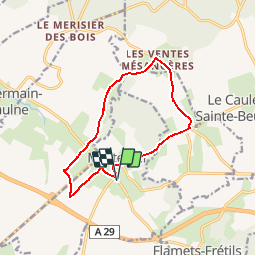
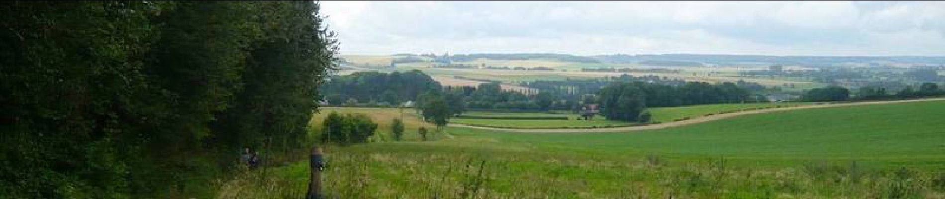
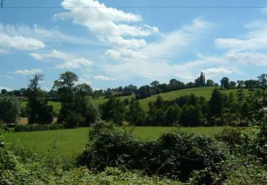
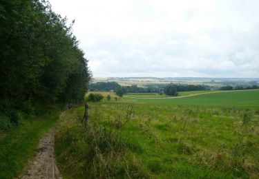
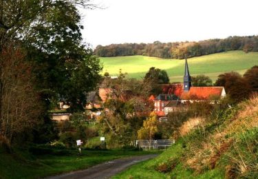
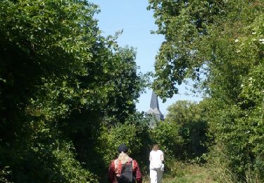
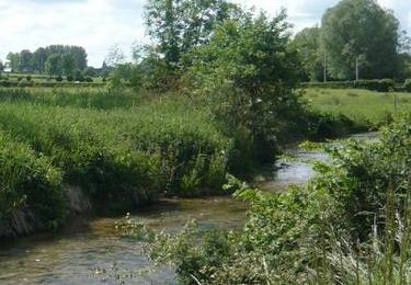
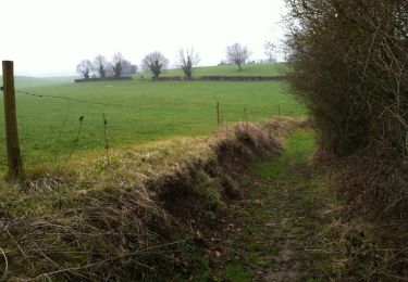
Trail Walking of 10.7 km to be discovered at Normandy, Seine-Maritime, Mortemer. This trail is proposed by tracegps.
Description
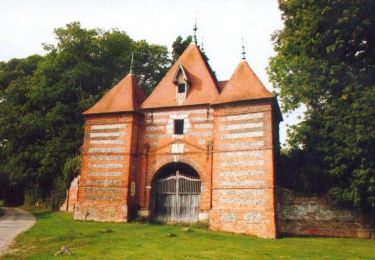
Circuit proposé par l'Office de Tourisme du Pays de Neufchâtelois. Départ de la mairie de Mortemer, 5 route de l'Eaulne . Arrêtez-vous devant le magnifique porche de l'ancien château d'Auvilliers et profitez du lavoir de Mortemer pour une pause pique-nique.
Positioning
Country:
France
Region :
Normandy
Department/Province :
Seine-Maritime
Municipality :
Mortemer
Location:
Unknown
Start:(Dec)
Start:(UTM)
395706 ; 5511676 (31U) N.
Comments
Trails nearby
![Trail Cycle Saint-Germain-sur-Eaulne - Le Carré - Saint Germain sur Eaulne - Photo](https://media.geolcdn.com/t/375/260/ext.jpg?maxdim=2&url=https%3A%2F%2Fservices.sitytrail.com%2FGeolivesWS%2FDownloadMedia.ashx%3FTrailID%3D172646%26Media%3D14017_2.jpg)
![Cycle Cycle](https://static1.geolcdn.com/sitytour/trail-icons/200.png)
Le Carré - Saint Germain sur Eaulne
Cycle
Medium
Saint-Germain-sur-Eaulne,
Normandy,
Seine-Maritime,
France
![](/images/other/stat-length.png)
28 km | 34 km-effort
2h 30min
![](https://static1.geolcdn.com/siteimages/upload/files/16400158638029165_repeat_loop_refresh_sync_direction_icon.png)
Yes
![Trail Cycle Nesle-Hodeng - Le coeur - Nesle Hodeng - Photo](https://media.geolcdn.com/t/375/260/ext.jpg?maxdim=2&url=https%3A%2F%2Fservices.sitytrail.com%2FGeolivesWS%2FDownloadMedia.ashx%3FTrailID%3D172645%26Media%3D14016_4.jpg)
![Cycle Cycle](https://static1.geolcdn.com/sitytour/trail-icons/200.png)
Le coeur - Nesle Hodeng
Cycle
Medium
Nesle-Hodeng,
Normandy,
Seine-Maritime,
France
![](/images/other/stat-length.png)
33 km | 39 km-effort
3h 0min
![](https://static1.geolcdn.com/siteimages/upload/files/16400158638029165_repeat_loop_refresh_sync_direction_icon.png)
Yes
![Trail Mountain bike Sainte-Beuve-en-Rivière - A partir de Ste-Beuve-en-Rivière - Photo](https://media.geolcdn.com/t/375/260/ext.jpg?maxdim=2&url=https%3A%2F%2Fservices.sitytrail.com%2FGeolivesWS%2FDownloadMedia.ashx%3FTrailID%3D172567%26Media%3D13935_5.jpg)
![Mountain bike Mountain bike](https://static1.geolcdn.com/sitytour/trail-icons/202.png)
A partir de Ste-Beuve-en-Rivière
Mountain bike
Medium
Sainte-Beuve-en-Rivière,
Normandy,
Seine-Maritime,
France
![](/images/other/stat-length.png)
19.4 km | 24 km-effort
2h 0min
![](https://static1.geolcdn.com/siteimages/upload/files/16400158638029165_repeat_loop_refresh_sync_direction_icon.png)
Yes
![Trail Mountain bike Nesle-Hodeng - A partir de Nesle-Hodeng - Photo](https://media.geolcdn.com/t/375/260/ext.jpg?maxdim=2&url=https%3A%2F%2Fservices.sitytrail.com%2FGeolivesWS%2FDownloadMedia.ashx%3FTrailID%3D172544%26Media%3D13910_5.jpg)
![Mountain bike Mountain bike](https://static1.geolcdn.com/sitytour/trail-icons/202.png)
A partir de Nesle-Hodeng
Mountain bike
Medium
Nesle-Hodeng,
Normandy,
Seine-Maritime,
France
![](/images/other/stat-length.png)
23 km | 28 km-effort
2h 30min
![](https://static1.geolcdn.com/siteimages/upload/files/16400158638029165_repeat_loop_refresh_sync_direction_icon.png)
Yes
![Trail Walking Flamets-Frétils - La mare aux Daims - Flamets-Fretils - Photo](https://media.geolcdn.com/t/375/260/ext.jpg?maxdim=2&url=https%3A%2F%2Fservices.sitytrail.com%2FGeolivesWS%2FDownloadMedia.ashx%3FTrailID%3D172426%26Media%3D13770_5.jpg)
![Walking Walking](https://static1.geolcdn.com/sitytour/trail-icons/101.png)
La mare aux Daims - Flamets-Fretils
Walking
Difficult
Flamets-Frétils,
Normandy,
Seine-Maritime,
France
![](/images/other/stat-length.png)
13.9 km | 17.2 km-effort
3h 30min
![](https://static1.geolcdn.com/siteimages/upload/files/16400158638029165_repeat_loop_refresh_sync_direction_icon.png)
Yes
![Trail Walking Sainte-Beuve-en-Rivière - Au fil de l'Eaulne - Sainte Beuve en Rivière - Photo](https://media.geolcdn.com/t/375/260/ext.jpg?maxdim=2&url=https%3A%2F%2Fservices.sitytrail.com%2FGeolivesWS%2FDownloadMedia.ashx%3FTrailID%3D172425%26Media%3D13769_5.jpg)
![Walking Walking](https://static1.geolcdn.com/sitytour/trail-icons/101.png)
Au fil de l'Eaulne - Sainte Beuve en Rivière
Walking
Difficult
Sainte-Beuve-en-Rivière,
Normandy,
Seine-Maritime,
France
![](/images/other/stat-length.png)
12.2 km | 15 km-effort
3h 4min
![](https://static1.geolcdn.com/siteimages/upload/files/16400158638029165_repeat_loop_refresh_sync_direction_icon.png)
Yes
![Trail Walking Graval - Promenade à Graval - Photo](https://media.geolcdn.com/t/375/260/ext.jpg?maxdim=2&url=https%3A%2F%2Fservices.sitytrail.com%2FGeolivesWS%2FDownloadMedia.ashx%3FTrailID%3D107144%26Media%3D11984_1.jpg)
![Walking Walking](https://static1.geolcdn.com/sitytour/trail-icons/101.png)
Promenade à Graval
Walking
Medium
Graval,
Normandy,
Seine-Maritime,
France
![](/images/other/stat-length.png)
19 km | 23 km-effort
3h 45min
![](https://static1.geolcdn.com/siteimages/upload/files/16400158638029165_repeat_loop_refresh_sync_direction_icon.png)
Yes
![Trail Walking Mortemer - Mortemer - Photo](https://media.geolcdn.com/t/375/260/ext.jpg?maxdim=2&url=https%3A%2F%2Fstatic1.geolcdn.com%2Fsiteimages%2Fupload%2Ffiles%2F1553511878bg_sport_marche.png)
![Walking Walking](https://static1.geolcdn.com/sitytour/trail-icons/101.png)
Mortemer
Walking
Medium
Mortemer,
Normandy,
Seine-Maritime,
France
![](/images/other/stat-length.png)
15.8 km | 19.1 km-effort
4h 8min
![](https://static1.geolcdn.com/siteimages/upload/files/16400158638029165_repeat_loop_refresh_sync_direction_icon.png)
Yes
![Trail Walking Flamets-Frétils - 18 janvier 2015 - Photo](https://media.geolcdn.com/t/375/260/ext.jpg?maxdim=2&url=https%3A%2F%2Fstatic1.geolcdn.com%2Fsiteimages%2Fupload%2Ffiles%2F1553511878bg_sport_marche.png)
![Walking Walking](https://static1.geolcdn.com/sitytour/trail-icons/101.png)
18 janvier 2015
Walking
Very easy
Flamets-Frétils,
Normandy,
Seine-Maritime,
France
![](/images/other/stat-length.png)
9.8 km | 11.3 km-effort
2h 29min
![](https://static1.geolcdn.com/siteimages/upload/files/16400158638029165_repeat_loop_refresh_sync_direction_icon.png)
No
super mais ça sent le caca Meumeu