![](/images/other/stat-length.png)
![Trail Walking Meulers - Balade à Meulers - Photo](https://media.geolcdn.com/t/1900/400/ext.pjpeg?maxdim=2&url=https%3A%2F%2Fservices.sitytrail.com%2FGeolivesWS%2FDownloadMedia.ashx%3FTrailID%3D172485%26Media%3D13843_1.jpg)
Balade à Meulers
tracegps
User
![Length](/images/other/stat-length.png)
Length
13.5 km
![Max alt](https://static1.geolcdn.com/siteimages/upload/files/1508320355ic_sort_altitude_max_24dp.png)
Max alt
153 m
![Uphill gradient](https://static1.geolcdn.com/siteimages/upload/files/1508320355ic_sort_den_pos_24dp.png)
Uphill gradient
329 m
![Km-Effort](/images/other/stat-length.png)
Km-Effort
17.9 km
![Min alt](https://static1.geolcdn.com/siteimages/upload/files/1508320355ic_sort_altitude_min_24dp.png)
Min alt
17 m
![Downhill gradient](https://static1.geolcdn.com/siteimages/upload/files/1508320355ic_sort_den_neg_24dp.png)
Downhill gradient
329 m
![Boucle](https://static1.geolcdn.com/siteimages/upload/files/16400158638029165_repeat_loop_refresh_sync_direction_icon.png)
Boucle
Yes
Creation date :
2014-12-10 00:00:00.0
Updated on :
2014-12-10 00:00:00.0
![Walking](https://static1.geolcdn.com/sitytour/trail-icons/101.png)
2h49
Difficulty : Easy
![Scan this QR Code to open this trail in the SityTrail application](https://capi.geolives.com/qq0zvz2zws4bq2lad0pu/sitytour/trails/172485/qr.png?size=200)
FREE GPS app for hiking
About
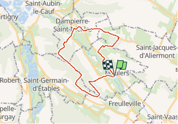
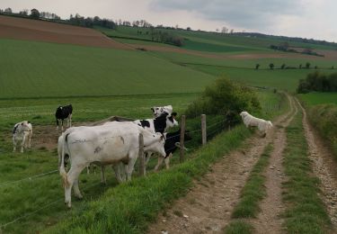
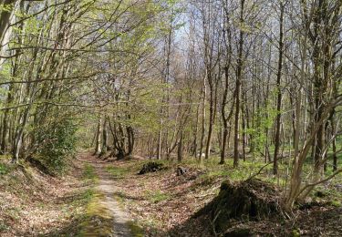
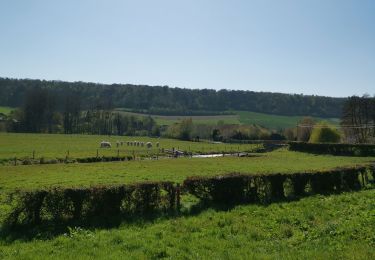
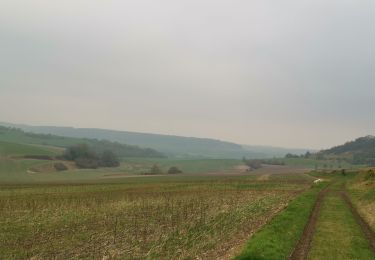
Trail Walking of 13.5 km to be discovered at Normandy, Seine-Maritime, Meulers. This trail is proposed by tracegps.
Description
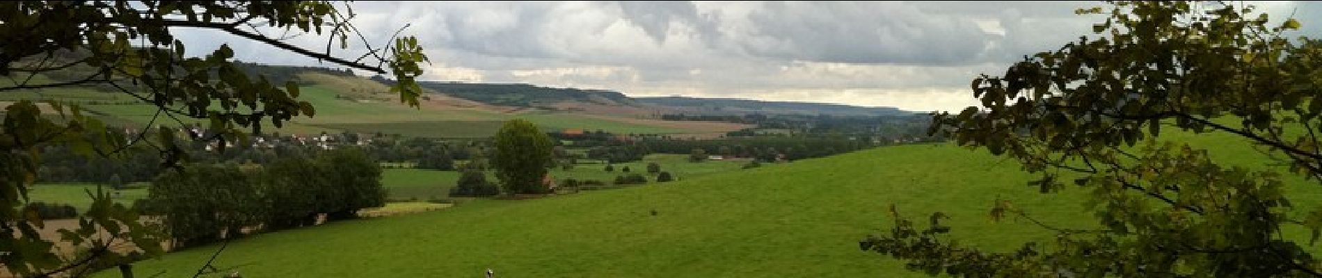
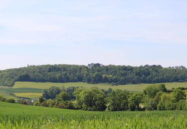
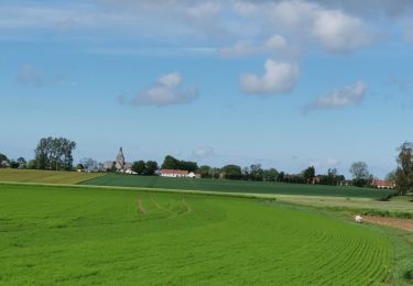
Balade sur les coteaux des deux rives de la Béthune, avec un bref passage sur l'Avenue Verte qui relie Forges les Eaux à Dieppe. Une balade à retrouver sur ICI .
Positioning
Country:
France
Region :
Normandy
Department/Province :
Seine-Maritime
Municipality :
Meulers
Location:
Unknown
Start:(Dec)
Start:(UTM)
372675 ; 5522128 (31U) N.
Comments
Trails nearby
![Trail Walking Freulleville - Val de Ricarville - Photo](https://media.geolcdn.com/t/375/260/ext.jpg?maxdim=2&url=https%3A%2F%2Fstatic1.geolcdn.com%2Fsiteimages%2Fupload%2Ffiles%2F1553511878bg_sport_marche.png)
![Walking Walking](https://static1.geolcdn.com/sitytour/trail-icons/101.png)
Val de Ricarville
Walking
Medium
(1)
Freulleville,
Normandy,
Seine-Maritime,
France
![](/images/other/stat-length.png)
12.9 km | 15.3 km-effort
3h 45min
![](https://static1.geolcdn.com/siteimages/upload/files/16400158638029165_repeat_loop_refresh_sync_direction_icon.png)
Yes
![Trail Walking Freulleville - Avenue verte Freulleville - Photo](https://media.geolcdn.com/t/375/260/ext.jpg?maxdim=2&url=https%3A%2F%2Fstatic1.geolcdn.com%2Fsiteimages%2Fupload%2Ffiles%2F1553511878bg_sport_marche.png)
![Walking Walking](https://static1.geolcdn.com/sitytour/trail-icons/101.png)
Avenue verte Freulleville
Walking
Easy
(1)
Freulleville,
Normandy,
Seine-Maritime,
France
![](/images/other/stat-length.png)
8.6 km | 10.4 km-effort
2h 16min
![](https://static1.geolcdn.com/siteimages/upload/files/16400158638029165_repeat_loop_refresh_sync_direction_icon.png)
Yes
![Trail Mountain bike Freulleville - fumechon - Photo](https://media.geolcdn.com/t/375/260/ext.jpg?maxdim=2&url=https%3A%2F%2Fstatic1.geolcdn.com%2Fsiteimages%2Fupload%2Ffiles%2F1524743154velo.jpg)
![Mountain bike Mountain bike](https://static1.geolcdn.com/sitytour/trail-icons/202.png)
fumechon
Mountain bike
Very difficult
(1)
Freulleville,
Normandy,
Seine-Maritime,
France
![](/images/other/stat-length.png)
48 km | 57 km-effort
3h 13min
![](https://static1.geolcdn.com/siteimages/upload/files/16400158638029165_repeat_loop_refresh_sync_direction_icon.png)
Yes
![Walking Walking](https://static1.geolcdn.com/sitytour/trail-icons/101.png)
La Vallée de la Varenne , vu du haut de Torcy
Walking
Medium
Torcy-le-Petit,
Normandy,
Seine-Maritime,
France
![](/images/other/stat-length.png)
4.5 km | 6.3 km-effort
1h 25min
![](https://static1.geolcdn.com/siteimages/upload/files/16400158638029165_repeat_loop_refresh_sync_direction_icon.png)
Yes
![Trail Walking Notre-Dame-d'Aliermont - Notre Dame d'aliermont - Photo](https://media.geolcdn.com/t/375/260/be0aff73-38f2-4e52-a2ef-91b4f66c77ba.jpg&format=jpg&maxdim=2)
![Walking Walking](https://static1.geolcdn.com/sitytour/trail-icons/101.png)
Notre Dame d'aliermont
Walking
Medium
Notre-Dame-d'Aliermont,
Normandy,
Seine-Maritime,
France
![](/images/other/stat-length.png)
7.2 km | 8.8 km-effort
1h 24min
![](https://static1.geolcdn.com/siteimages/upload/files/16400158638029165_repeat_loop_refresh_sync_direction_icon.png)
Yes
![Trail Walking Saint-Jacques-d'Aliermont - St Jacques d'aliermont-ste agathe - Photo](https://media.geolcdn.com/t/375/260/6ed55fef-d488-41f8-9fde-71b80412a4f9.jpg&format=jpg&maxdim=2)
![Walking Walking](https://static1.geolcdn.com/sitytour/trail-icons/101.png)
St Jacques d'aliermont-ste agathe
Walking
Medium
Saint-Jacques-d'Aliermont,
Normandy,
Seine-Maritime,
France
![](/images/other/stat-length.png)
10.1 km | 11.6 km-effort
1h 54min
![](https://static1.geolcdn.com/siteimages/upload/files/16400158638029165_repeat_loop_refresh_sync_direction_icon.png)
Yes
![Trail Walking Freulleville - forêt d'eawy torcy - Photo](https://media.geolcdn.com/t/375/260/6312d56a-96b5-462e-a737-70631a638906.jpg&format=jpg&maxdim=2)
![Walking Walking](https://static1.geolcdn.com/sitytour/trail-icons/101.png)
forêt d'eawy torcy
Walking
Medium
Freulleville,
Normandy,
Seine-Maritime,
France
![](/images/other/stat-length.png)
8.8 km | 11.1 km-effort
1h 36min
![](https://static1.geolcdn.com/siteimages/upload/files/16400158638029165_repeat_loop_refresh_sync_direction_icon.png)
Yes
![Trail Walking Dampierre-Saint-Nicolas - Dampierre st Nicolas bois de Pimont freulleville - Photo](https://media.geolcdn.com/t/375/260/e35ff1c0-e51d-4736-8196-d8e56969896a.jpg&format=jpg&maxdim=2)
![Walking Walking](https://static1.geolcdn.com/sitytour/trail-icons/101.png)
Dampierre st Nicolas bois de Pimont freulleville
Walking
Difficult
Dampierre-Saint-Nicolas,
Normandy,
Seine-Maritime,
France
![](/images/other/stat-length.png)
13.2 km | 15.8 km-effort
2h 9min
![](https://static1.geolcdn.com/siteimages/upload/files/16400158638029165_repeat_loop_refresh_sync_direction_icon.png)
Yes
![Trail Walking Saint-Vaast-d'Équiqueville - St vaast d'esquive ville freulleville St Jacques d'aliermont - Photo](https://media.geolcdn.com/t/375/260/77de1c3c-08f5-48b8-8b35-8875a3408662.jpg&format=jpg&maxdim=2)
![Walking Walking](https://static1.geolcdn.com/sitytour/trail-icons/101.png)
St vaast d'esquive ville freulleville St Jacques d'aliermont
Walking
Very easy
Saint-Vaast-d'Équiqueville,
Normandy,
Seine-Maritime,
France
![](/images/other/stat-length.png)
9.8 km | 12 km-effort
1h 44min
![](https://static1.geolcdn.com/siteimages/upload/files/16400158638029165_repeat_loop_refresh_sync_direction_icon.png)
Yes