Trail Walking Bagnères-de-Bigorre - Circuit des Lacs entre la Mongie et Barèges - 3 jours dans le Néouvielle - Photo

Circuit des Lacs entre la Mongie et Barèges - 3 jours dans le Néouvielle

 tracegps
tracegps

User

© OpenStreetMap contributors
Length
Length
31 km
Max alt
Max alt
2496 m
Uphill gradient
Uphill gradient
2011 m
Km-Effort
Km-Effort  
58 km
Min alt
Min alt
1426 m
Downhill gradient
Downhill gradient
1983 m
Boucle
Boucle
No
Creation date :
2014-12-10 00:00:00.0
Updated on :
2014-12-10 00:00:00.0

(0 Reviews)

Walking
Walking
78h00
Difficulty : Medium

Scan this QR Code to open this trail in the SityTrail application

FREE GPS app for hiking

Logo SityTrail SityTrail

IGN / Geographical institutes

Download SityTrail from the App Store Download SityTrail from Google Play

Logo SityTrail SityTrail World

The world is yours!

Download SityTrail from the App Store Download SityTrail from Google Play Download SityTrail on Huawei AppGallery

About

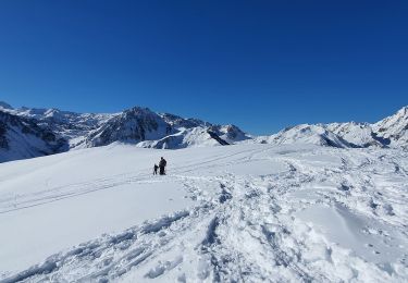
Trail Walking of 31 km to be discovered at Occitania, Hautespyrenees, Bagnères-de-Bigorre. This trail is proposed by tracegps.

Description

Départ sur la D918 à 3 km à l’est de la Mongie par le GR10C, pour une première série de lacs: Réservoir des Laquets, lac et laquette de Gréziolles, lac du Campana, lac Arredoun puis redescente pour passer la nuit près du refuge de Campana. Deuxième jour : lac de la Hourquette, puis après la hourquette de Carderolles, le lac de Bastan, les laquets de Port-Biehl, le laquet de Coste Ouéillere, le lac de Gourguet et le lac supérieur d’Estibère, près duquel on plante la tente pour la seconde nuit. Troisième jour : le lac d’Aumar, passage à proximité du lac d’Aubert puis après la hourquette d’Aubert, le lac d’Estagnol, le lac Nère, le lac Blanc, le lac de la Jonquère et le lac Dets Coubous avant la descente sur la D918 au lieu dit Tournaboup entre Barèges et Super Barèges.

Elevation profile

Photos

Points of interest

Point of interest Vielle-Aure - Col d'Aumar - Photo
tracegps
VIELLE-AURE 
Point of interest Barèges - Hourquette d'Aubert - Photo
tracegps
Point of interest Vielle-Aure - Hourquette de Caderolles - Photo
tracegps
Point of interest Bagnères-de-Bigorre - N1 - Photo
tracegps
BAGNÈRES-DE-BIGORRE 
Point of interest Vielle-Aure - N2 - Photo
tracegps
VIELLE-AURE 

Positioning

Country:
France
Region :
Occitania
Department/Province :
Hautespyrenees
Municipality :
Bagnères-de-Bigorre
Location:
Unknown
Start:(UTM)
272239 ; 4755364 (31T) N.

Trails nearby

Trail Walking Campan - Lac d'Arizes - Campan - Photo
Walking
tracegps

Walking

Medium
(1)
Campan, Occitania, Hautespyrenees, France
10.2 km | 20 km-effort
3h 30min
Yes
Trail Walking Ancizan - Vallée de la Gaoube - Photo
Walking
bliguet

Walking

Medium
(1)
Ancizan, Occitania, Hautespyrenees, France
6.6 km | 9.1 km-effort
4h 49min
Yes
Trail Walking Campan - La soula de Tournes - Photo
Walking
GUIDE
LouisROGER

Walking

Easy
(1)
Campan, Occitania, Hautespyrenees, France
7.7 km | 11.3 km-effort
2h 21min
Yes
Trail On foot Campan - SityTrail - 2444920 - artigues-la-mongie-g3-lpc-corrigex - Photo
On foot
JACQUESD

On foot

Very easy
(1)
Campan, Occitania, Hautespyrenees, France
7.8 km | 15.7 km-effort
Unknown
Yes
Trail Walking Campan - artigues à payolle - Photo
Walking
GUIDE
LouisROGER

Walking

Very easy
Campan, Occitania, Hautespyrenees, France
15.1 km | 19.8 km-effort
6h 10min
No
Trail Walking Campan - Pic Midi Bigorres - Photo
Walking
doume82

Walking

Difficult
(1)
Campan, Occitania, Hautespyrenees, France
9.2 km | 25 km-effort
4h 30min
No
Trail Walking Bagnères-de-Bigorre - Sommet TUHOU GRAN 1911m - Photo
Walking
chrisgps

Walking

Difficult
Bagnères-de-Bigorre, Occitania, Hautespyrenees, France
8.4 km | 16.3 km-effort
3h 42min
Yes
Trail Walking Bagnères-de-Bigorre - Lac de Gréziolles - Photo
Walking
HANUCIL

Walking

Medium
Bagnères-de-Bigorre, Occitania, Hautespyrenees, France
10.8 km | 21 km-effort
4h 1min
Yes
Trail Walking Bagnères-de-Bigorre - G2 articles lac de grezillard - Photo
Walking
GUIDE
LouisROGER

Walking

Very difficult
Bagnères-de-Bigorre, Occitania, Hautespyrenees, France
10.4 km | 20 km-effort
7h 18min
Yes


Close
My subscriptions