![](/images/other/stat-length.png)
![Trail Mountain bike Cleppé - Randonnée de la Tour - Cléppé - Photo](https://media.geolcdn.com/t/1900/400/ext.pjpeg?maxdim=2&url=https%3A%2F%2Fservices.sitytrail.com%2FGeolivesWS%2FDownloadMedia.ashx%3FTrailID%3D172375%26Media%3D13718_6.jpg)
Randonnée de la Tour - Cléppé
tracegps
User
![Length](/images/other/stat-length.png)
![Max alt](https://static1.geolcdn.com/siteimages/upload/files/1508320355ic_sort_altitude_max_24dp.png)
![Uphill gradient](https://static1.geolcdn.com/siteimages/upload/files/1508320355ic_sort_den_pos_24dp.png)
![Km-Effort](/images/other/stat-length.png)
![Min alt](https://static1.geolcdn.com/siteimages/upload/files/1508320355ic_sort_altitude_min_24dp.png)
![Downhill gradient](https://static1.geolcdn.com/siteimages/upload/files/1508320355ic_sort_den_neg_24dp.png)
![Boucle](https://static1.geolcdn.com/siteimages/upload/files/16400158638029165_repeat_loop_refresh_sync_direction_icon.png)
![Mountain bike](https://static1.geolcdn.com/sitytour/trail-icons/202.png)
2h19
Difficulty : Easy
![Scan this QR Code to open this trail in the SityTrail application](https://capi.geolives.com/qq0zvz2zws4bq2lad0pu/sitytour/trails/172375/qr.png?size=200)
FREE GPS app for hiking
About
Trail Mountain bike of 25 km to be discovered at Auvergne-Rhône-Alpes, Loire, Cleppé. This trail is proposed by tracegps.
Description
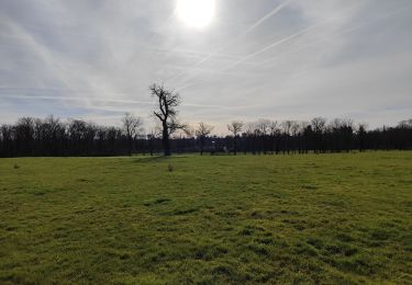
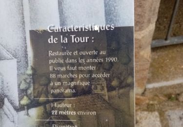
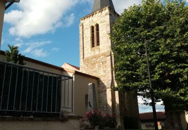
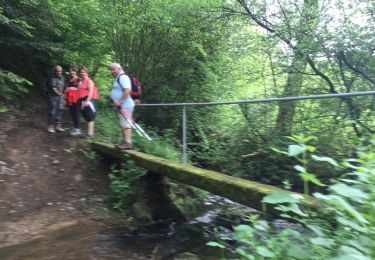
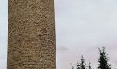
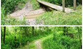
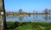
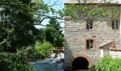
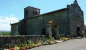
Parking et départ de la mairie (derrière la Tour). Ce circuit est inspiré de la marche organisée par le Tennis-Club de Cléppé qui s'est déroulée le dimanche 10 juin 2012. Le parcours est sans aucune difficulté, il est très roulant avec de beaux sous bois et des petits cours d'eau que l'on traverse à gué ou sur de petites passerelles en bois. Eviter par terrain gras. La marche initiale traversant des passages privés qui ne sont ouverts que le jour de l'évènement, j'ai donc légèrement modifié ce parcours ainsi que sont point de départ. Topo-guide : Montagnes du Matin, randonnée pédestre, 550 km de sentiers, 54 circuits balisés dans 29 communes.
Positioning
Comments
Trails nearby
![Trail Walking Sainte-Foy-Saint-Sulpice - Randonnée des étangs Sainte Foy-Saint Sulpice - Photo](https://media.geolcdn.com/t/375/260/5eb7908f-45a2-4198-a740-829f89797dcc.jpg&format=jpg&maxdim=2)
![Walking Walking](https://static1.geolcdn.com/sitytour/trail-icons/101.png)
Walking
![](/images/other/stat-length.png)
![](https://static1.geolcdn.com/siteimages/upload/files/16400158638029165_repeat_loop_refresh_sync_direction_icon.png)
![Trail Walking Feurs - Randonnée au dessus de Feurs - Photo](https://media.geolcdn.com/t/375/260/d2c52346-f2e5-4497-8257-48fbc24ee939.jpg&format=jpg&maxdim=2)
![Walking Walking](https://static1.geolcdn.com/sitytour/trail-icons/101.png)
Walking
![](/images/other/stat-length.png)
![](https://static1.geolcdn.com/siteimages/upload/files/16400158638029165_repeat_loop_refresh_sync_direction_icon.png)
![Trail Walking Pouilly-lès-Feurs - Randonnée de Pouilly les Feurs - Photo](https://media.geolcdn.com/t/375/260/0f77cdd6-65d8-41be-b44b-39fa6456f5ec.jpg&format=jpg&maxdim=2)
![Walking Walking](https://static1.geolcdn.com/sitytour/trail-icons/101.png)
Walking
![](/images/other/stat-length.png)
![](https://static1.geolcdn.com/siteimages/upload/files/16400158638029165_repeat_loop_refresh_sync_direction_icon.png)
![Trail Walking Mizérieux - Mizerieux - Photo](https://media.geolcdn.com/t/375/260/ext.jpg?maxdim=2&url=https%3A%2F%2Fstatic1.geolcdn.com%2Fsiteimages%2Fupload%2Ffiles%2F1553511878bg_sport_marche.png)
![Walking Walking](https://static1.geolcdn.com/sitytour/trail-icons/101.png)
Walking
![](/images/other/stat-length.png)
![](https://static1.geolcdn.com/siteimages/upload/files/16400158638029165_repeat_loop_refresh_sync_direction_icon.png)
![Trail Walking Poncins - rando autour de Po'cin, pour la cause de Keur d'Afrique - Photo](https://media.geolcdn.com/t/375/260/cee6d893-3319-4124-852c-e6f360b5ea32.jpg&format=jpg&maxdim=2)
![Walking Walking](https://static1.geolcdn.com/sitytour/trail-icons/101.png)
Walking
![](/images/other/stat-length.png)
![](https://static1.geolcdn.com/siteimages/upload/files/16400158638029165_repeat_loop_refresh_sync_direction_icon.png)
![Trail Walking Cleppé - Cleppe - Photo](https://media.geolcdn.com/t/375/260/e763cdde-54ba-49eb-adef-c0398a496538.jpg&format=jpg&maxdim=2)
![Walking Walking](https://static1.geolcdn.com/sitytour/trail-icons/101.png)
Walking
![](/images/other/stat-length.png)
![](https://static1.geolcdn.com/siteimages/upload/files/16400158638029165_repeat_loop_refresh_sync_direction_icon.png)
![Trail Walking Mizérieux - Mizerieux, les grands Chambons - Photo](https://media.geolcdn.com/t/375/260/411c1e0d-db77-493e-a8ae-e8ad36add8e4.jpg&format=jpg&maxdim=2)
![Walking Walking](https://static1.geolcdn.com/sitytour/trail-icons/101.png)
Walking
![](/images/other/stat-length.png)
![](https://static1.geolcdn.com/siteimages/upload/files/16400158638029165_repeat_loop_refresh_sync_direction_icon.png)
![Trail Walking Pouilly-lès-Feurs - Pouilly les Feurs - Photo](https://media.geolcdn.com/t/375/260/ext.jpg?maxdim=2&url=https%3A%2F%2Fservices.sitytrail.com%2FGeolivesWS%2FDownloadMedia.ashx%3FTrailID%3D581484%26Media%3D20160524165910.jpg)
![Walking Walking](https://static1.geolcdn.com/sitytour/trail-icons/101.png)
Walking
![](/images/other/stat-length.png)
![](https://static1.geolcdn.com/siteimages/upload/files/16400158638029165_repeat_loop_refresh_sync_direction_icon.png)
![Trail Mountain bike Feurs - Du Barrage de Villerest au Barrage de Grangent en 10 boucles / Boucle N° 05 : Pont de Feurs - Pont de Montrond-les-Bains - Photo](https://media.geolcdn.com/t/375/260/ext.jpg?maxdim=2&url=https%3A%2F%2Fservices.sitytrail.com%2FGeolivesWS%2FDownloadMedia.ashx%3FTrailID%3D316882%26Media%3D15966_6.jpg)
![Mountain bike Mountain bike](https://static1.geolcdn.com/sitytour/trail-icons/202.png)
Mountain bike
![](/images/other/stat-length.png)
![](https://static1.geolcdn.com/siteimages/upload/files/16400158638029165_repeat_loop_refresh_sync_direction_icon.png)
le top pour promenade en vtt, à pied, etc.... et surtout très facile à maîtriser comparé à d'autres navigateurs. Je recommande à tous les amateurs. .. Bravo au développeur.