![](/images/other/stat-length.png)
![Trail Mountain bike Nervieux - E4 - VTT Montagnes du Matin - Nervieux - Photo](https://media.geolcdn.com/t/1900/400/ext.pjpeg?maxdim=2&url=https%3A%2F%2Fservices.sitytrail.com%2FGeolivesWS%2FDownloadMedia.ashx%3FTrailID%3D172342%26Media%3D13665_6.jpg)
E4 - VTT Montagnes du Matin - Nervieux
tracegps
User
![Length](/images/other/stat-length.png)
![Max alt](https://static1.geolcdn.com/siteimages/upload/files/1508320355ic_sort_altitude_max_24dp.png)
![Uphill gradient](https://static1.geolcdn.com/siteimages/upload/files/1508320355ic_sort_den_pos_24dp.png)
![Km-Effort](/images/other/stat-length.png)
![Min alt](https://static1.geolcdn.com/siteimages/upload/files/1508320355ic_sort_altitude_min_24dp.png)
![Downhill gradient](https://static1.geolcdn.com/siteimages/upload/files/1508320355ic_sort_den_neg_24dp.png)
![Boucle](https://static1.geolcdn.com/siteimages/upload/files/16400158638029165_repeat_loop_refresh_sync_direction_icon.png)
![Mountain bike](https://static1.geolcdn.com/sitytour/trail-icons/202.png)
1h45
Difficulty : Medium
![Scan this QR Code to open this trail in the SityTrail application](https://capi.geolives.com/qq0zvz2zws4bq2lad0pu/sitytour/trails/172342/qr.png?size=200)
FREE GPS app for hiking
About
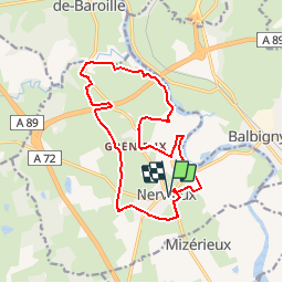
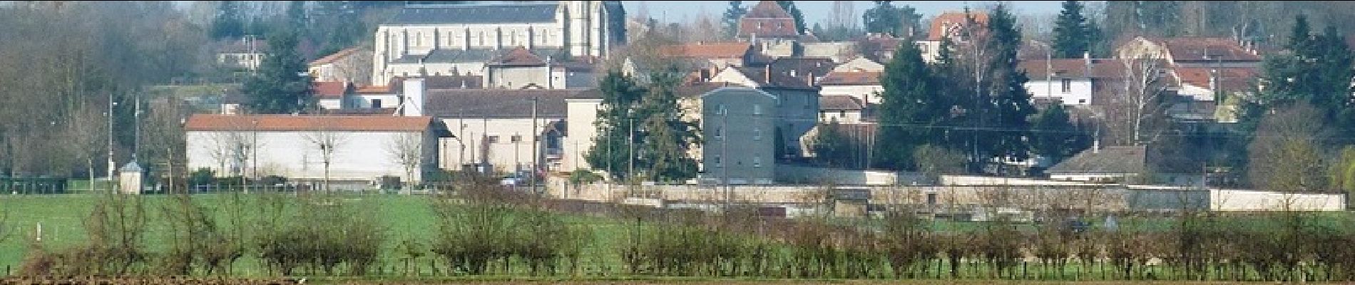
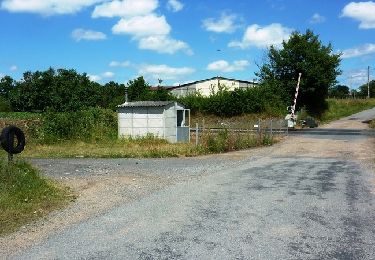
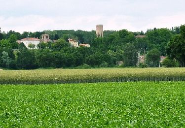
Trail Mountain bike of 16 km to be discovered at Auvergne-Rhône-Alpes, Loire, Nervieux. This trail is proposed by tracegps.
Description
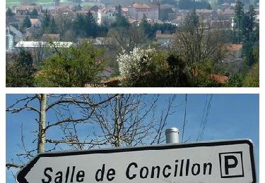
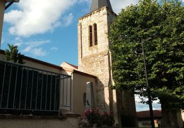
Parking est départ de la place derrière l'église. Pour plus d’infos, visitez le site de l' Office de Tourisme des Montagnes du Matin. Les Montagnes du Matin sont situées sur la partie ouest des monts du Lyonnais, côté Loire (42), vers la plaine du Forez. Carte avec le plan du réseau des 26 itinéraires VTT dans les Montagnes du Matin (350 km de sentiers aménagés) disponible dans les OT/SI de la région (Panissières, Violay, Balbigny, Roanne).
Positioning
Comments
Trails nearby
![Trail Walking Balbigny - Autour des Gorges de la Loire - PR N° 2 : Le Funiculaire de Biesse - Les Chessieux - Photo](https://media.geolcdn.com/t/375/260/ext.jpg?maxdim=2&url=https%3A%2F%2Fservices.sitytrail.com%2FGeolivesWS%2FDownloadMedia.ashx%3FTrailID%3D215160%26Media%3D15762_6.jpg)
![Walking Walking](https://static1.geolcdn.com/sitytour/trail-icons/101.png)
Walking
![](/images/other/stat-length.png)
![](https://static1.geolcdn.com/siteimages/upload/files/16400158638029165_repeat_loop_refresh_sync_direction_icon.png)
![Trail Mountain bike Cleppé - Randonnée de la Tour - Cléppé - Photo](https://media.geolcdn.com/t/375/260/ext.jpg?maxdim=2&url=https%3A%2F%2Fservices.sitytrail.com%2FGeolivesWS%2FDownloadMedia.ashx%3FTrailID%3D172375%26Media%3D13718_6.jpg)
![Mountain bike Mountain bike](https://static1.geolcdn.com/sitytour/trail-icons/202.png)
Mountain bike
![](/images/other/stat-length.png)
![](https://static1.geolcdn.com/siteimages/upload/files/16400158638029165_repeat_loop_refresh_sync_direction_icon.png)
![Trail Mountain bike Balbigny - B6 - VTT Montagnes du Matin - Balbigny - Photo](https://media.geolcdn.com/t/375/260/ext.jpg?maxdim=2&url=https%3A%2F%2Fservices.sitytrail.com%2FGeolivesWS%2FDownloadMedia.ashx%3FTrailID%3D172328%26Media%3D13651_6.jpg)
![Mountain bike Mountain bike](https://static1.geolcdn.com/sitytour/trail-icons/202.png)
Mountain bike
![](/images/other/stat-length.png)
![](https://static1.geolcdn.com/siteimages/upload/files/16400158638029165_repeat_loop_refresh_sync_direction_icon.png)
![Trail Walking Sainte-Foy-Saint-Sulpice - Randonnée des étangs Sainte Foy-Saint Sulpice - Photo](https://media.geolcdn.com/t/375/260/5eb7908f-45a2-4198-a740-829f89797dcc.jpg&format=jpg&maxdim=2)
![Walking Walking](https://static1.geolcdn.com/sitytour/trail-icons/101.png)
Walking
![](/images/other/stat-length.png)
![](https://static1.geolcdn.com/siteimages/upload/files/16400158638029165_repeat_loop_refresh_sync_direction_icon.png)
![Trail Walking Mizérieux - Mizerieux - Photo](https://media.geolcdn.com/t/375/260/ext.jpg?maxdim=2&url=https%3A%2F%2Fstatic1.geolcdn.com%2Fsiteimages%2Fupload%2Ffiles%2F1553511878bg_sport_marche.png)
![Walking Walking](https://static1.geolcdn.com/sitytour/trail-icons/101.png)
Walking
![](/images/other/stat-length.png)
![](https://static1.geolcdn.com/siteimages/upload/files/16400158638029165_repeat_loop_refresh_sync_direction_icon.png)
![Trail Walking Balbigny - rando au départ de Balbigny, viaduc Chessieu, St Georges de Barolles, les Sigauds, Grenieux, Nervieux, Pont de Balbigny - Photo](https://media.geolcdn.com/t/375/260/5db3212e-40b4-459c-9353-6a43c13d12c3.jpg&format=jpg&maxdim=2)
![Walking Walking](https://static1.geolcdn.com/sitytour/trail-icons/101.png)
Walking
![](/images/other/stat-length.png)
![](https://static1.geolcdn.com/siteimages/upload/files/16400158638029165_repeat_loop_refresh_sync_direction_icon.png)
![Trail Walking Cleppé - Cleppe - Photo](https://media.geolcdn.com/t/375/260/e763cdde-54ba-49eb-adef-c0398a496538.jpg&format=jpg&maxdim=2)
![Walking Walking](https://static1.geolcdn.com/sitytour/trail-icons/101.png)
Walking
![](/images/other/stat-length.png)
![](https://static1.geolcdn.com/siteimages/upload/files/16400158638029165_repeat_loop_refresh_sync_direction_icon.png)
![Trail Walking Mizérieux - Mizerieux, les grands Chambons - Photo](https://media.geolcdn.com/t/375/260/411c1e0d-db77-493e-a8ae-e8ad36add8e4.jpg&format=jpg&maxdim=2)
![Walking Walking](https://static1.geolcdn.com/sitytour/trail-icons/101.png)
Walking
![](/images/other/stat-length.png)
![](https://static1.geolcdn.com/siteimages/upload/files/16400158638029165_repeat_loop_refresh_sync_direction_icon.png)
![Trail Walking Balbigny - départ de carrefour market Balbigny, les Chessieu, le Chatelard, la digue de Pinay, retour sur Balbigny - Photo](https://media.geolcdn.com/t/375/260/471fef2b-1bad-4105-ac34-0aa84a5add34.jpg&format=jpg&maxdim=2)
![Walking Walking](https://static1.geolcdn.com/sitytour/trail-icons/101.png)
Walking
![](/images/other/stat-length.png)
![](https://static1.geolcdn.com/siteimages/upload/files/16400158638029165_repeat_loop_refresh_sync_direction_icon.png)