![](/images/other/stat-length.png)
![Trail Walking Ballay - Les Bois de Landéves - Ballay - Photo](https://media.geolcdn.com/t/1900/400/ext.pjpeg?maxdim=2&url=https%3A%2F%2Fservices.sitytrail.com%2FGeolivesWS%2FDownloadMedia.ashx%3FTrailID%3D172272%26Media%3D13587_1.jpg)
Les Bois de Landéves - Ballay
tracegps
User
![Length](/images/other/stat-length.png)
Length
9.6 km
![Max alt](https://static1.geolcdn.com/siteimages/upload/files/1508320355ic_sort_altitude_max_24dp.png)
Max alt
214 m
![Uphill gradient](https://static1.geolcdn.com/siteimages/upload/files/1508320355ic_sort_den_pos_24dp.png)
Uphill gradient
204 m
![Km-Effort](/images/other/stat-length.png)
Km-Effort
12.3 km
![Min alt](https://static1.geolcdn.com/siteimages/upload/files/1508320355ic_sort_altitude_min_24dp.png)
Min alt
110 m
![Downhill gradient](https://static1.geolcdn.com/siteimages/upload/files/1508320355ic_sort_den_neg_24dp.png)
Downhill gradient
204 m
![Boucle](https://static1.geolcdn.com/siteimages/upload/files/16400158638029165_repeat_loop_refresh_sync_direction_icon.png)
Boucle
Yes
Creation date :
2014-12-10 00:00:00.0
Updated on :
2014-12-10 00:00:00.0
![Walking](https://static1.geolcdn.com/sitytour/trail-icons/101.png)
2h30
Difficulty : Medium
![Scan this QR Code to open this trail in the SityTrail application](https://capi.geolives.com/qq0zvz2zws4bq2lad0pu/sitytour/trails/172272/qr.png?size=200)
FREE GPS app for hiking
About
Trail Walking of 9.6 km to be discovered at Grand Est, Ardennes, Ballay. This trail is proposed by tracegps.
Description
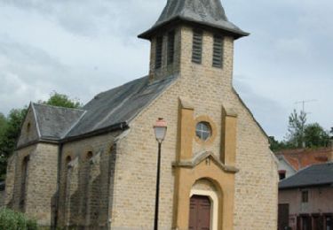
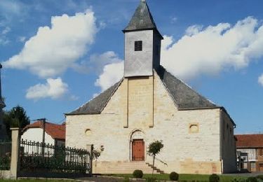
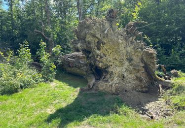
Départ place de Ballay, montez vers le cimetière, prenez la route forestière, de beaux petits ruisseaux vous attendent. Chevreuils renards blaireaux souvent sur les chemins.
Positioning
Country:
France
Region :
Grand Est
Department/Province :
Ardennes
Municipality :
Ballay
Location:
Unknown
Start:(Dec)
Start:(UTM)
626871 ; 5476488 (31U) N.
Comments
Trails nearby
![Trail Walking La Croix-aux-Bois - Forêt de la Croix aux Bois - Photo](https://media.geolcdn.com/t/375/260/ext.jpg?maxdim=2&url=https%3A%2F%2Fservices.sitytrail.com%2FGeolivesWS%2FDownloadMedia.ashx%3FTrailID%3D129652%26Media%3D13179_5.jpg)
![Walking Walking](https://static1.geolcdn.com/sitytour/trail-icons/101.png)
Forêt de la Croix aux Bois
Walking
Medium
La Croix-aux-Bois,
Grand Est,
Ardennes,
France
![](/images/other/stat-length.png)
16.1 km | 19.7 km-effort
3h 0min
![](https://static1.geolcdn.com/siteimages/upload/files/16400158638029165_repeat_loop_refresh_sync_direction_icon.png)
Yes
![Trail Walking Ballay - Le tour de Toges - Ballay - Photo](https://media.geolcdn.com/t/375/260/ext.jpg?maxdim=2&url=https%3A%2F%2Fservices.sitytrail.com%2FGeolivesWS%2FDownloadMedia.ashx%3FTrailID%3D172274%26Media%3D13590_1.jpg)
![Walking Walking](https://static1.geolcdn.com/sitytour/trail-icons/101.png)
Le tour de Toges - Ballay
Walking
Medium
Ballay,
Grand Est,
Ardennes,
France
![](/images/other/stat-length.png)
12.5 km | 14.8 km-effort
3h 0min
![](https://static1.geolcdn.com/siteimages/upload/files/16400158638029165_repeat_loop_refresh_sync_direction_icon.png)
Yes
![Trail Walking Quatre-Champs - La forêt de Vandy - Quatre Champs - Photo](https://media.geolcdn.com/t/375/260/ext.jpg?maxdim=2&url=https%3A%2F%2Fservices.sitytrail.com%2FGeolivesWS%2FDownloadMedia.ashx%3FTrailID%3D172271%26Media%3D13585_1.jpg)
![Walking Walking](https://static1.geolcdn.com/sitytour/trail-icons/101.png)
La forêt de Vandy - Quatre Champs
Walking
Medium
Quatre-Champs,
Grand Est,
Ardennes,
France
![](/images/other/stat-length.png)
10.4 km | 13.4 km-effort
3h 0min
![](https://static1.geolcdn.com/siteimages/upload/files/16400158638029165_repeat_loop_refresh_sync_direction_icon.png)
Yes
![Trail Walking Boult-aux-Bois - 2024 06 Boult au bois t1 - Photo](https://media.geolcdn.com/t/375/260/46e42a26-d7a3-43ac-95b1-04437c859b4d.jpg&format=jpg&maxdim=2)
![Walking Walking](https://static1.geolcdn.com/sitytour/trail-icons/101.png)
2024 06 Boult au bois t1
Walking
Very difficult
Boult-aux-Bois,
Grand Est,
Ardennes,
France
![](/images/other/stat-length.png)
49 km | 57 km-effort
3h 29min
![](https://static1.geolcdn.com/siteimages/upload/files/16400158638029165_repeat_loop_refresh_sync_direction_icon.png)
No
![Trail Walking Vouziers - condé 1 - Photo](https://media.geolcdn.com/t/375/260/ext.jpg?maxdim=2&url=https%3A%2F%2Fstatic1.geolcdn.com%2Fsiteimages%2Fupload%2Ffiles%2F1553511878bg_sport_marche.png)
![Walking Walking](https://static1.geolcdn.com/sitytour/trail-icons/101.png)
![Trail Walking Vandy - Le Bouiillon - Photo](https://media.geolcdn.com/t/375/260/ext.jpg?maxdim=2&url=https%3A%2F%2Fstatic1.geolcdn.com%2Fsiteimages%2Fupload%2Ffiles%2F1553511878bg_sport_marche.png)
![Walking Walking](https://static1.geolcdn.com/sitytour/trail-icons/101.png)
![Trail Walking Toges - Les Tasséniéres - Photo](https://media.geolcdn.com/t/375/260/ext.jpg?maxdim=2&url=https%3A%2F%2Fstatic1.geolcdn.com%2Fsiteimages%2Fupload%2Ffiles%2F1553511878bg_sport_marche.png)
![Walking Walking](https://static1.geolcdn.com/sitytour/trail-icons/101.png)
Les Tasséniéres
Walking
Medium
Toges,
Grand Est,
Ardennes,
France
![](/images/other/stat-length.png)
8.6 km | 11.3 km-effort
2h 35min
![](https://static1.geolcdn.com/siteimages/upload/files/16400158638029165_repeat_loop_refresh_sync_direction_icon.png)
Yes
![Trail Walking Toges - Toges - Photo](https://media.geolcdn.com/t/375/260/ext.jpg?maxdim=2&url=https%3A%2F%2Fstatic1.geolcdn.com%2Fsiteimages%2Fupload%2Ffiles%2F1553511878bg_sport_marche.png)
![Walking Walking](https://static1.geolcdn.com/sitytour/trail-icons/101.png)
![Trail Nordic walking Vouziers - Les Pâquis maison - Photo](https://media.geolcdn.com/t/375/260/ext.jpg?maxdim=2&url=https%3A%2F%2Fstatic1.geolcdn.com%2Fsiteimages%2Fupload%2Ffiles%2F1545311037marcheuse_200dpi.jpg)
![Nordic walking Nordic walking](https://static1.geolcdn.com/sitytour/trail-icons/102.png)
Les Pâquis maison
Nordic walking
Vouziers,
Grand Est,
Ardennes,
France
![](/images/other/stat-length.png)
3.2 km | 3.7 km-effort
1h 0min
![](https://static1.geolcdn.com/siteimages/upload/files/16400158638029165_repeat_loop_refresh_sync_direction_icon.png)
Yes