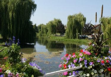
59 km | 69 km-effort
Kayak Sarrebourg
bbazin
User
Length
101 km
Max alt
254 m
Uphill gradient
569 m
Km-Effort
109 km
Min alt
174 m
Downhill gradient
627 m
Boucle
No
Creation date :
2014-12-10 00:00:00.0
Updated on :
2014-12-10 00:00:00.0
40h00
Difficulty : Unknown
FREE GPS app for hiking
About
Trail Other activity of 101 km to be discovered at Grand Est, Moselle, Sarrebourg. This trail is proposed by bbazin.
Description
Descente de la Sarre de Sarrebourg(France) à Sarrebruck(Deutchland)

Positioning
Country:
France
Region :
Grand Est
Department/Province :
Moselle
Municipality :
Sarrebourg
Location:
Unknown
Start:(Dec)
Start:(UTM)
355058 ; 5398967 (32U) N.
Comments
Trails nearby
Aux portes de Sarrebourg, le Pays des Grands Etangs - Sarrebourg - Circuit 20
Cycle
Difficult
Sarrebourg,
Grand Est,
Moselle,
France
3h 30min
Yes
2022-05-25-Circuit St Ulrich
Walking
Easy
Dolving,
Grand Est,
Moselle,
France
4.8 km | 5.9 km-effort
1h 20min
Yes
Circuit VTT de Réding-Sarrebourg
Mountain bike
Difficult
Sarrebourg,
Grand Est,
Moselle,
France
35 km | 42 km-effort
4h 0min
Yes
Circuit VTT des Etangs de Rinting
Mountain bike
Difficult
Sarrebourg,
Grand Est,
Moselle,
France
26 km | 31 km-effort
2h 30min
Yes
Circuit VTT de la Vallée de la Sarre -Sarrebourg
Mountain bike
Medium
(1)
Sarrebourg,
Grand Est,
Moselle,
France
18.9 km | 23 km-effort
1h 30min
Yes
Circuit VTT de la Zone de Loisirs - Sarrebourg
Mountain bike
Easy
Sarrebourg,
Grand Est,
Moselle,
France
4.6 km | 5.3 km-effort
30min
Yes
2024 août sarrebourg zap
Walking
Very difficult
Sarrebourg,
Grand Est,
Moselle,
France
16.6 km | 19.8 km-effort
5h 14min
Yes
export-route-des-cretes-cols-vosgiens
Motorbike
Very easy
Sarrebourg,
Grand Est,
Moselle,
France
449 km | 571 km-effort
Unknown
No
Bebing-Walscheid-Mont Ste Odile en VTT
Mountain bike
Difficult
Bébing,
Grand Est,
Moselle,
France
72 km | 97 km-effort
6h 40min
No