


26 km | 38 km-effort


User


FREE GPS app for hiking
 SityTrail
IGN / Geographical institutes
SityTrail World
The world is yours!
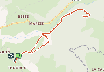
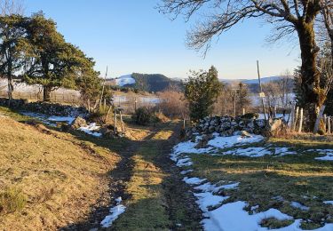
Trail Walking of 6.5 km to be discovered at Auvergne-Rhône-Alpes, Cantal, Saint-Cernin. This trail is proposed by benga15.
Mountain bike
Walking
Walking
Walking

Nordic walking
On foot

Walking
Walking

Mountain bike
Balade sympathique. Ça grimpe bien sur la fin. Attention à l'arrivée au rocher. C'est un promontoire rocheux avec une vu 360. Mais l'accès est difficile. Petit bémol aussi: il y'a au pied du rocher des arbres enduit de goudron et un drôle de bidon attaché à un arbre. Apparemment une zone de nourriture pour les sangliers. ... méfiance s imposé.