


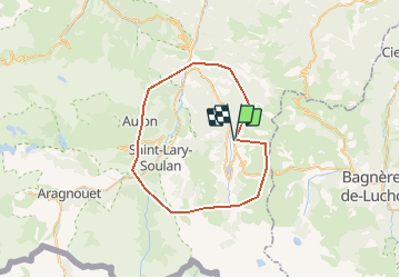

9.9 km | 18.4 km-effort


User


FREE GPS app for hiking
 SityTrail
IGN / Geographical institutes
SityTrail World
The world is yours!
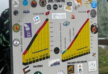
Trail Other activity of 49 km to be discovered at Occitania, Hautespyrenees, Cazaux-Fréchet-Anéran-Camors. This trail is proposed by lolo4786.
lo

Walking

Walking
Walking

Walking

Walking
Walking
Snowshoes
Walking
Walking