


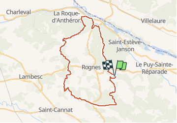

11.1 km | 14.1 km-effort


User


FREE GPS app for hiking
 SityTrail
IGN / Geographical institutes
SityTrail World
The world is yours!
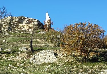
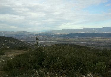
Trail Mountain bike of 36 km to be discovered at Provence-Alpes-Côte d'Azur, Bouches-du-Rhône, Rognes. This trail is proposed by oboiron.
Petit tour sur la commune de Rognes. On traverse successivment la chaîne de la Trévaresse, la chaîne des Côtes le vallon du Ru et les collines de Valfere.
Walking
Walking
Walking
Walking
Walking
Mountain bike


sport

Walking
Walking