Trail Walking Valpuiseaux - Manu-121124-Gâtinais - Valpuiseaux-Farcheville - Photo

Manu-121124-Gâtinais - Valpuiseaux-Farcheville

 randodan
randodan

User

© OpenStreetMap contributors
Length
Length
20 km
Max alt
Max alt
139 m
Uphill gradient
Uphill gradient
266 m
Km-Effort
Km-Effort  
24 km
Min alt
Min alt
68 m
Downhill gradient
Downhill gradient
268 m
Boucle
Boucle
Yes
Creation date :
2014-12-10 00:00:00.0
Updated on :
2014-12-10 00:00:00.0

(0 Reviews)

Walking
Walking
5h18
Difficulty : Very easy

Scan this QR Code to open this trail in the SityTrail application

FREE GPS app for hiking

Logo SityTrail SityTrail
IGN / Geographical institutes

Download SityTrail from the App Store Download SityTrail from Google Play

Logo SityTrail SityTrail World
The world is yours!

Download SityTrail from the App Store Download SityTrail from Google Play Download SityTrail on Huawei AppGallery

About

Trail Walking of 20 km to be discovered at Ile-de-France, Essonne, Valpuiseaux. This trail is proposed by randodan.

Description

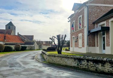
2012 - Gâtinais Manureva - 24 novembre -<br>J1: boucle Valpuiseaux-Farcheville .<br>
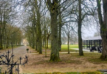
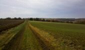
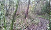
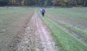
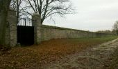
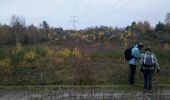
Départ de l´église de Valpuiseaux, 10h . Petits chemins de champs et de bois . Midi, après une courte mais glissante descente (sans crampons !) nous ´´accrochons´´ le GR111A . Sous la ligne haute tension, un beau paysage de rochers et de lande parsemée de touches dorées, on se croirait en forêt de Fontainebleau . 12h30, un long mur à notre droite : le domaine du Château de Farcheville .<br>
13h pile, devant la grille du Château pour le pique-nique .<br>
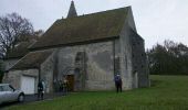
14h, on se remet en route, toujours le GR111A . A Puiselet-le-Marais, après la visite impromptue de l´église, le GR devient le Chemin de Compostelle (Via turonensis : la voie de Tours) en provenance d´Étampes, c´est tout droit de chez tout droit ! Le Saint-Jacques nous ramène à Valpuiseaux vers 16h.<br>
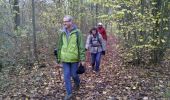
6 participants .

Elevation profile

Photos

Points of interest

Point of interest Valpuiseaux - 02 - Vers les Vaux Gauthier - Photo
randodan
Point of interest D'Huison-Longueville - 03 - Gros Rocher - Photo
randodan
D'HUISON-LONGUEVILLE 
Point of interest Bouville - 07 - Bois de la Vigne - Photo
randodan
Point of interest Puiselet-le-Marais - 08 - Puiselet-le-Marais - Photo
randodan
PUISELET-LE-MARAIS 
Point of interest Puiselet-le-Marais - 09 - Sur le Chemin de Compostelle (Via turonensis) - Photo
randodan
PUISELET-LE-MARAIS 
Point of interest Valpuiseaux - 01 - Valpuiseaux - Photo
randodan
VALPUISEAUX 
Point of interest Valpuiseaux - Au sujet du Chemin de Compostelle (Via turonensis)... - Photo
randodan

Positioning

Country:
France
Region :
Ile-de-France
Department/Province :
Essonne
Municipality :
Valpuiseaux
Location:
Unknown
Start:(UTM)
448662 ; 5360261 (31U) N.

Trails nearby

Trail Walking Bouville - farcheville 3 - Photo
Walking
reflexe

Walking

Medium
Bouville, Ile-de-France, Essonne, France
7.9 km | 9.3 km-effort
2h 6min
Yes
Trail On foot Puiselet-le-Marais - boucle puiselet le marais - Photo
On foot
reflexe

On foot

Easy
Puiselet-le-Marais, Ile-de-France, Essonne, France
7.7 km | 9.1 km-effort
2h 3min
Yes
Trail Walking Valpuiseaux - SityTrail - Manu-121124-Gâtinais - Valpuiseaux-Farcheville - Photo
Walking
franjouph

Walking

Very difficult
Valpuiseaux, Ile-de-France, Essonne, France
19.3 km | 23 km-effort
5h 11min
Yes
Trail Walking Valpuiseaux - valpuiseaux - Photo
Walking
osbach

Walking

Easy
Valpuiseaux, Ile-de-France, Essonne, France
15.1 km | 17.6 km-effort
5h 10min
Yes
Trail Walking Bouville - Farcheville - Photo
Walking
Gerard Jourdy

Walking

Bouville, Ile-de-France, Essonne, France
30 km | 34 km-effort
2h 21min
No
Trail Walking Bouville - Bouville (91) PC dec 2018 - Photo
Walking
CRUZILLACP

Walking

Medium
Bouville, Ile-de-France, Essonne, France
13.9 km | 16.5 km-effort
3h 35min
Yes
Trail Walking Valpuiseaux - VALPUISEAUX - Photo
Walking
aucamus

Walking

Easy
Valpuiseaux, Ile-de-France, Essonne, France
22 km | 26 km-effort
5h 39min
No
Trail Walking Valpuiseaux - Valpuiseaux / Champmotteux - Photo
Walking
chateau77

Walking

Easy
Valpuiseaux, Ile-de-France, Essonne, France
15.5 km | 18 km-effort
4h 3min
Yes
Trail Walking Bouville - bouville - Photo
Walking
petergole

Walking

Very easy
Bouville, Ile-de-France, Essonne, France
13.5 km | 15.8 km-effort
3h 16min
Yes


Close
My subscriptions