Trail Walking Auzat - Pyrénées-120906 - Fourcat.1-montéeRefuge - Photo

Pyrénées-120906 - Fourcat.1-montéeRefuge

 randodan
randodan

User

© OpenStreetMap contributors
Length
Length
10.1 km
Max alt
Max alt
2653 m
Uphill gradient
Uphill gradient
1206 m
Km-Effort
Km-Effort  
23 km
Min alt
Min alt
1560 m
Downhill gradient
Downhill gradient
336 m
Boucle
Boucle
No
Creation date :
2014-12-10 00:00:00.0
Updated on :
2014-12-10 00:00:00.0

(0 Reviews)

Walking
Walking
8h22
Difficulty : Difficult

Scan this QR Code to open this trail in the SityTrail application

FREE GPS app for hiking

Logo SityTrail SityTrail

IGN / Geographical institutes

Download SityTrail from the App Store Download SityTrail from Google Play

Logo SityTrail SityTrail World

The world is yours!

Download SityTrail from the App Store Download SityTrail from Google Play Download SityTrail on Huawei AppGallery

About

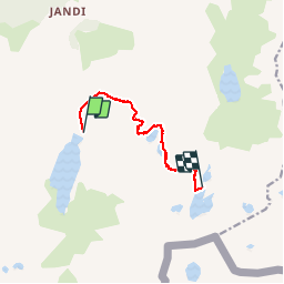
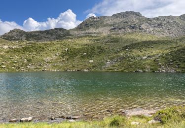
Trail Walking of 10.1 km to be discovered at Occitania, Ariège, Auzat. This trail is proposed by randodan.

Description

2012 - Camp de base : Vicdessos - 06 sep -<br>
Rando sur 3 jours .<br>
1er jour : montée au Refuge des Étangs Fourcat .<br>
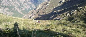
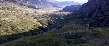
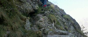
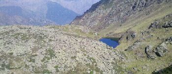
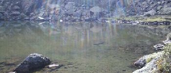
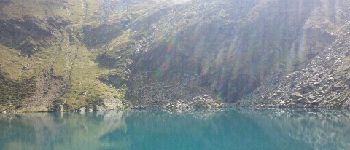
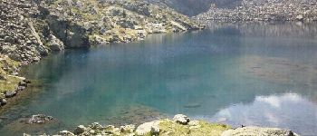
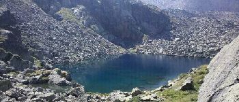
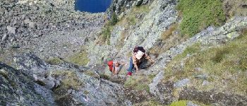
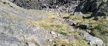
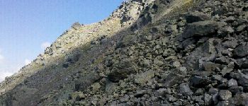
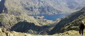
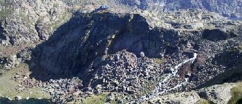
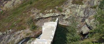
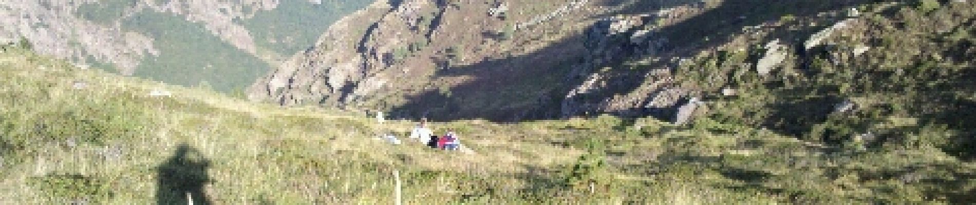
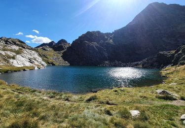
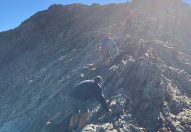
Départ Barrage de Soulcem 9h10, 1565 m. Isards à 1800 m . 11h au 1er étang du Picot ; 11h45 au 2e ; 12h30 au 3e, le plus grand, un bout de saucisson vite fait . 13h30 au 4e . 14h30, 2550-2600 m, 2 passages de 2 longueurs de câbles .<br>
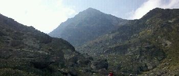
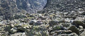
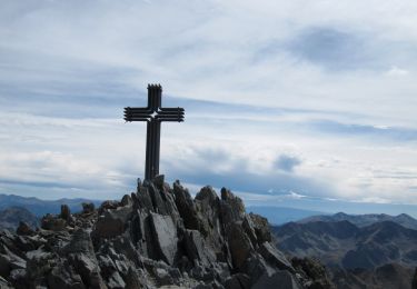
15h au 1er col, 2655 m... Damned !.. Faut descendre et remonter dans un énorme pierrier . 16h au 2e col, 2610 m, mais ça monte encore un peu derrière (2650 m) et ce n’est qu’1/2h après qu´on aperçoit enfin le refuge .<br>
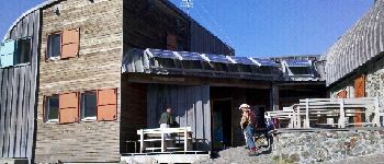
17h20, enfin au Refuge des Étangs Fourcat, 2445 m .<br>
D JL Dan<br>
-----------<br>
Attention, dans la zone du Soulcem (jusqu’au 4e étang), les points GPS sont parfois fantaisistes .<br>

Elevation profile

Photos

24 photos in total. Please click on a photo to see them all in the gallery.

Points of interest

Positioning

Country:
France
Region :
Occitania
Department/Province :
Ariège
Municipality :
Auzat
Location:
Unknown
Start:(UTM)
373211 ; 4726161 (31T) N.

Trails nearby

Trail Walking Auzat - Le Picot - Photo
Walking
beautrix

Walking

Difficult
(2)
Auzat, Occitania, Ariège, France
6.3 km | 18.9 km-effort
4h 0min
No
Trail Walking Auzat - Les étangs de la Gardelle - Auzat - Photo
Walking
tracegps

Walking

Difficult
(2)
Auzat, Occitania, Ariège, France
8.3 km | 21 km-effort
6h 0min
Yes
Trail Walking Auzat - Pica d'Estats et Montcalm - Photo
Walking
ARVIEU

Walking

Very difficult
Auzat, Occitania, Ariège, France
18.8 km | 46 km-effort
10h 23min
Yes
Trail Walking Auzat - Domaine de Montcalm -port Rat Pic Rouge  - Photo
Walking
altaya

Walking

Very difficult
Auzat, Occitania, Ariège, France
17.1 km | 39 km-effort
10h 8min
Yes
Trail Walking Auzat - Tour des lacs - Sarroucanes - Photo
Walking
altaya

Walking

Very difficult
Auzat, Occitania, Ariège, France
16 km | 0 m-effort
8h 42min
No
Trail Walking Auzat - Caraussans - Photo
Walking
georghinio

Walking

Very difficult
Auzat, Occitania, Ariège, France
19.6 km | 41 km-effort
9h 16min
Yes
Trail Walking Auzat - Boucle etangs de la Gardelle - Photo
Walking
prous31

Walking

Difficult
Auzat, Occitania, Ariège, France
10.9 km | 23 km-effort
4h 45min
Yes
Trail Walking Auzat - Fourcat  - Photo
Walking
georghinio

Walking

Very difficult
Auzat, Occitania, Ariège, France
15.7 km | 31 km-effort
8h 7min
No
Trail Walking Auzat - Randonnée des étangs de Sarroucane au pic de la rouge - Photo
Walking
altaya

Walking

Very difficult
(1)
Auzat, Occitania, Ariège, France
16 km | 34 km-effort
8h 1min
Yes


Close
My subscriptions