


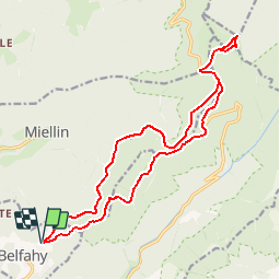

14.6 km | 23 km-effort


User


FREE GPS app for hiking
 SityTrail
IGN / Geographical institutes
SityTrail World
The world is yours!
Trail Walking of 17.9 km to be discovered at Bourgogne-Franche-Comté, Haute-Saône, Belfahy. This trail is proposed by ballet.
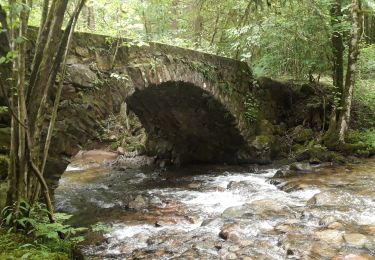
Tracé empruntant les sous-bois sur les crétes.
Même si le tracé emprunte en grande partie le GR, le sentier n'est pas large et est bordé de ronces donc pantalons recommandés

Walking

Walking

Walking

Walking

Walking

Walking

Walking
Walking
Walking