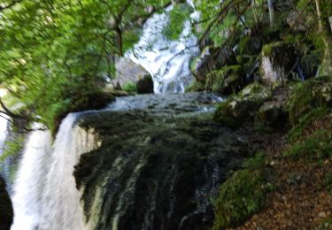
Trail Walking Saint-Jean-d'Arvey - 2012 08 26 Croix de Nivollet - Photo

2012 08 26 Croix de Nivollet

 lechner
lechner

User

© OpenStreetMap contributors
Length
Length
14.7 km
Max alt
Max alt
1536 m
Uphill gradient
Uphill gradient
952 m
Km-Effort
Km-Effort  
27 km
Min alt
Min alt
684 m
Downhill gradient
Downhill gradient
953 m
Boucle
Boucle
Yes
Creation date :
2018-08-07 09:25:36.26
Updated on :
2018-08-07 09:25:36.366

(0 Reviews)

Walking
Walking
5h40
Difficulty : Medium

Scan this QR Code to open this trail in the SityTrail application

FREE GPS app for hiking

Logo SityTrail SityTrail

IGN / Geographical institutes

Download SityTrail from the App Store Download SityTrail from Google Play

Logo SityTrail SityTrail World

The world is yours!

Download SityTrail from the App Store Download SityTrail from Google Play Download SityTrail on Huawei AppGallery

About

Trail Walking of 14.7 km to be discovered at Auvergne-Rhône-Alpes, Savoy, Saint-Jean-d'Arvey. This trail is proposed by lechner.

Elevation profile

Positioning

Country:
France
Region :
Auvergne-Rhône-Alpes
Department/Province :
Savoy
Municipality :
Saint-Jean-d'Arvey
Location:
Unknown
Start:(UTM)
731596 ; 5053492 (31T) N.

Comments

Please log in to post a review or rate the element


Randonnée sportive et engagée avec un peu de technicité. Sympa ! Vous pouvez aussi aller tout droit juste avant les échelles pour éviter la petite boucle (mais ça grimpe). Je suis arrivé dans le brouillard, dommage, je n'ai pas vu le panorama. Vous ne pourrez pas accéder au lieu dit Louvettaz, c' est interdit au non résident. Il y a un parking juste avant, suivez le balisage indiqué, vous rejoindrez le tracé.


Trails nearby

Trail Running Saint-Jean-d'Arvey - Tour du plateau de la Leysse - Photo
Running
pzellner

Running

Very easy
(1)
Saint-Jean-d'Arvey, Auvergne-Rhône-Alpes, Savoy, France
47 km | 82 km-effort
10h 0min
Yes
Trail Walking Challes-les-Eaux - Le Mont Saint-Michel 895 m, depuis Challes-les-Eaux - Photo
Walking
tracegps

Walking

Difficult
(1)
Challes-les-Eaux, Auvergne-Rhône-Alpes, Savoy, France
7.6 km | 15 km-effort
4h 15min
Yes
Trail Mountain bike Bassens - Pragondra - Photo
Mountain bike
Gorki

Mountain bike

Very easy
(1)
Bassens, Auvergne-Rhône-Alpes, Savoy, France
24 km | 34 km-effort
2h 49min
No
Trail Walking Les Déserts - Circuit de la Croix Nivolet - Photo
Walking
GUIDE
pscheven

Walking

Very easy
(1)
Les Déserts, Auvergne-Rhône-Alpes, Savoy, France
3.5 km | 5.6 km-effort
Unknown
Yes
Trail Cycle Saint-Jean-d'Arvey - st jean meythet via plainpalais et semnoz - Photo
Cycle
jojoimothep

Cycle

Difficult
(1)
Saint-Jean-d'Arvey, Auvergne-Rhône-Alpes, Savoy, France
66 km | 92 km-effort
3h 16min
No
Trail Walking Saint-Alban-Leysse - 73- Le chemin des poussettes - Photo
Walking
cavpsy74

Walking

Easy
(1)
Saint-Alban-Leysse, Auvergne-Rhône-Alpes, Savoy, France
4.9 km | 10.6 km-effort
2h 2min
Yes
Trail Mountain bike Saint-Alban-Leysse - 2012-03-24 - Malpassant+ St sat - Photo
Mountain bike
maxx73

Mountain bike

Medium
(1)
Saint-Alban-Leysse, Auvergne-Rhône-Alpes, Savoy, France
27 km | 44 km-effort
3h 2min
Yes
Trail Walking Curienne - Boucle de curienne  - Photo
Walking
choubaka77

Walking

Easy
Curienne, Auvergne-Rhône-Alpes, Savoy, France
6.2 km | 9.1 km-effort
2h 22min
Yes
Trail Walking Les Déserts - Nivolet - Photo
Walking
cousam

Walking

Medium
Les Déserts, Auvergne-Rhône-Alpes, Savoy, France
8.5 km | 19 km-effort
5h 29min
Yes


Close
My subscriptions