


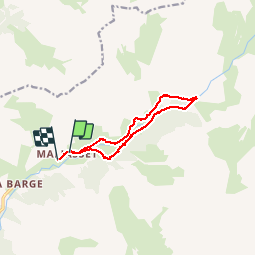

16.7 km | 31 km-effort


User


FREE GPS app for hiking
 SityTrail
IGN / Geographical institutes
SityTrail World
The world is yours!
Trail Walking of 11.7 km to be discovered at Provence-Alpes-Côte d'Azur, Alpes-de-Haute-Provence, Saint-Paul-sur-Ubaye. This trail is proposed by yoyolyon.
Le lac de Parouart créé par un énorme éboulement venu barrer la vallée, s'est comblé il y 50 ans environ. Il reste aujourd'hui une étrange plaine humide où coule, sans bruit, une Ubaye tranquille.

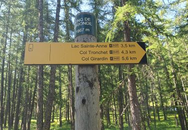
Walking

Other activity
Walking

Walking
Walking

Walking
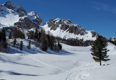
Snowshoes

Walking
Walking