![](/images/other/stat-length.png)
![Trail Walking Mérens-les-Vals - GR10 De Mérens-les-Vals (Ariège) à Batère (Pyrénées-Orientales) - Photo](https://media.geolcdn.com/t/1900/400/ext.pjpeg?maxdim=2&url=https%3A%2F%2Fstatic1.geolcdn.com%2Fsiteimages%2Fupload%2Ffiles%2F1553511878bg_sport_marche.png)
GR10 De Mérens-les-Vals (Ariège) à Batère (Pyrénées-Orientales)
poussin18
User
![Length](/images/other/stat-length.png)
Length
111 km
![Max alt](https://static1.geolcdn.com/siteimages/upload/files/1508320355ic_sort_altitude_max_24dp.png)
Max alt
2485 m
![Uphill gradient](https://static1.geolcdn.com/siteimages/upload/files/1508320355ic_sort_den_pos_24dp.png)
Uphill gradient
6495 m
![Km-Effort](/images/other/stat-length.png)
Km-Effort
196 km
![Min alt](https://static1.geolcdn.com/siteimages/upload/files/1508320355ic_sort_altitude_min_24dp.png)
Min alt
934 m
![Downhill gradient](https://static1.geolcdn.com/siteimages/upload/files/1508320355ic_sort_den_neg_24dp.png)
Downhill gradient
6071 m
![Boucle](https://static1.geolcdn.com/siteimages/upload/files/16400158638029165_repeat_loop_refresh_sync_direction_icon.png)
Boucle
No
Creation date :
2014-12-10 00:00:00.0
Updated on :
2014-12-10 00:00:00.0
![Walking](https://static1.geolcdn.com/sitytour/trail-icons/101.png)
--
Difficulty : Difficult
![Scan this QR Code to open this trail in the SityTrail application](https://capi.geolives.com/qq0zvz2zws4bq2lad0pu/sitytour/trails/148860/qr.png?size=200)
FREE GPS app for hiking
About
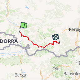
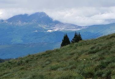
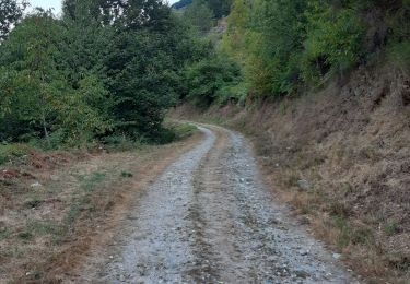
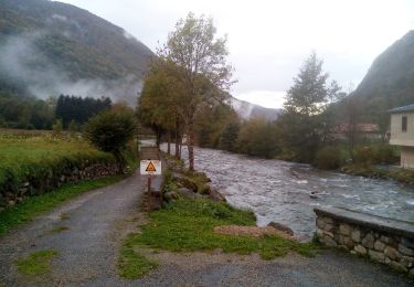
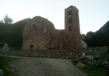
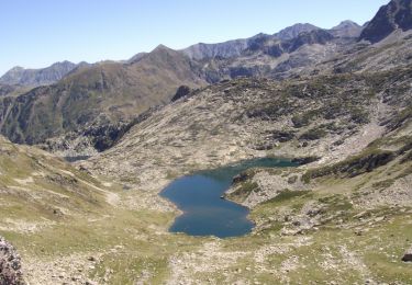
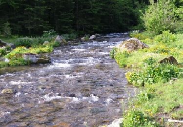
Trail Walking of 111 km to be discovered at Occitania, Ariège, Mérens-les-Vals. This trail is proposed by poussin18.
Description
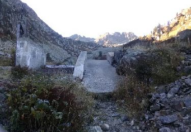
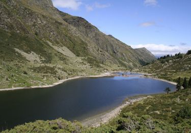
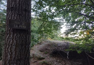
Randonnée avec le GR10 à travers l'Ariège et les Pyrénées-Orientales de Mérens-les-Vals à Batère. Mérens-les-Vals: Gîte d'étape du Nabre, 05 61 01 89 36
Planès: Gîte d'étape et refuge l'Orri de Planès, 04 68 04 29 47
Batère (Corsavy): Gîte d'étape l'Aventurine, 04 68 39 12 01
Positioning
Country:
France
Region :
Occitania
Department/Province :
Ariège
Municipality :
Mérens-les-Vals
Location:
Unknown
Start:(Dec)
Start:(UTM)
404607 ; 4723330 (31T) N.
Comments
Trails nearby
![Trail Walking Orgeix - aiguelongue - Photo](https://media.geolcdn.com/t/375/260/ext.jpg?maxdim=2&url=https%3A%2F%2Fservices.sitytrail.com%2FGeolivesWS%2FDownloadMedia.ashx%3FTrailID%3D643989%26Media%3Dfix__20161010104856.jpg)
![Walking Walking](https://static1.geolcdn.com/sitytour/trail-icons/101.png)
![Trail Walking Mérens-les-Vals - Etang de Comte - Merens les Vals - Photo](https://media.geolcdn.com/t/375/260/ext.jpg?maxdim=2&url=https%3A%2F%2Fservices.sitytrail.com%2FGeolivesWS%2FDownloadMedia.ashx%3FTrailID%3D104799%26Media%3D8276_1.jpg)
![Walking Walking](https://static1.geolcdn.com/sitytour/trail-icons/101.png)
Etang de Comte - Merens les Vals
Walking
Medium
(1)
Mérens-les-Vals,
Occitania,
Ariège,
France
![](/images/other/stat-length.png)
6.8 km | 10.7 km-effort
2h 15min
![](https://static1.geolcdn.com/siteimages/upload/files/16400158638029165_repeat_loop_refresh_sync_direction_icon.png)
Yes
![Trail Walking Orlu - Le roc de la péra - Photo](https://media.geolcdn.com/t/375/260/73155c20-8e48-42b7-9201-111106b56065.jpg&format=jpg&maxdim=2)
![Walking Walking](https://static1.geolcdn.com/sitytour/trail-icons/101.png)
Le roc de la péra
Walking
Medium
(1)
Orlu,
Occitania,
Ariège,
France
![](/images/other/stat-length.png)
9.3 km | 15 km-effort
2h 52min
![](https://static1.geolcdn.com/siteimages/upload/files/16400158638029165_repeat_loop_refresh_sync_direction_icon.png)
Yes
![Trail Walking Mérens-les-Vals - Pic de canals en boucle - Photo](https://media.geolcdn.com/t/375/260/57bc1271-5a5a-4949-81ec-e2fba4899a43.jpg&format=jpg&maxdim=2)
![Walking Walking](https://static1.geolcdn.com/sitytour/trail-icons/101.png)
Pic de canals en boucle
Walking
Medium
Mérens-les-Vals,
Occitania,
Ariège,
France
![](/images/other/stat-length.png)
10.7 km | 23 km-effort
6h 20min
![](https://static1.geolcdn.com/siteimages/upload/files/16400158638029165_repeat_loop_refresh_sync_direction_icon.png)
Yes
![Trail Nordic walking Orlu - Orlu, col de l'Osque, Porteille d'Orgeix, Orgeix - Photo](https://media.geolcdn.com/t/375/260/bb96309c-1ffe-4fdf-ba7a-51865c84fc15.jpg&format=jpg&maxdim=2)
![Nordic walking Nordic walking](https://static1.geolcdn.com/sitytour/trail-icons/102.png)
Orlu, col de l'Osque, Porteille d'Orgeix, Orgeix
Nordic walking
Very easy
Orlu,
Occitania,
Ariège,
France
![](/images/other/stat-length.png)
13.9 km | 22 km-effort
3h 21min
![](https://static1.geolcdn.com/siteimages/upload/files/16400158638029165_repeat_loop_refresh_sync_direction_icon.png)
Yes
![Trail Walking Orlu - LaLiau - Photo](https://media.geolcdn.com/t/375/260/a1553a6f-6a25-457e-a62d-a8e503e31d85.jpg&format=jpg&maxdim=2)
![Walking Walking](https://static1.geolcdn.com/sitytour/trail-icons/101.png)
![Trail Walking Mérens-les-Vals - Pic de Canals - Photo](https://media.geolcdn.com/t/375/260/c8c92fc2-dcb2-4400-9d3c-800f4744a213.jpg&format=jpg&maxdim=2)
![Walking Walking](https://static1.geolcdn.com/sitytour/trail-icons/101.png)
Pic de Canals
Walking
Difficult
Mérens-les-Vals,
Occitania,
Ariège,
France
![](/images/other/stat-length.png)
16.7 km | 31 km-effort
8h 27min
![](https://static1.geolcdn.com/siteimages/upload/files/16400158638029165_repeat_loop_refresh_sync_direction_icon.png)
Yes
![Trail Walking Orgeix - Pic de l'homme par les crêtes - Photo](https://media.geolcdn.com/t/375/260/ext.jpg?maxdim=2&url=https%3A%2F%2Fservices.sitytrail.com%2FGeolivesWS%2FDownloadMedia.ashx%3FTrailID%3D815731%26Media%3D50b6cd61-3adc-46d0-8ebf-fb8b362ce67b.JPG)
![Walking Walking](https://static1.geolcdn.com/sitytour/trail-icons/101.png)
Pic de l'homme par les crêtes
Walking
Difficult
Orgeix,
Occitania,
Ariège,
France
![](/images/other/stat-length.png)
11.5 km | 27 km-effort
5h 12min
![](https://static1.geolcdn.com/siteimages/upload/files/16400158638029165_repeat_loop_refresh_sync_direction_icon.png)
Yes
![Trail Walking Mérens-les-Vals - le lac Couart - Photo](https://media.geolcdn.com/t/375/260/ext.jpg?maxdim=2&url=https%3A%2F%2Fservices.sitytrail.com%2FGeolivesWS%2FDownloadMedia.ashx%3FTrailID%3D315324%26Media%3Dfix__20140622084804.jpg)
![Walking Walking](https://static1.geolcdn.com/sitytour/trail-icons/101.png)
le lac Couart
Walking
Difficult
Mérens-les-Vals,
Occitania,
Ariège,
France
![](/images/other/stat-length.png)
15 km | 26 km-effort
7h 33min
![](https://static1.geolcdn.com/siteimages/upload/files/16400158638029165_repeat_loop_refresh_sync_direction_icon.png)
Yes