![](/images/other/stat-length.png)
![Trail Walking Berrias-et-Casteljau - Chassezac Cirque d'Endieu tour Nord - Photo](https://media.geolcdn.com/t/1900/400/ext.pjpeg?maxdim=2&url=https%3A%2F%2Fstatic1.geolcdn.com%2Fsiteimages%2Fupload%2Ffiles%2F1553511878bg_sport_marche.png)
Chassezac Cirque d'Endieu tour Nord
jmheydorff
User
![Length](/images/other/stat-length.png)
![Max alt](https://static1.geolcdn.com/siteimages/upload/files/1508320355ic_sort_altitude_max_24dp.png)
![Uphill gradient](https://static1.geolcdn.com/siteimages/upload/files/1508320355ic_sort_den_pos_24dp.png)
![Km-Effort](/images/other/stat-length.png)
![Min alt](https://static1.geolcdn.com/siteimages/upload/files/1508320355ic_sort_altitude_min_24dp.png)
![Downhill gradient](https://static1.geolcdn.com/siteimages/upload/files/1508320355ic_sort_den_neg_24dp.png)
![Boucle](https://static1.geolcdn.com/siteimages/upload/files/16400158638029165_repeat_loop_refresh_sync_direction_icon.png)
![Walking](https://static1.geolcdn.com/sitytour/trail-icons/101.png)
2h30
Difficulty : Medium
![Scan this QR Code to open this trail in the SityTrail application](https://capi.geolives.com/qq0zvz2zws4bq2lad0pu/sitytour/trails/148835/qr.png?size=200)
FREE GPS app for hiking
About
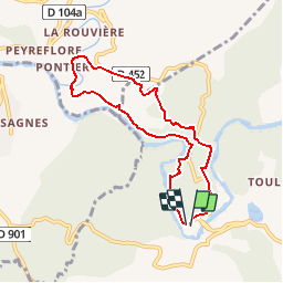
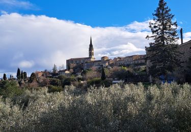
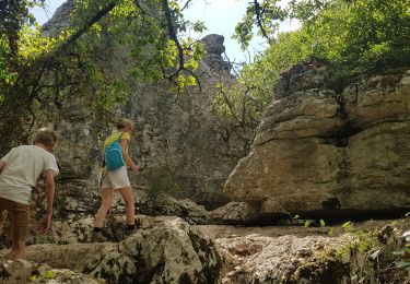
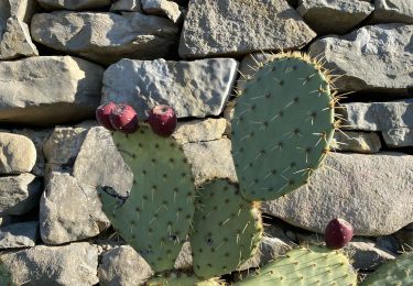
Trail Walking of 7.4 km to be discovered at Auvergne-Rhône-Alpes, Ardèche, Berrias-et-Casteljau. This trail is proposed by jmheydorff.
Description
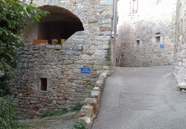
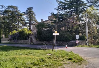
Pkg près du pont sous Casteljau.Monter N sur D452, puis sentier en balcon au-dessus du ranc de Fromen; rebenir W à la route, la prendre N sur qulques mètres, puis à gauche sentier en surplomb du cirque d'Endieu; il s'en éloigne N, traverse 2 fois (stèle)la D452, descend NW sur le Pontier; revenir en descendant le ruisseau; après le 2° pont, monter fort un sentier qui rejoint les ruines de Cornillon, puis qui passe sous les falaises d'Endieu, et remonte jusqu'à la R452, que l'on prend S sur 170 m; puis on reprend un sentier (avant le virage) W et on redscend sur le Chassezac, que l'on suit jusqu'au parking.
Positioning
Comments
Trails nearby
![Trail Walking Berrias-et-Casteljau - ARDÈCHE. BERRIAS. GORGES DE CHASSEZAC O - Photo](https://media.geolcdn.com/t/375/260/57afbf73-5c77-4144-bf42-14d64b3b569f.jpg&format=jpg&maxdim=2)
![Walking Walking](https://static1.geolcdn.com/sitytour/trail-icons/101.png)
Walking
![](/images/other/stat-length.png)
![](https://static1.geolcdn.com/siteimages/upload/files/16400158638029165_repeat_loop_refresh_sync_direction_icon.png)
![Trail Walking Banne - Autour de Banne - Photo](https://media.geolcdn.com/t/375/260/0d756104-e1b5-4f2e-b3d0-c252da0f965f.jpg&format=jpg&maxdim=2)
![Walking Walking](https://static1.geolcdn.com/sitytour/trail-icons/101.png)
Walking
![](/images/other/stat-length.png)
![](https://static1.geolcdn.com/siteimages/upload/files/16400158638029165_repeat_loop_refresh_sync_direction_icon.png)
![Trail Walking Berrias-et-Casteljau - Wikiloc Bois de Paiolive (PVDB) - Photo](https://media.geolcdn.com/t/375/260/045714af-a6fd-44e6-8871-35194bcde521.jpg&format=jpg&maxdim=2)
![Walking Walking](https://static1.geolcdn.com/sitytour/trail-icons/101.png)
Walking
![](/images/other/stat-length.png)
![](https://static1.geolcdn.com/siteimages/upload/files/16400158638029165_repeat_loop_refresh_sync_direction_icon.png)
![Trail Walking Les Vans - Bois de Païolive - Photo](https://media.geolcdn.com/t/375/260/ext.jpg?maxdim=2&url=https%3A%2F%2Fservices.sitytrail.com%2FGeolivesWS%2FDownloadMedia.ashx%3FTrailID%3D372613%26Media%3Dfix__20141226114045.jpg)
![Walking Walking](https://static1.geolcdn.com/sitytour/trail-icons/101.png)
Walking
![](/images/other/stat-length.png)
![](https://static1.geolcdn.com/siteimages/upload/files/16400158638029165_repeat_loop_refresh_sync_direction_icon.png)
![Trail Walking Berrias-et-Casteljau - paiolive - Photo](https://media.geolcdn.com/t/375/260/ext.jpg?maxdim=2&url=https%3A%2F%2Fstatic1.geolcdn.com%2Fsiteimages%2Fupload%2Ffiles%2F1553511878bg_sport_marche.png)
![Walking Walking](https://static1.geolcdn.com/sitytour/trail-icons/101.png)
Walking
![](/images/other/stat-length.png)
![](https://static1.geolcdn.com/siteimages/upload/files/16400158638029165_repeat_loop_refresh_sync_direction_icon.png)
![Trail Mountain bike Berrias-et-Casteljau - Berias et environ - Photo](https://media.geolcdn.com/t/375/260/ext.jpg?maxdim=2&url=https%3A%2F%2Fstatic1.geolcdn.com%2Fsiteimages%2Fupload%2Ffiles%2F1524743154velo.jpg)
![Mountain bike Mountain bike](https://static1.geolcdn.com/sitytour/trail-icons/202.png)
Mountain bike
![](/images/other/stat-length.png)
![](https://static1.geolcdn.com/siteimages/upload/files/16400158638029165_repeat_loop_refresh_sync_direction_icon.png)
![Trail Walking Les Vans - Granzon petit tour - Photo](https://media.geolcdn.com/t/375/260/f2b62cf6-814d-43d1-9d14-ffc0ac06b0e6.jpg&format=jpg&maxdim=2)
![Walking Walking](https://static1.geolcdn.com/sitytour/trail-icons/101.png)
Walking
![](/images/other/stat-length.png)
![](https://static1.geolcdn.com/siteimages/upload/files/16400158638029165_repeat_loop_refresh_sync_direction_icon.png)
![Trail Walking Les Vans - Chabiscol du 26/08/2024 - Photo](https://media.geolcdn.com/t/375/260/b153c81c-81a0-4828-8297-c29e9496a4e0.jpg&format=jpg&maxdim=2)
![Walking Walking](https://static1.geolcdn.com/sitytour/trail-icons/101.png)
Walking
![](/images/other/stat-length.png)
![](https://static1.geolcdn.com/siteimages/upload/files/16400158638029165_repeat_loop_refresh_sync_direction_icon.png)
![Trail Walking Banne - 07_Banne_8km290m - Photo](https://media.geolcdn.com/t/375/260/cc4349b5-bd6c-4fd5-b4f7-03cbd86b8a3c.jpg&format=jpg&maxdim=2)
![Walking Walking](https://static1.geolcdn.com/sitytour/trail-icons/101.png)
Walking
![](/images/other/stat-length.png)
![](https://static1.geolcdn.com/siteimages/upload/files/16400158638029165_repeat_loop_refresh_sync_direction_icon.png)
tres bien