![](/images/other/stat-length.png)
![Trail Running Saint-Christol - la Segoyere - Photo](https://media.geolcdn.com/t/1900/400/ext.pjpeg?maxdim=2&url=https%3A%2F%2Fstatic1.geolcdn.com%2Fsiteimages%2Fupload%2Ffiles%2F1524743154running.jpg)
la Segoyere
sabert84
User
![Length](/images/other/stat-length.png)
Length
8.5 km
![Max alt](https://static1.geolcdn.com/siteimages/upload/files/1508320355ic_sort_altitude_max_24dp.png)
Max alt
947 m
![Uphill gradient](https://static1.geolcdn.com/siteimages/upload/files/1508320355ic_sort_den_pos_24dp.png)
Uphill gradient
178 m
![Km-Effort](/images/other/stat-length.png)
Km-Effort
10.9 km
![Min alt](https://static1.geolcdn.com/siteimages/upload/files/1508320355ic_sort_altitude_min_24dp.png)
Min alt
825 m
![Downhill gradient](https://static1.geolcdn.com/siteimages/upload/files/1508320355ic_sort_den_neg_24dp.png)
Downhill gradient
172 m
![Boucle](https://static1.geolcdn.com/siteimages/upload/files/16400158638029165_repeat_loop_refresh_sync_direction_icon.png)
Boucle
No
Creation date :
2014-12-10 00:00:00.0
Updated on :
2014-12-10 00:00:00.0
![Running](https://static1.geolcdn.com/sitytour/trail-icons/103.png)
1h17
Difficulty : Easy
![Scan this QR Code to open this trail in the SityTrail application](https://capi.geolives.com/qq0zvz2zws4bq2lad0pu/sitytour/trails/146769/qr.png?size=200)
FREE GPS app for hiking
About
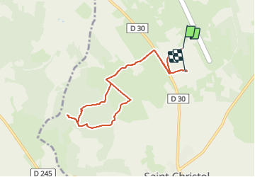
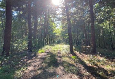
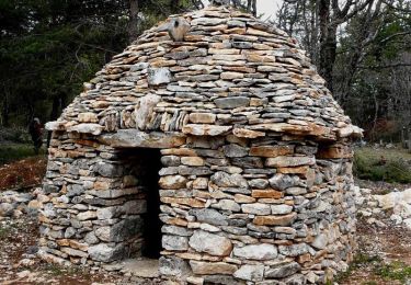
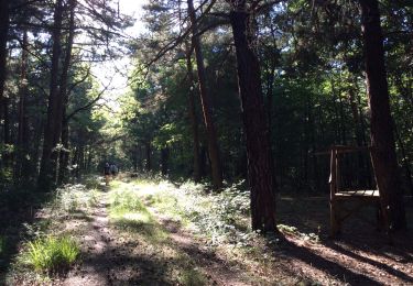
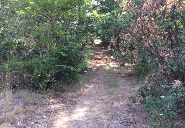
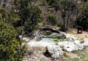
Trail Running of 8.5 km to be discovered at Provence-Alpes-Côte d'Azur, Vaucluse, Saint-Christol. This trail is proposed by sabert84.
Description
Circuit simple. Attention aux voisins qui ne savent pas lire le cadastre et qui ont tendance à s'approprier le domaine public.
Positioning
Country:
France
Region :
Provence-Alpes-Côte d'Azur
Department/Province :
Vaucluse
Municipality :
Saint-Christol
Location:
Unknown
Start:(Dec)
Start:(UTM)
699743 ; 4880688 (31T) N.
Comments
Trails nearby
![Trail Walking Saint-Christol - Grand-Bois Saint-Christol (grand tour) - Photo](https://media.geolcdn.com/t/375/260/8695cda8-239e-4ac2-a0d8-fd45863a7455.jpg&format=jpg&maxdim=2)
![Walking Walking](https://static1.geolcdn.com/sitytour/trail-icons/101.png)
Grand-Bois Saint-Christol (grand tour)
Walking
Easy
Saint-Christol,
Provence-Alpes-Côte d'Azur,
Vaucluse,
France
![](/images/other/stat-length.png)
11.1 km | 12.7 km-effort
3h 2min
![](https://static1.geolcdn.com/siteimages/upload/files/16400158638029165_repeat_loop_refresh_sync_direction_icon.png)
Yes
![Trail Walking Saint-Saturnin-lès-Apt - Les Ayguiers de Travignon - Savouillon - Photo](https://media.geolcdn.com/t/375/260/ext.jpg?maxdim=2&url=https%3A%2F%2Fservices.sitytrail.com%2FGeolivesWS%2FDownloadMedia.ashx%3FTrailID%3D105354%26Media%3D9056_3.jpg)
![Walking Walking](https://static1.geolcdn.com/sitytour/trail-icons/101.png)
Les Ayguiers de Travignon - Savouillon
Walking
Medium
Saint-Saturnin-lès-Apt,
Provence-Alpes-Côte d'Azur,
Vaucluse,
France
![](/images/other/stat-length.png)
14.6 km | 19.8 km-effort
3h 19min
![](https://static1.geolcdn.com/siteimages/upload/files/16400158638029165_repeat_loop_refresh_sync_direction_icon.png)
Yes
![Trail Walking Saint-Christol - Forêt Saint-Christol - Photo](https://media.geolcdn.com/t/375/260/2775495d-191b-4962-ba0c-6b7cd561a054.jpg&format=jpg&maxdim=2)
![Walking Walking](https://static1.geolcdn.com/sitytour/trail-icons/101.png)
Forêt Saint-Christol
Walking
Easy
Saint-Christol,
Provence-Alpes-Côte d'Azur,
Vaucluse,
France
![](/images/other/stat-length.png)
11.1 km | 12.6 km-effort
3h 2min
![](https://static1.geolcdn.com/siteimages/upload/files/16400158638029165_repeat_loop_refresh_sync_direction_icon.png)
Yes
![Trail Walking Saint-Christol - St. Christol - le Grand Bois - petit tour - Photo](https://media.geolcdn.com/t/375/260/ca1d64fa-0dda-4bc5-b3b5-ff4fdc461521.jpg&format=jpg&maxdim=2)
![Walking Walking](https://static1.geolcdn.com/sitytour/trail-icons/101.png)
St. Christol - le Grand Bois - petit tour
Walking
Very easy
Saint-Christol,
Provence-Alpes-Côte d'Azur,
Vaucluse,
France
![](/images/other/stat-length.png)
5.3 km | 6 km-effort
1h 30min
![](https://static1.geolcdn.com/siteimages/upload/files/16400158638029165_repeat_loop_refresh_sync_direction_icon.png)
Yes
![Trail Walking Saint-Christol - PhP - Photo](https://media.geolcdn.com/t/375/260/ext.jpg?maxdim=2&url=https%3A%2F%2Fstatic1.geolcdn.com%2Fsiteimages%2Fupload%2Ffiles%2F1553511878bg_sport_marche.png)
![Walking Walking](https://static1.geolcdn.com/sitytour/trail-icons/101.png)
PhP
Walking
Medium
Saint-Christol,
Provence-Alpes-Côte d'Azur,
Vaucluse,
France
![](/images/other/stat-length.png)
5.5 km | 6.2 km-effort
1h 22min
![](https://static1.geolcdn.com/siteimages/upload/files/16400158638029165_repeat_loop_refresh_sync_direction_icon.png)
Yes
![Trail Walking Saint-Christol - Grand-Bois - St. Christol (moyen tour) - Photo](https://media.geolcdn.com/t/375/260/ext.jpg?maxdim=2&url=https%3A%2F%2Fstatic1.geolcdn.com%2Fsiteimages%2Fupload%2Ffiles%2F1553511878bg_sport_marche.png)
![Walking Walking](https://static1.geolcdn.com/sitytour/trail-icons/101.png)
Grand-Bois - St. Christol (moyen tour)
Walking
Very easy
(1)
Saint-Christol,
Provence-Alpes-Côte d'Azur,
Vaucluse,
France
![](/images/other/stat-length.png)
6.1 km | 7 km-effort
1h 33min
![](https://static1.geolcdn.com/siteimages/upload/files/16400158638029165_repeat_loop_refresh_sync_direction_icon.png)
Yes
![Trail Road bike Sault - helmut trip jour 2 - Photo](https://media.geolcdn.com/t/375/260/ext.jpg?maxdim=2&url=https%3A%2F%2Fstatic1.geolcdn.com%2Fsiteimages%2Fupload%2Ffiles%2F1524743154velo.jpg)
![Road bike Road bike](https://static1.geolcdn.com/sitytour/trail-icons/201.png)
helmut trip jour 2
Road bike
Very difficult
Sault,
Provence-Alpes-Côte d'Azur,
Vaucluse,
France
![](/images/other/stat-length.png)
97 km | 121 km-effort
7h 20min
![](https://static1.geolcdn.com/siteimages/upload/files/16400158638029165_repeat_loop_refresh_sync_direction_icon.png)
No
![Trail Walking Saint-Saturnin-lès-Apt - Les Ayguiers de Travignon - Savouillon - Photo](https://media.geolcdn.com/t/375/260/ext.jpg?maxdim=2&url=https%3A%2F%2Fservices.sitytrail.com%2FGeolivesWS%2FDownloadMedia.ashx%3FTrailID%3D1047983%26Media%3D97a35027-c3fd-48f8-bb67-5cff17262d9b.jpg)
![Walking Walking](https://static1.geolcdn.com/sitytour/trail-icons/101.png)
Les Ayguiers de Travignon - Savouillon
Walking
Medium
Saint-Saturnin-lès-Apt,
Provence-Alpes-Côte d'Azur,
Vaucluse,
France
![](/images/other/stat-length.png)
14.6 km | 19.8 km-effort
3h 19min
![](https://static1.geolcdn.com/siteimages/upload/files/16400158638029165_repeat_loop_refresh_sync_direction_icon.png)
Yes
![Trail Running Saint-Christol - trail - Photo](https://media.geolcdn.com/t/375/260/ext.jpg?maxdim=2&url=https%3A%2F%2Fstatic1.geolcdn.com%2Fsiteimages%2Fupload%2Ffiles%2F1524743154running.jpg)
![Running Running](https://static1.geolcdn.com/sitytour/trail-icons/103.png)
trail
Running
Very easy
Saint-Christol,
Provence-Alpes-Côte d'Azur,
Vaucluse,
France
![](/images/other/stat-length.png)
27 km | 33 km-effort
2h 41min
![](https://static1.geolcdn.com/siteimages/upload/files/16400158638029165_repeat_loop_refresh_sync_direction_icon.png)
Yes