Trail Walking Carlucet - Carlucet - Photo
© OpenStreetMap contributors
Length
Length
22 km
Max alt
Max alt
382 m
Uphill gradient
Uphill gradient
337 m
Km-Effort
Km-Effort  
26 km
Min alt
Min alt
235 m
Downhill gradient
Downhill gradient
340 m
Boucle
Boucle
Yes
Creation date :
2014-12-10 00:00:00.0
Updated on :
2014-12-10 00:00:00.0

(0 Reviews)

Walking
Walking
4h00
Difficulty : Medium

Scan this QR Code to open this trail in the SityTrail application

FREE GPS app for hiking

Logo SityTrail SityTrail

IGN / Geographical institutes

Download SityTrail from the App Store Download SityTrail from Google Play

Logo SityTrail SityTrail World

The world is yours!

Download SityTrail from the App Store Download SityTrail from Google Play Download SityTrail on Huawei AppGallery

About

Trail Walking of 22 km to be discovered at Occitania, Lot, Carlucet. This trail is proposed by poupartbertrand.

Description

BALISAGE JAUNE

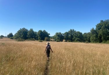
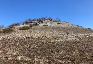
Sentier dans les environs de Carlucet. Pas de dénivelé très abrupt ; la seule difficulté réside dans la longueur de la randonnée.
Quelques passages dans des sous-bois (petits décrochages du GPS). Franchissement de chasses privées mais autorisées (portails, portillons balisés).
Difficile de stationner dans le village ; parking au pied du village sur la D32 (petit parking dans le virage ; un plus grand et aménagé 100 m plus bas).
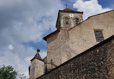
Pour bien débuter, prenez le petit sentier à droite situé tout de suite après l'hôtel de ville (en direction de l'église). Bonne rando !
         

Elevation profile

Points of interest

Point of interest Le Bastit - Portail - Photo
poupartbertrand
LE BASTIT 
Point of interest Le Bastit - Intersection - Photo
poupartbertrand
LE BASTIT 
Point of interest Le Bastit - Arrêt pique-nique - Photo
poupartbertrand
Point of interest Le Bastit - Décrochage GPS - Photo
poupartbertrand
LE BASTIT 

Positioning

Country:
France
Region :
Occitania
Department/Province :
Lot
Municipality :
Carlucet
Location:
Unknown
Start:(UTM)
390197 ; 4953113 (31T) N.

Trails nearby

Trail Walking Carlucet - Carlucet  - Photo
Walking
GUIDE
antignacs

Walking

Very easy
Carlucet, Occitania, Lot, France
6.5 km | 8.1 km-effort
2h 10min
Yes
Trail Walking Montfaucon - Le bastit carlucet  - Photo
Walking
GUIDE
antignacs

Walking

Very easy
Montfaucon, Occitania, Lot, France
20 km | 25 km-effort
4h 11min
Yes
Trail Walking Carlucet - Carlucet_le Bastit - Photo
Walking
viam19

Walking

Medium
Carlucet, Occitania, Lot, France
15.4 km | 18.4 km-effort
5h 14min
Yes
Trail Walking Couzou - Couzou - Photo
Walking
Gaillard Isabelle

Walking

Medium
Couzou, Occitania, Lot, France
17 km | 22 km-effort
4h 55min
Yes
Trail Road bike Le Bastit - Rando-Cyclo6-Rocamadour-63km-Juin21 - Photo
Road bike
Patrick2019

Road bike

Very difficult
Le Bastit, Occitania, Lot, France
63 km | 79 km-effort
4h 47min
Yes
Trail Road bike Le Bastit - Rando-Cyclo14-LeCausse-62km-Juin21 - Photo
Road bike
Patrick2019

Road bike

Very difficult
Le Bastit, Occitania, Lot, France
62 km | 75 km-effort
4h 33min
Yes
Trail Road bike Le Bastit - Rando-Cyclo15-Racamadour-56Km-Juin21 - Photo
Road bike
Patrick2019

Road bike

Very difficult
Le Bastit, Occitania, Lot, France
56 km | 70 km-effort
4h 15min
Yes
Trail Walking Montfaucon - Étape 4 septembre 2024 - Photo
Walking
Pascal Bernaud

Walking

Very difficult
Montfaucon, Occitania, Lot, France
18.3 km | 24 km-effort
6h 27min
No
Trail Walking Carlucet - Carlucet - Labastide Murat - Photo
Walking
Bernard Lejeune

Walking

Difficult
Carlucet, Occitania, Lot, France
14.4 km | 19 km-effort
4h 18min
No


Close
My subscriptions